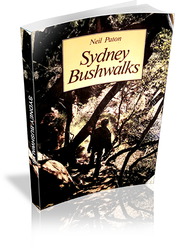
Sydney bushwalks
About this book
Bushwalks in Sydney
Our review notes
Tracknotes
- Level of detail
- Detailed route information
- Walk summaries
- No
- Grade system explained
- No
- Ascent/descent info
- No
- Driving directions
- No
- Review dates given
- No
- Alternate routes
- Many walks
- Interpretive info
- Minimal
Maps & photos
- Maps for walking
- Yes - limited detail
- Map type
- Sketch
- Map colour
- Black and White
- Map size
- Full page
- Regional map
- No
- Photos
- Black and White
- Photo comment
- Photographs, on average, every four to six pages
List of walks in this book
| Walk Name | Length | Time | Grade | Page |
|---|---|---|---|---|
| Fullers Bridge to Epping Road | 28 | |||
| Fullers Bridge to De Burghs Bridge, East Side | 32 | |||
| De Burghs Bridge to Fullers Bridge, West Side | 37 | |||
| Lorna Pass | 38 | |||
| Comenarra Parkway to Kissing Point Road | 41 | |||
| Kissing Point Road to De Burghs Bridge | 45 | |||
| Pennant Hills Park Area | 47 | |||
| De Burghs Bridge to Khartoum Road | 48 | |||
| Browns Waterhole Tracks | 49 | |||
| Roseville Bridge to Lindfield | 53 | |||
| Gordon Creek to Hunter Avenue | 57 | |||
| Upper Middle Harbour Creek | 62 | |||
| East Killara | 65 | |||
| Upper Middle Harbour Creek, West Side | 66 | |||
| The Bare Creek Track | 68 | |||
| The Heath Track | 69 | |||
| Pipelines and Carroll Creek | 70 | |||
| The Quarry Track | 70 | |||
| The Govenor Phillip Walk | 74 | |||
| East Gordon Fire Trails | 76 | |||
| Casuarina Track | 77 | |||
| Flat Rock Track | 78 | |||
| The Magazine Track | 79 | |||
| Cook Street to Forestville Park | 81 | |||
| The Oval Track | 83 | |||
| The Old Bullock Track | 85 | |||
| The Timbergetters Track | 86 | |||
| The Engravings Track | 87 | |||
| The Bay Track and the Bluff | 88 | |||
| Pennant Hills to Galston Gorge | 91 | |||
| Hornsby to Fishponds Waterhole | 96 | |||
| Mt Kuring-Gai to Calna Creek | 97 | |||
| Galston Gorge to Berowra | 100 | |||
| Jerusalem Bay | 109 | |||
| Berowra to Bobbin Head | 112 | |||
| The Mt Kuring-Gai Track | 114 | |||
| Bobbin Head to the Sphinx Track | 115 | |||
| The Bobbin Head Track | 116 | |||
| Christies Pool | 120 | |||
| The Warrimoo Track | 120 | |||
| The Grosvenor Track | 122 | |||
| The Murrua Track | 125 | |||
| The Fraser Brook Tracks | 126 | |||
| Hornsby Area and Links Track | 128 | |||
| The Ryland and Cooyong Tracks | 130 | |||
| The Bibbenluke and Namba Road Tracks | 133 | |||
| Duffys Track and Slade Lookout | 134 | |||
| The Cullamine Track, Long Track and Cowan Track | 135 | |||
| The Wilkins Track | 137 | |||
| The Perimeter Track | 138 | |||
| Smiths Creek | 140 | |||
| Duckhole Track | 141 | |||
| The Chiltern Road Trails | 144 | |||
| Flint and Steel Beach | 148 | |||
| America Bay | 149 | |||
| The Basin and Basin Track | 150 | |||
| Challenger Track | 151 | |||
| The Bairne Track | 152 | |||
| The Topham Track | 152 | |||
| The Towlers Bay Track | 153 | |||
| The Willunga Track | 153 | |||
| The Salvation and Wallaroo Tracks | 156 | |||
| The Elvina Track | 158 | |||
| The Waratah Track | 158 | |||
| The Bullawarring Track | 161 | |||
| The Battery Causeway | 166 | |||
| Mt Westmacott | 167 | |||
| The Moray Track | 168 | |||
| Kingfisher Creek | 169 | |||
| The Moray Ridge Trail | 169 | |||
| Morella Ridge | 170 | |||
| Scouters Mountain | 171 | |||
| Engadine to Audley | 175 | |||
| Audley to Warumbul Road | 177 | |||
| Winifred Falls | 178 | |||
| Maianbar and Bundeena | 179 | |||
| The Coast Track | 179 | |||
| The Cliff Track | 184 | |||
| Governor Game Lookout | 185 | |||
| Couranga Track | 186 | |||
| Wettong | 186 | |||
| Waterfall to Uloola Fails | 187 | |||
| Uloola Falls to Heathcote | 188 | |||
| Gurrumboola Ridge | 189 | |||
| The Marley Track | 190 |