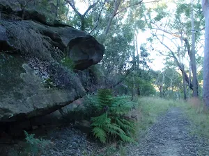
Refuge Rock and Natural Arch

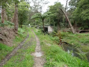
(0km) End of Trevors Ln → Refuge Rock
Turn left: From the intersection, the walk follows the management trail, directly away from the houses. After a short distance, the trail reaches an intersection with another management trail, signposted '92A/92B ...'.
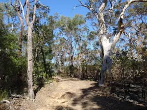
Veer left: From the intersection, the walk follows the 'ST22/23' arrow, going gently up the hill, along the management trail. After a very short distance, the trail passes under some high voltage powerlines and immediately reaches an intersection with a bush track, to the right, and management trail, to the left.
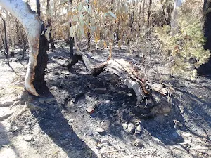
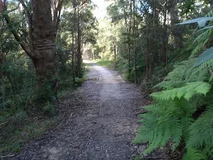
Continue straight: From the intersection, the walk follows the management trail away from the high voltage powerlines, leaving the visible tower to the left. The trail descends gently, through pleasant forest (ignoring an unmarked bush track to the right) and reaches an intersection with another management trail, signposted '92A 92B/16'.
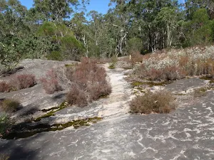
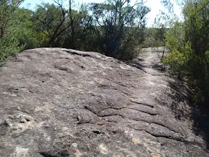
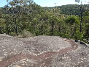
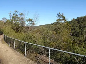
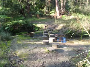
Veer right: From the intersection, the walk follows the level management trail, leaving the '92A 92B/16' signpost behind on the left. After a short distance, the trail passes a clearing, to the left, and descends for a while before arriving at a large, flat rock outcrop, the western edge of 'Refuge Rock'.
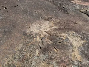
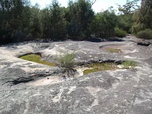
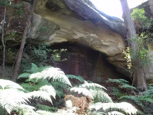
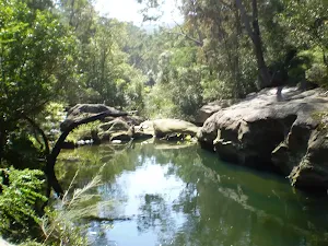
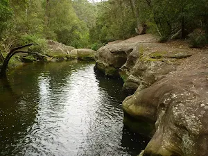
Refuge Rock
(1km) Refuge Rock → Natural Arch
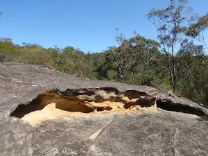
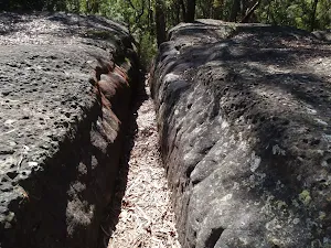
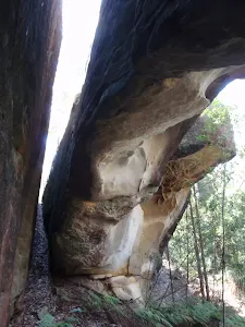
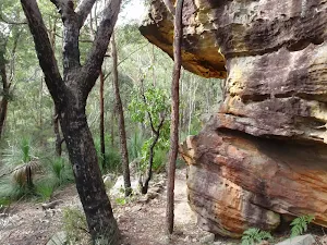
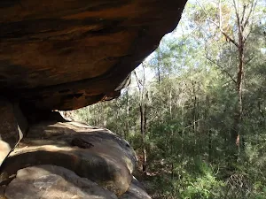
Veer left: From the intersection, the walk drops into the first of two very prominent slots in the rock platform to the north-east (beside a banksia tree). The walk follows this slot to the edge of the rock platform then bends around to the right to enter the next slot (closer to the cliff line). The walk drops through this very narrow slot to emerge at the base of the very cool natural arch. At the end of this side trip, retrace your steps back to the main walk then Continue straight.
Natural Arch
Maps for the Refuge Rock and Natural Arch walk
You can download the PDF for this walk to print a map.
These maps below cover the walk and the wider area around the walk, they are worth carrying for safety reasons.
| Hornsby | 1:25 000 Map Series | 91304S HORNSBY | NSW-91304S |
| Sydney | 1:100 000 Map Series | 9130 SYDNEY | 9130 |
Cross sectional view of the Refuge Rock and Natural Arch bushwalking track
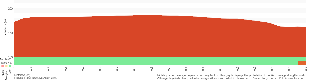
Analysis and summary of the altitude variation on the Refuge Rock and Natural Arch
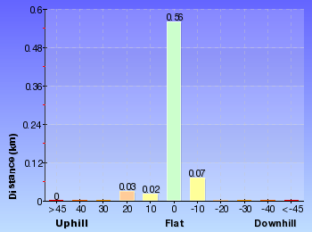
Overview of this walks grade – based on the AS 2156.1 – 2001
Under this standard, a walk is graded based on the most difficult section of the walk.
| Length | 1.4 km | ||
| Time | 30 mins | ||
| . | |||
Grade 3/6 Moderate track | AS 2156.1 | Gradient | Gentle hills with occasional steps (2/6) |
| Quality of track | Clear and well formed track or trail (2/6) | ||
| Signs | Directional signs along the way (3/6) | ||
| Experience Required | No experience required (1/6) | ||
| Weather | Weather generally has little impact on safety (1/6) | ||
| Infrastructure | Limited facilities, not all cliffs are fenced (3/6) |
Some more details of this walks Grading
Here is a bit more details explaining grading looking at sections of the walk
Gradient
This whole walk, 690m has gentle hills with occasional steps.
Quality of track
This whole walk, 690m follows a clear and well formed track or trail.
Signs
This whole walk, 690m has directional signs at most intersection.
Experience Required
This whole walk, 690m requires no previous bushwalking experience.
weather
This whole walk, 690m is not usually affected by severe weather events (that would unexpectedly impact safety and navigation).
Infrastructure
This whole walk, 690m has limited facilities (such as not all cliffs fenced).
Similar walks
A list of walks that share part of the track with the Refuge Rock and Natural Arch walk.
Cherrybrook to Refuge Rock
4.1 km One way, 1 hr 45 mins
Moderate track
Other Nearby walks
A list of walks that start near the Refuge Rock and Natural Arch walk.
Daphne Place dog walking trail
515 m One way, 15 mins
Moderate track
Elouera Lookout
828 m Return, 30 mins
Moderate track
Wareemba Ave to Thornleigh Station
8.6 km One way, 3 hrs 45 mins
Hard track
Blackwattle Trail
2.2 km One way, 1 Hr
Moderate track
Callicoma Loop
5.1 km Circuit, 2 hrs
Hard track
Cherrybrook to Hornsby via Fishponds
9 km One way, 3 hrs 45 mins
Hard track
Cherrybrook to Thornleigh
4.4 km One way, 1 hr 45 mins
Moderate track
The Lakes of Cherrybrook loop
439 m Circuit, 15 mins

Moderate track
Blue Gum Walk (Joe's Mountain Circuit)
4.2 km Circuit, 2 hrs
Hard track
Stringybark Ridge loop via Bellamy St
4.2 km Circuit, 1 hr 45 mins

Hard track
Callicoma caves
2.5 km Return, 1 hr 30 mins
Hard track
Plan your trip to and from the walk here
The Refuge Rock and Natural Arch walk starts and ends at the End of Trevors Ln (gps: -33.708264, 151.05772)
Weather Forecast
This walk starts in the Metropolitan weather district.
Current Alerts
Park Information
Berowra Valley National Park
Following the Berowra Creek the Berowra Valley National Park is located on the Hornsby Plateau and is made up of typical Hawkesbury Sandstone. The great North walk, Benowie walking track, and many other great walks stretch spann this park. The area has varied vegetation including many different sorts of Eucalyptus and plenty of native animals, includingl swamp wallibies, water dragons, bandicoots, Lyre Birds, and bush turkeys. There are several campsites within the Park, and Crosslands Reserve is also a popular spot near the middle of the park.
Comments
Short URL: http://wild.tl/rr