Cox's River return via Narrowneck
* This walk passes through very remote areas and sections have no visible track. At least one person in your group should have training and experience in off track walking and navigation. Even with these notes and a GPS these extra skills and equipment are required.
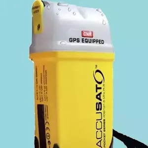
Free Beacon Hire
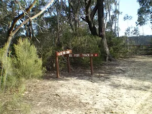
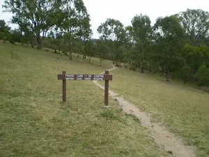
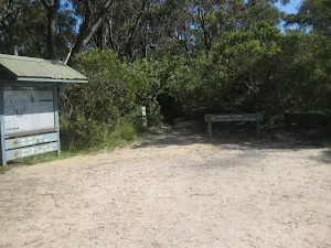
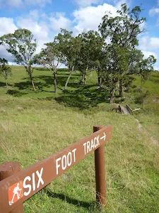
(0km) Explorers Tree → Six Foot Track Info Shelter
(0km) Six Foot Track Info Shelter → Int of 6 Foot Track and Norths Lookout Trail
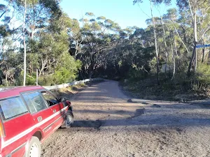
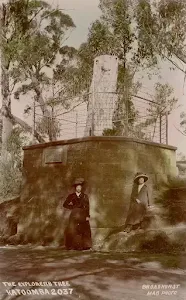
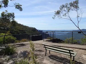
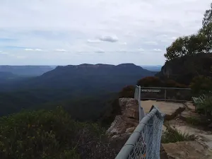
Explorers Tree (Katoomba)
(1km) Int of Six Foot Track and Norths Lookout Trail → Int at Lower Nellies Glen
(2km) Int at Lower Nellies Glen → Megalong Village site
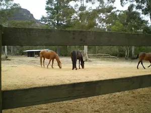
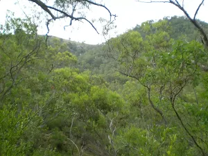
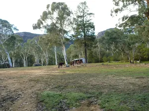
Continue straight: From the intersection, this walk walk follows the 'Six Foot Track' sign[31] along the Nellies Glen trail, to cross the culverted Diamond Creek[32] to then come pass alongside the old Megalong 'Village site'[33] and horse paddock[34] (which is on your left).
Megalong Village (Historic)
(5km) Megalong Village site → Int Mitchells Creek and Nellies Glen Rd trails
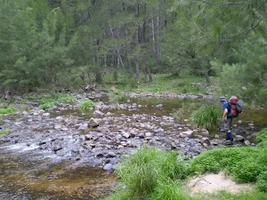
(6km) Intersection of Medlow Gap Management Trail and 6 Foot Track → Megalong Ford
(7km) Megalong Ford → Int of Six Foot Track and Megalong Rd
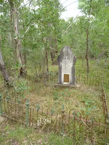
(8km) Int of 6 Foot Track and Megalong Rd → Megalong Cemetery
Megalong Cemetery (historical)
(8km) Megalong Cemetery → Int Near Guyver Bridge
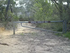
(9km) Int Near Guyver Bridge → Euroka back gate
(11km) Private Gate → Bowtells Bridge East
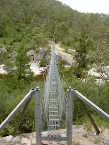
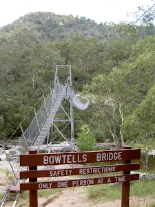
(14km) Bowtells Swing Bridge → Bowtells Swing Bridge North
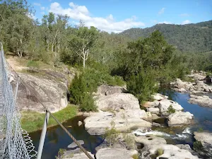
Bowtells Swing Bridge
(15km) Bowtells Bridge West → Coxs River Campsite
Turn sharp right: From the intersection and clearing, this walk follows the 'Camping Ground-500mtrs' sign[134] north up the timber steps. The track soon bends left and follows the side of the hill[135] for about 130m to then head through a gate with a 'Welcome' sign[136]. The walk continues along the clear track for another 70m to the intersection with the timber path[137] just below the 'Six Foot Track Lodge'[138].
Continue straight: From the intersection below the 'Six Foot Track Lodge'[139], this walk follows the clear track west initially keeping the lodge up to your right. After about 30m this walk crosses a gully[140] then climbs over a fence using stile[141]. Here the walk turns right and follows the track for almost 50m to a T-intersection[142] with a wide trail, beside a private property gate[143] and marked with several 'Six Foot Track' signs[144].
Veer left: From the intersection, this walk follows the 'Camping Ground-200m' sign[145] gently down along wide trail[146]. After about 230m the trail flattens out and passes below the main camping area[147] marked with a 'Coxs River Reserve' sign[148]. About 30m past here, this walk comes to a clear intersection with a dirt road marked with a 'Six Foot Track' sign[149].
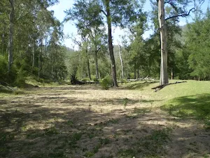
Coxs River Camping Area
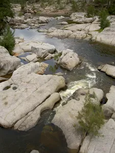
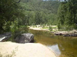
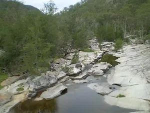
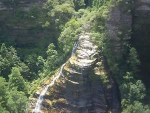
Coxs River
End of day 1
(16km) Coxs River Campsite → Coxs River Floodplain
(16km) Cox's River Campsite (East) → Little River and Coxs River Int
(19km) Little River and Coxs River Int → Quartpot Gully/ Coxs River Track Intersection
(22km) Quartpot Gully/ Coxs River Track Intersection → Coxs River Blue Mountains NP Entry
(24km) Coxs River Blue Mountains NP Entry → Int of Coxs Ck and Breakfast Ck Trks
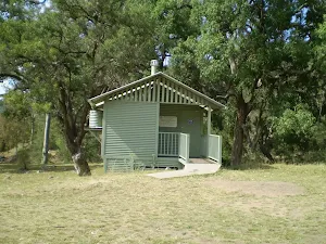
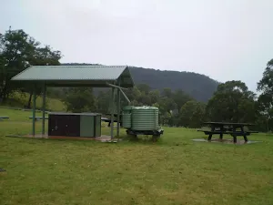
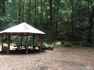
Breakfast Creek Campsite
(27km) Int of Coxs Ck and Breakfast Ck Trks → Breakfast Ck and Blackhorse Ridge Trk Int
(31km) Breakfast Ck and Blackhorse Ridge Trk Int → Int of Ironpot Mtn and Dunphys Servicetrails
(34km) Int of Ironpot Mtn and Dunphys Servicetrails → Dunphys Camping Area
Dunphys Camping Area
(34km) Dunphys Camping Area → Int Dunphys Servicetrail and Bellbird Ridge L.O. trk
(35km) Int Dunphys Servicetrail and Bellbird Ridge L.O. trk → Int Medlow Gap Management Trail and Carlons Head trk
(36km) Int Medlow Gap Management Trail and Carlons Head trk → Bottom of Carlon Head Pass
(36km) Bottom of Carlon Head Pass → Top of Carlon Head Pass
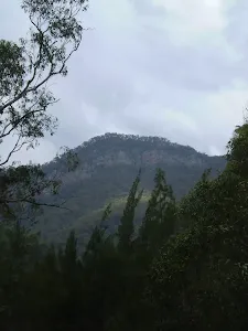
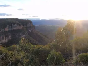
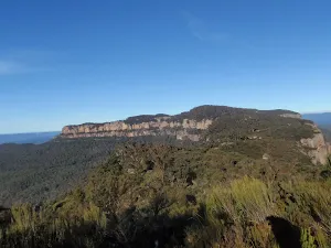
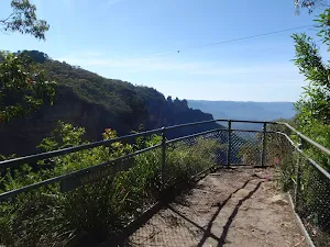
Carlon Head Pass
(36km) Top of Carlon Head Pass → Fire Tower
(38km) Fire Tower → Int of Glenraphael and Cliff Drives
Continue straight: From the intersection, this walk follows the dirt road up to the top of the steep hill. The track then flattens out and continues along until it reaches the intersection of the northern Castle Head track.
Continue straight: From the intersection, this walk heads north, following the dirt road as it undulates along the ridge for a while, before it reaches the National Park gate and the car park just on the other side. (For emergency access, keys to the National Park gate are available from the local council, police and National Parks services.)
Continue straight: From the National Park gate, this walk follows Glenraphael Drive north through the parking area. The dirt road continues through the bush, undulating along the ridge for about 1km before coming to the signposted intersection at the top of the Golden Stairs, with some more car parking either side of the road.
Continue straight: From the Golden Stairs car park, this walk follows the dirt road north, down the gentle hill and along the ridge as it undulates up and down for about 1km, before reaching the Sydney Water management trail - this is closed to the public at all times.
Veer right: From the intersection, this walk follows the dirt road heading up the hill and undulating along the ridge for about 1km, before it climbs up to the intersection with Cliff Drive.
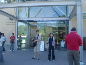
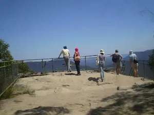
(47km) Int of Glenraphael and Cliff Drives → Scenic World
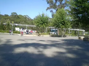
Scenic World
Maps for the Cox's River return via Narrowneck walk
You can download the PDF for this walk to print a map.
These maps below cover the walk and the wider area around the walk, they are worth carrying for safety reasons.
| Six Foot Track | 1:50 000 Map Series | Six Foot Track | NSW-six-foot-track |
| Hampton | 1:25 000 Map Series | 89304S HAMPTON | NSW-89304S |
| Jenolan | 1:25 000 Map Series | 89303N JENOLAN | NSW-89303N |
| Jamison | 1:25 000 Map Series | 89302N JAMISON | NSW-89302N |
| Katoomba | 1:25 000 Map Series | 89301S KATOOMBA | NSW-89301S |
| Katoomba | 1:100 000 Map Series | 8930 KATOOMBA | 8930 |
Cross sectional view of the Cox's River return via Narrowneck bushwalking track
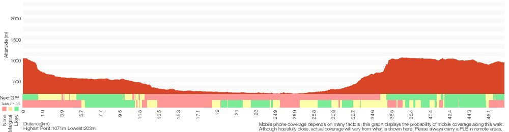
Analysis and summary of the altitude variation on the Cox's River return via Narrowneck
Overview of this walks grade – based on the AS 2156.1 – 2001
Under this standard, a walk is graded based on the most difficult section of the walk.
| Length | 47.8 km | ||
| Time | 2 Days | ||
| . | |||
Grade 6/6 Very experienced only | AS 2156.1 | Gradient | Very steep exposed rock scrambling and climbing (6/6) |
| Quality of track | Off track (no visible track at times) (6/6) | ||
| Signs | No directional signs (5/6) | ||
| Experience Required | High level of bushwalking experience recommended (5/6) | ||
| Weather | Forecast, unforecast storms and severe weather likely to have an impact on your navigation and safety (5/6) | ||
| Infrastructure | Limited facilities (such as cliffs not fenced, significant creeks not bridged) (4/6) |
Some more details of this walks Grading
Here is a bit more details explaining grading looking at sections of the walk
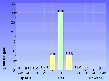
Gradient
28km of this walk has short steep hills, 9km has gentle hills with occasional steps and another 8km is very steep. Whilst another 1.5km section of this walk is flat with no steps and a 550m is very steep with difficult rock scrambles. The remaining 95m is very steep with exposed rock scrambles and climbing.
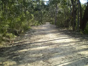
Quality of track
21km of this walk follows a formed track, with some branches and other obstacles and another 20km follows a clear and well formed track or trail. Whilst another 5km follows a rough track, where fallen trees and other obstacles are likely and a 1.3km section follows a rough unclear track. The remaining 95m follows a known route where there is no visible track.
Signs
27km of this walk has directional signs at most intersection and another 13km is clearly signposted. Whilst another 7km has minimal directional signs and the remaining 1.4km Has no directional signs.
Experience Required
20km of this walk requires no previous bushwalking experience and another 15km requires a leader a with moderate level of bushwalking experience. Whilst another 13km requires some bushwalking experience and the remaining 95m requires a leader with a high level of bushwalking experience.
weather
29km of this walk is not usually affected by severe weather events (that would unexpectedly impact safety and navigation) and another 18km is affected by storms that may impact your navigation and safety. Whilst another 720m is affected by forecast, unforecast storms and severe weather events that may impact on navigation and safety and the remaining 95m forecast, unforecast storms and severe weather likely to have an impact on your navigation and safety.
Infrastructure
21km of this walk is close to useful facilities (such as fenced cliffs and seats) and another 14km has limited facilities (such as not all cliffs fenced). The remaining (12km) has limited facilities (such as cliffs not fenced, significant creeks not bridged).
Similar walks
A list of walks that share part of the track with the Cox's River return via Narrowneck walk.
Nellie's Glen Lookout
2 km Return, 1 Hr
Moderate track
Farnell Road to Explorers Tree
4 km Return, 2 hrs
Moderate track
Narrow Neck to Castle Head
4.2 km Return, 1 hr 45 mins
Hard track
Scenic Railway to Golden Staircase Circuit
5.9 km Circuit, 3 hrs 30 mins
Hard track
Scenic World down Furber Steps to Narrow Neck loop
6.8 km Circuit, 5 hrs
Hard track
Devil's Hole Trail
7 km One way, 3 hrs 30 mins
Very experienced only
Megalong Rd to Bowtells Swing Bridge (Coxs River)
12.6 km Return, 5 hrs 30 mins
Hard track
Scenic Railway to Mt Solitary via the Ruined Castle
16.2 km Return, 11 hrs
Experienced only
Along Narrow Neck to Taro's Ladder
20 km Return, 7 hrs
Moderate track
Six Foot Track
44.8 km One way, 3 Days
Hard track
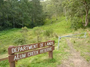
Six Foot Track (Alum Creek Reserve)
44.8 km One way, 2 Days
Hard track
Cox's River return via Dunphy's campsite
47.8 km One way, 3 Days
Very experienced only
Other Nearby walks
A list of walks that start near the Cox's River return via Narrowneck walk.
Farnell Road to Nellies Glen Lookout return
2.2 km Return, 1 hr 30 mins
Moderate track
Katoomba Falls to Echo Point via Prince Henry Cliff Walk
1.8 km One way, 1 Hr
Moderate track
Katoomba Kiosk to base of Katoomba Falls
1.7 km Return, 2 hrs
Hard track
Katoomba Kiosk to Katoomba Falls
1.1 km Return, 45 mins
Moderate track
Reids Plateau Loop
352 m Circuit, 20 mins
Moderate track
Round Walk
854 m Circuit, 45 mins
Hard track
Carrington Park to BurraBarroo Lookout
582 m Return, 30 mins
Moderate track
Carrington Park to Bridal View Lookout
3.3 km Return, 1 hr 30 mins
Moderate track
Carrington Park to Bridal Veil Lookout return
892 m Return, 30 mins
Moderate track
Carrington Park to Leura Forest and pass loop
4.8 km Circuit, 3 hrs
Hard track
Carrington Park to Leura Forest return
2.3 km Return, 1 hr 30 mins
Hard track
Carrington Park to Marguerite Cascades
1.7 km Return, 1 hr 15 mins
Hard track
Plan your trip to and from the walk here
The Cox's River return via Narrowneck walk starts at the Explorers Tree (gps: -33.703970, 150.29126)
The Cox's River return via Narrowneck ends at the Scenic World (gps: -33.728585, 150.30095)
Weather Forecast
This walk starts in the Central Tablelands weather district.
Current Alerts
Park Information
Blue Mountains National Park
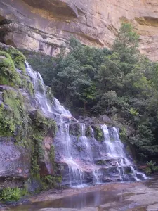
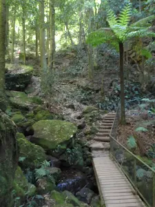
Attracting over 3 million visitors annually, Blue Mountains National Park holds some of Australia's most spectacular and diverse wilderness areas. Explore the Grose Valley, with its sheer sandstone cliffs, waterfalls and scenic walking, or enjoy the famous views of the Three Sisters. Easy access makes a day trips very worthwhile, but with such diversity it would be great to stay in one of the many B&B's and spend a few days soaking up the region.
Kanangra-Boyd National Park
Comments
Short URL: http://wild.tl/crrvdc