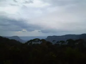
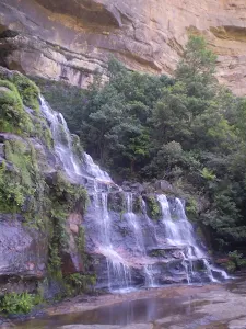
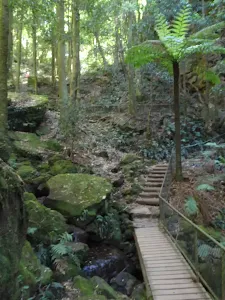
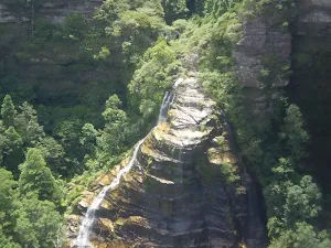
Devil's Hole Trail
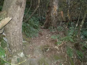
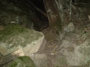
* This walk passes through very remote areas and sections have no visible track. At least one person in your group should have training and experience in off track walking and navigation. Even with these notes and a GPS these extra skills and equipment are required.
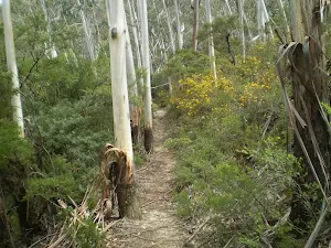
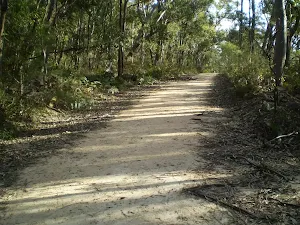
(0km) Int of Farnells Rd and Cliff Track → Intersection of Cliff Track and Therabulat Lookout Track
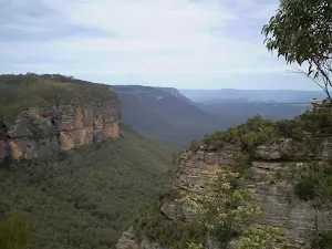
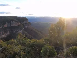
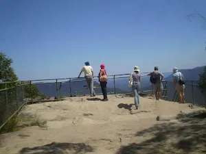
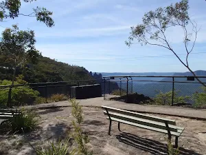
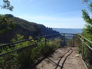
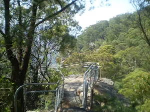
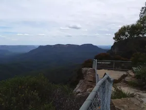
(0km) Intersection of Cliff Track and Therabulat Lookout Track → Therabulat Lookout
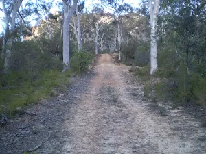
(0km) Intersection of Cliff Track and Therabulat Lookout Track → Int of Cliff Track and Norths Lookout Trail
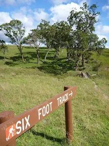
(1km) Int of 6 Foot Track and Norths Lookout Trail → Norths Lookout
(1km) Int of Cliff Track and Norths Lookout Trail → Int of 6 Foot Track and Norths Lookout Trail
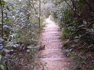
(1km) Int of Six Foot Track and Norths Lookout Trail → Int at Lower Nellies Glen
(3km) Int at Lower Nellies Glen → Int of Nellies Glen Rd Trail and Devils Hole Trail
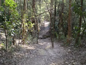
(5km) Int of 6 Ft Track and Devil's Hole Servicetrail → Int of Devil's Hole Bushtrack and Cliff Rd
Maps for the Devil's Hole Trail walk
You can download the PDF for this walk to print a map.
These maps below cover the walk and the wider area around the walk, they are worth carrying for safety reasons.
| Six Foot Track | 1:50 000 Map Series | Six Foot Track | NSW-six-foot-track |
| Katoomba | 1:25 000 Map Series | 89301S KATOOMBA | NSW-89301S |
| Katoomba | 1:100 000 Map Series | 8930 KATOOMBA | 8930 |
Cross sectional view of the Devil's Hole Trail bushwalking track
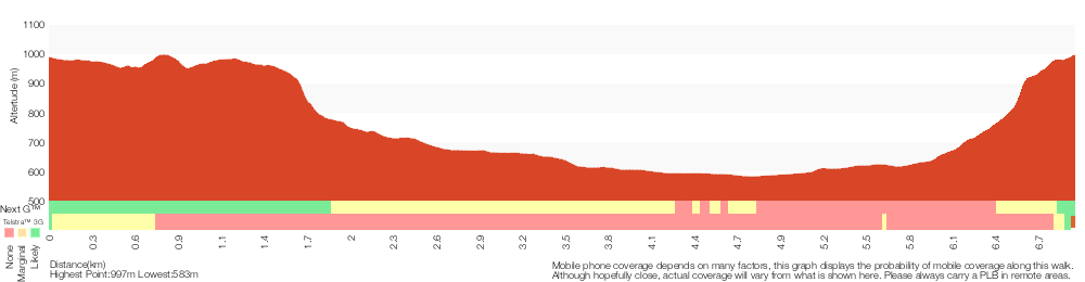
Analysis and summary of the altitude variation on the Devil's Hole Trail
Overview of this walks grade – based on the AS 2156.1 – 2001
Under this standard, a walk is graded based on the most difficult section of the walk.
| Length | 7 km | ||
| Time | 3 hrs 30 mins | ||
| . | |||
Grade 6/6 Very experienced only | AS 2156.1 | Gradient | Very steep and difficult scrambles (5/6) |
| Quality of track | Rough track, where fallen trees and other obstacles are likely (4/6) | ||
| Signs | No directional signs (5/6) | ||
| Experience Required | Moderate level of bushwalking experience recommended (4/6) | ||
| Weather | Storms may impact on navigation and safety (3/6) | ||
| Infrastructure | Limited facilities (such as cliffs not fenced, significant creeks not bridged) (4/6) |
Some more details of this walks Grading
Here is a bit more details explaining grading looking at sections of the walk
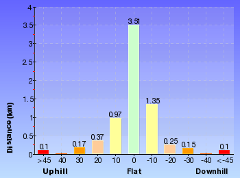
Gradient
2.4km of this walk has gentle hills with occasional steps and another 2.2km is very steep with difficult rock scrambles. Whilst another 1.6km is very steep and the remaining 790m has short steep hills.
Quality of track
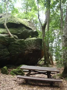
3.8km of this walk follows a rough track, where fallen trees and other obstacles are likely and another 2.1km follows a clear and well formed track or trail. The remaining (1km) follows a formed track, with some branches and other obstacles.
Signs
3.8km of this walk is clearly signposted and another 2.2km Has no directional signs. The remaining (1km) has directional signs at most intersection.
Experience Required
4.6km of this walk requires some bushwalking experience and another 2.2km requires a leader a with moderate level of bushwalking experience. The remaining (150m) requires no previous bushwalking experience.
weather
Around 3.8km of this walk is affected by storms that may impact your navigation and safety, whilst the remaining 3.1km is not usually affected by severe weather events (that would unexpectedly impact safety and navigation).
Infrastructure
3.8km of this walk has limited facilities (such as cliffs not fenced, significant creeks not bridged) and another 2.2km is close to useful facilities (such as fenced cliffs and seats). The remaining (940m) has limited facilities (such as not all cliffs fenced).
Similar walks
A list of walks that share part of the track with the Devil's Hole Trail walk.
Nellie's Glen Lookout
2 km Return, 1 Hr
Moderate track
Farnell Road to Nellies Glen Lookout return
2.2 km Return, 1 hr 30 mins
Moderate track
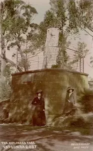
Farnell Road to Explorers Tree
4 km Return, 2 hrs
Moderate track
Six Foot Track
44.8 km One way, 3 Days
Hard track
Six Foot Track (Alum Creek Reserve)
44.8 km One way, 2 Days
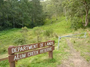
Hard track
Cox's River return via Narrowneck
47.8 km One way, 2 Days
Very experienced only
Cox's River return via Dunphy's campsite
47.8 km One way, 3 Days
Very experienced only
Other Nearby walks
A list of walks that start near the Devil's Hole Trail walk.
Katoomba Falls to Echo Point via Prince Henry Cliff Walk
1.8 km One way, 1 Hr
Moderate track
Katoomba Kiosk to base of Katoomba Falls
1.7 km Return, 2 hrs
Hard track
Katoomba Kiosk to Katoomba Falls
1.1 km Return, 45 mins
Moderate track
Reids Plateau Loop
352 m Circuit, 20 mins
Moderate track
Round Walk
854 m Circuit, 45 mins
Hard track
Carrington Park to BurraBarroo Lookout
582 m Return, 30 mins
Moderate track
Carrington Park to Bridal View Lookout
3.3 km Return, 1 hr 30 mins
Moderate track
Carrington Park to Bridal Veil Lookout return
892 m Return, 30 mins
Moderate track
Carrington Park to Leura Forest and pass loop
4.8 km Circuit, 3 hrs
Hard track
Carrington Park to Leura Forest return
2.3 km Return, 1 hr 30 mins
Hard track
Carrington Park to Marguerite Cascades
1.7 km Return, 1 hr 15 mins
Hard track
Federal Pass Walking Track
8 km One way, 5 hrs
Hard track
Plan your trip to and from the walk here
The Devil's Hole Trail walk starts at the Int of Farnells Rd and Cliff Track (gps: -33.713807, 150.29254)
The Devil's Hole Trail ends at the Int of Devil's Hole Bushtrack and Cliff Rd (gps: -33.722501, 150.28916)
Weather Forecast
This walk starts in the Central Tablelands weather district.
Current Alerts
Park Information
Comments
Short URL: http://wild.tl/dht