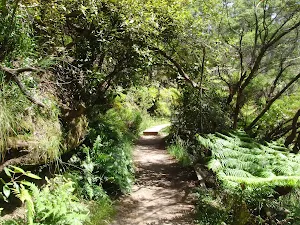
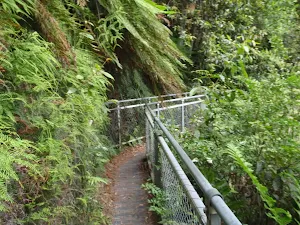
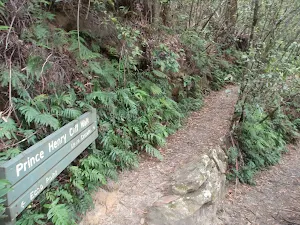
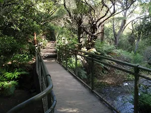
The Prince Henry Cliff Walk


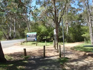
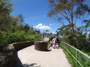

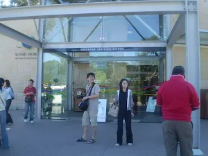
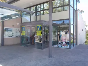
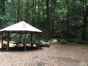
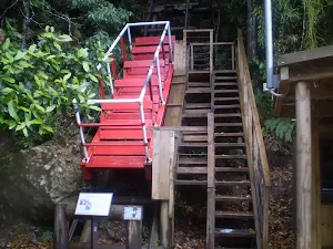
Scenic World
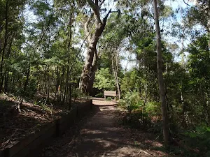
(0km) Scenic World → Int of Katoomba Kiosk Track and Prince Henry Cliff Walk
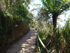
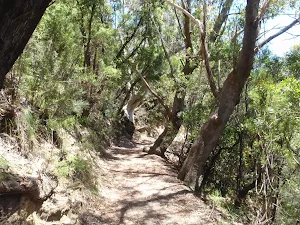
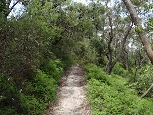
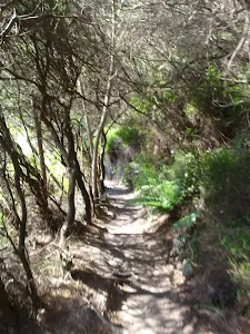
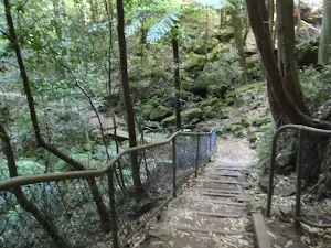
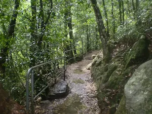
Continue straight: From the intersection, this walk follows the bush track down the gentle hill, winding down some wooden steps as the track bends around to the right. It then arrives at the signposted intersection of the 'Prince Henry Cliff Walk' and the track to the base of the Scenic Railway.
Veer left: From the intersection, the walk follows the 'Caravan Park' sign along the bush track that winds along the side of the hill, heading through the forest to the signposted intersection of the Prince Henry Cliff Walk at the back of the park, near the Katoomba Falls Kiosk.
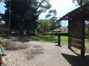
(0km) Int of Katoomba Kiosk Track and Prince Henry Cliff Walk → Katoomba Falls Kiosk
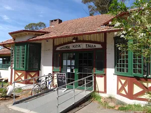
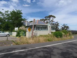
Katoomba Falls Kiosk
(0km) Int of Katoomba Kiosk Track and Prince Henry Cliff Walk → Int of Solitary Lookout track and Prince Henry Cliff Walk
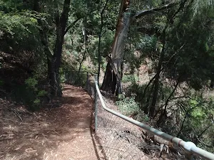
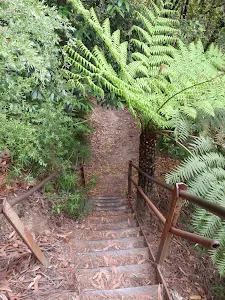
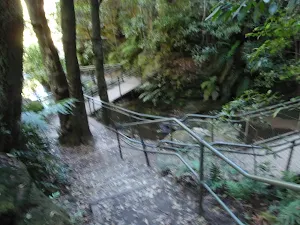
Turn left: From the intersection, this walk follows the 'Prince Henry Cliff Walk' signpost down the hardened footpath, winding down some wooden steps to the bottom of the hill, where it flattens out and continues through the forest for a short distance before coming to the intersection of Solitary Lookout track.
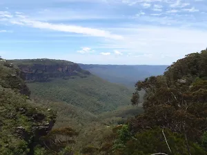
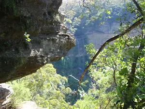
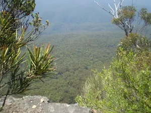
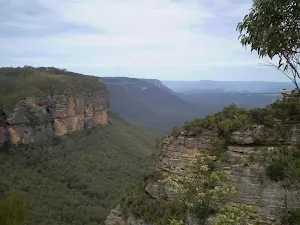
(1km) Int of Solitary Lookout track and Prince Henry Cliff Walk → Kedumba River lookout
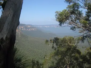
Kedumba River lookout
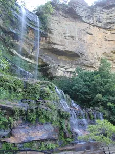
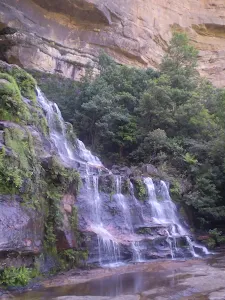
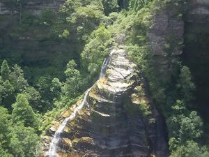
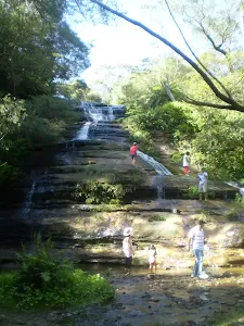
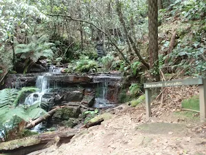
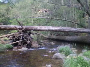
(1km) Kedumba River lookout → Katoomba Cascades
Katoomba Cascades
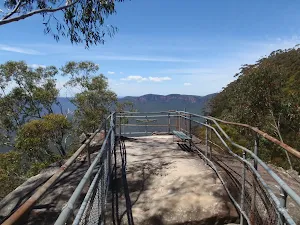
(1km) Katoomba Cascades → Katoomba Falls Park
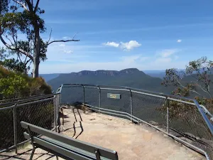
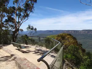
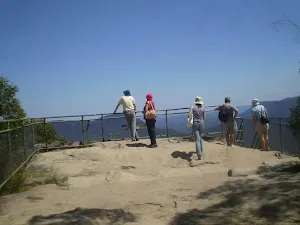
(1km) Katoomba Falls Park → Cliff View Lookout

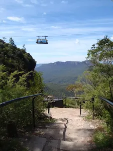
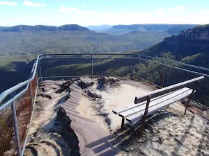
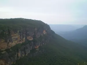
Continue straight: From the intersection[8], this walk follows the stenciled concrete path keeping the handrails on the right, almost immediately passing under the cables of the 'Skyway' cable car[9]. This walk continues for about 40m and goes up and over a gentle rise to come to a concrete platform[10] marked by the 'Cliff View Lookout' sign on the fence[11].
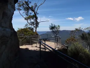
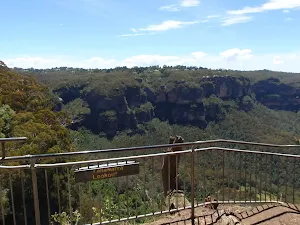
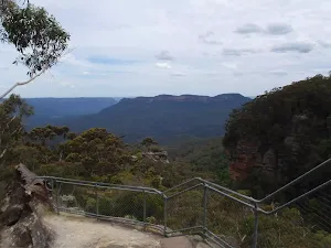
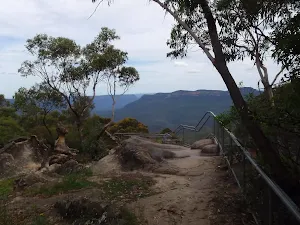
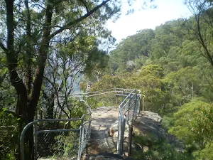
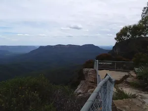
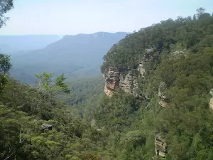
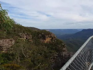
Cliff View Lookout


(1km) Cliff View Lookout → Wollumai Lookout
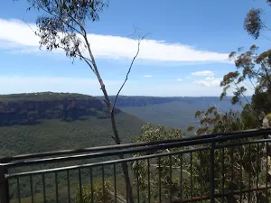
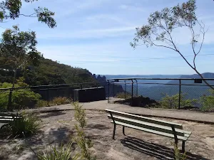
Wollumai Lookout
(1km) Wollumai Lookout → Allambie Lookout
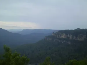
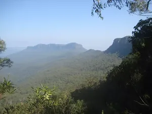
Allambie Lookout
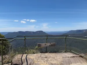
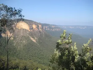
(2km) Allambie Lookout → Lady Darley Lookout
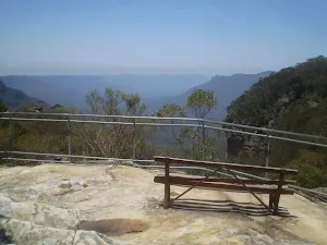
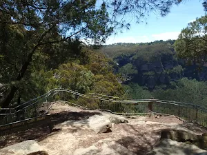
Lady Darley Lookout
(2km) Lady Darley Lookout → Kedumba View
(2km) Kedumba View → Echo Point
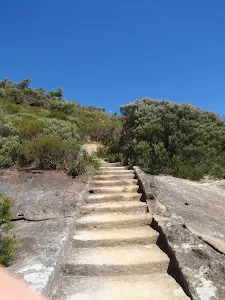
Veer left: From the intersection, this walk heads up the concrete ramp, climbing up the gentle hill to Echo Point.
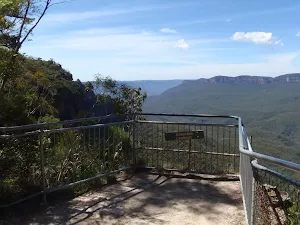
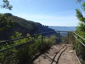
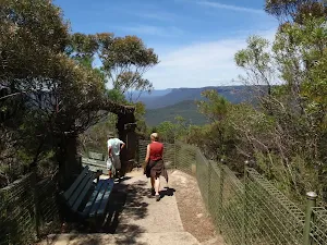
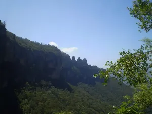
Echo Point
(2km) Echo Point → Echo Point Information Center


Echo Point Information Centre

(2km) Echo Point Information Center → Echo Point Archway Intersection
(2km) Echo Point Archway Intersection → Tallawarra Lookout
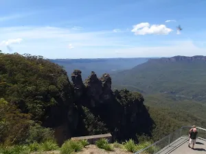
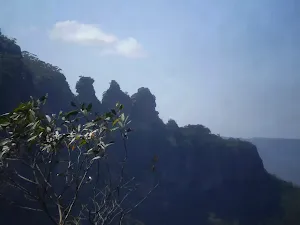
Continue straight: From the intersection, this walk follows the 'Three Sisters 400m' arrow[34] downhill along the concrete path, keeping the valley to the right. After about 15m the walk leads past a stone seat(on the left), with a blue tongue lizard sculpture[35]. The walk continues gently downhill for another 60m to pass another sandstone seat (on the left). From here the path winds gently downhill for another 70m to find yet another sandstone seat (on the left). The path continues downhill for another 45m to find a clear intersection marked with a large 'Three Sisters Walk' sign[36]. On the right is a small flat loose gravel area with two seats.


Veer left: From the intersection, this walk follows the track winding up the hill and through the bush, away from the cliffs and the valley, for about 50m before coming to the intersection of the Lady Game track.
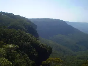
Turn left : From the intersection, the walk follows the 'Leura Cascades' sign along the bush track, winding around through the bush and following the cliffs (further down the hill to the right) around the valley until coming to the intersection with the Lady Carrington Lookout track.
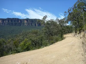
Veer left: From the intersection, the walk follows the 'Leura Cascades' sign along the bush track which winds through the forest, gradually climbing up a long gentle hill. The track then flattens out and follows a metal fence-line to the 'Tallawarra Lookout' shortly after (marked on some maps as 'Tallawalla Lookout').
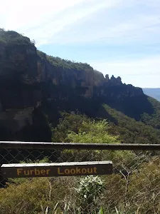
Tallawarra Lookout
(3km) Tallawarra Lookout → Millamurra Lookout
Millamurra Lookout
(3km) Millamurra Lookout → Int of Prince Henry Cliff and Honeymoon Lookout Tracks
(3km) Int of Prince Henry Cliff Walk and Honeymoon Lookout Tracks → Lomandra Lookout
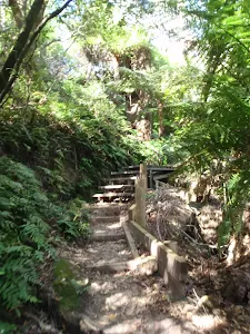
Veer left: From the intersection, this walk follows the bush track heading away from the lookout, keeping the valley down the hill to the right as it winds down a set of wooden steps to the signposted Banksia Streamlet.
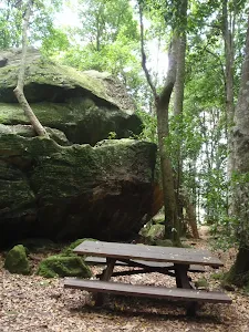
Continue straight: Keeping the valley down the hill to the right, the walk crosses the streamlet at the wooden bridge. The track continues up the wooden steps on the other side to the top of the hill, where the track flattens out and continues past a picnic chair and along the side of the hill to the Lomandra Lookout.
Lomandra Lookout
(4km) Lomandra Lookout → Int of Cliff Drive and Prince Henry Cliff Walk
Veer left: From the intersection, the walk follows the 'Leura Cascades' sign, climbing up the wooden steps and continuing along the bush track that winds through the forest, until coming to the intersection with the Carrington Park track.
Continue straight: From the intersection, this walk follows the 'Leura Cascades 1km' sign down the wooden steps and along the bush track, winding through the forest until coming to the signposted intersection of the 'Leura Forest' Track.
Continue straight: From the intersection, this walk follows the 'Leura Cascades' sign along the well-defined bush track, winding through the bush to the signposted intersection of the Echo Tree track at the bottom of the short set of stairs.
Turn left: From the intersection, this walk follows the short set of wooden steps up to Cliff Drive, opposite the car park behind Solitary Restaurant.
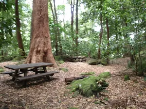
Solitary Kiosk and Restaurant
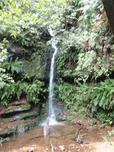
(5km) Int of Cliff Drive and Prince Henry Cliff Walk → Fossil Rock
Turn right: From the intersection, the walk follows the Leura Cascades sign down the wooden steps and along the short bush track to Fossil Rock Lookout.
Fossil Rock
(5km) Fossil Rock → Int of Prince Henry Cliff Walk and Leura Park Track
Veer left: From the intersection, the walk follows the track winding along the side of the hill, keeping the cliffs and the valley down to the right, soon coming to the signposted intersection with the track to 'Bridal Veil Lookout'.
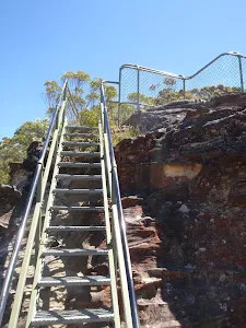
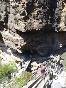
Turn left: Keeping the signposted 'Bridal Veil Lookout' track to the right, this walk follows the track winding around the top edge of the valley and down a metal staircase, continuing along a fenced, wooden footbridge and down the side of the hill via wooden and metal steps, to the sign pointing back along the 'Prince Henrey Walk' to 'Echo Point'.
Veer left: From the intersection, this walk follows the sign along the 'Prince Henry Cliff Walk' towards 'Leura Cascades', taking the higher track. The track heads along the side of the hill to come to a three-way intersection, just after passing a rock wall on the left.
Turn left: From the intersection, this walk steps up over a few rocks to keep the main rock outcrop on the left (and the valley and waterfall on the right). The track soon passes a small overhang with a bench seat, and gently winds along the side of the hill. After heading down the stairs, the track come to a 'T' intersection, with a handrail and a sign pointing back up to 'Echo Point'.
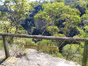
(5km) Int of Prince Henry Cliff Walk and Leura Park Track → The Rock
Veer left: From the intersection, this walk follows the 'Prince Henry Cliff Walk To Gordon Falls' sign up the timber steps. The walk continues along the bush track that steadily climbs to the top of the gentle hill, where it comes to an intersection with the Cliff Drive bush track.
Continue straight: From the intersection, the walk follows the bush track heading around the side of the hill, winding through the bush until it comes to the intersection of the short bush track to Cliff Drive.
Veer right: From the intersection, this walk follows the bush track winding around the valley down to the right for a short while, before coming to 'The Rock' lookout just off the track on the right.
The Rock
(6km) The Rock → Olympian Lookout
Turn left: From the intersection, this walk follows the 'Gordon Falls' sign along the bush track, winding through the dense bush for a short while before gradually climbing up a gentle hill to the signposted intersection of the Tarpeian Rock track.
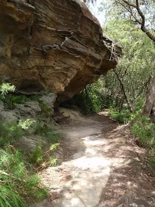
Continue straight: From the intersection, the walk follows the 'Gordon Falls' sign down the wooden steps and along the track. Notice the environment change to rainforest as the track winds around the valley down to the right. The walk follows the base of some tall rock overhangs, then climbs up a long set of wooden steps that continue on to rock steps, coming to 'Olympian Rock' lookout.
Olympian Lookout

(6km) Olympian Lookout → Elysian Lookout
Elysian Rock
(7km) Elysian Lookout → Corner of Olympian Parade and Lone Pine Ave
Turn left: From the intersection, this walk goes up the steps and into the park, and connects to the corner of Lone Pine Ave and Olympian Pde.
Maps for the The Prince Henry Cliff Walk walk
You can download the PDF for this walk to print a map.
These maps below cover the walk and the wider area around the walk, they are worth carrying for safety reasons.
| Six Foot Track | 1:50 000 Map Series | Six Foot Track | NSW-six-foot-track |
| Katoomba | 1:25 000 Map Series | 89301S KATOOMBA | NSW-89301S |
| Katoomba | 1:100 000 Map Series | 8930 KATOOMBA | 8930 |
Cross sectional view of the The Prince Henry Cliff Walk bushwalking track
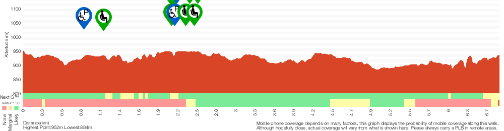
Analysis and summary of the altitude variation on the The Prince Henry Cliff Walk
Overview of this walks grade – based on the AS 2156.1 – 2001
Under this standard, a walk is graded based on the most difficult section of the walk.
| Length | 6.8 km | ||
| Time | 3 hrs 30 mins | ||
| . | |||
Grade 3/6 Moderate track | AS 2156.1 | Gradient | Short steep hills (3/6) |
| Quality of track | Formed track, with some branches and other obstacles (3/6) | ||
| Signs | Directional signs along the way (3/6) | ||
| Experience Required | Some bushwalking experience recommended (3/6) | ||
| Weather | Weather generally has little impact on safety (1/6) | ||
| Infrastructure | Limited facilities, not all cliffs are fenced (3/6) |
Some more details of this walks Grading
Here is a bit more details explaining grading looking at sections of the walk
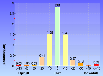
Gradient
4.4km of this walk has gentle hills with occasional steps and another 1.5km is flat with no steps. The remaining (960m) has short steep hills.
Quality of track
3.5km of this walk follows a clear and well formed track or trail and another 2km follows a smooth and hardened path. The remaining (1.3km) follows a formed track, with some branches and other obstacles.
Signs
Around 4.5km of this walk is clearly signposted, whilst the remaining 2.3km has directional signs at most intersection.
Experience Required
Around 6km of this walk requires no previous bushwalking experience, whilst the remaining 980m requires some bushwalking experience.
weather
This whole walk, 7km is not usually affected by severe weather events (that would unexpectedly impact safety and navigation).
Infrastructure
Around 4.8km of this walk is close to useful facilities (such as fenced cliffs and seats), whilst the remaining 2km has limited facilities (such as not all cliffs fenced).
Similar walks
A list of walks that share part of the track with the The Prince Henry Cliff Walk walk.
Solitary Restaurant to Fossil Rock
150 m Return, 15 mins
Moderate track
Katoomba Cascades
254 m Return, 15 mins
Moderate track
Gordon Falls Lookout Walk
260 m Return, 15 mins
Moderate track
Solitary Restaurant to Jamieson Lookout
308 m Return, 15 mins
Moderate track
Reids Plateau Loop
352 m Circuit, 20 mins
Moderate track
Katoomba Falls Park to Cliff View Lookout
556 m Return, 20 mins
Very easy
Solitary Kiosk and Restaurant to Copelands Lookout
570 m Return, 20 mins

Moderate track
Carrington Park to BurraBarroo Lookout
582 m Return, 30 mins
Moderate track
Silver Mist Park to Honeymoon Lookout
595 m One way, 30 mins
Moderate track
Leura Cascades Circuit
844 m Circuit, 30 mins

Moderate track
Round Walk- (Leura Cascades Loop)
844 m Circuit, 30 mins

Moderate track
Round Walk
854 m Circuit, 45 mins
Hard track
Furber Steps-Scenic Railway
869 m Circuit, 1 hr 15 mins
Hard track
Carrington Park to Bridal Veil Lookout return
892 m Return, 30 mins
Moderate track
Bridal Veil View Lookout Leura
954 m Return, 30 mins

Moderate track
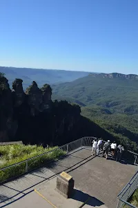
The Three Sisters Footpath
1.1 km Return, 45 mins
Hard track
Witches Leap Circuit
1.1 km Circuit, 2 hrs
Hard track
Katoomba Kiosk to Katoomba Falls
1.1 km Return, 45 mins
Moderate track
Scenic World to Katoomba Falls Lookout
1.2 km Return, 2 hrs
Hard track
Leura Park to Copelands Lookout
1.5 km Return, 1 Hr

Moderate track
Katoomba Falls Circuit
1.5 km Circuit, 1 hr 45 mins
Hard track
Katoomba Kiosk to base of Katoomba Falls
1.7 km Return, 2 hrs
Hard track
Carrington Park to Marguerite Cascades
1.7 km Return, 1 hr 15 mins
Hard track
Scenic World to base of Katoomba Falls (Via Furber Steps)
1.7 km Return, 3 hrs 45 mins
Hard track
Leura Cascades to Gordon Falls Reserve
1.8 km One way, 1 hr 15 mins
Moderate track
Katoomba Falls to Echo Point via Prince Henry Cliff Walk
1.8 km One way, 1 Hr
Moderate track
Bridal Veil View and Olympian Lookout Walk
2 km Circuit, 1 Hr
Moderate track
Scenic World to Echo Point
2.1 km One way, 1 hr 15 mins
Moderate track
Echo Point to Eastern Skyway Station
2.2 km Return, 1 hr 30 mins
Moderate track
Carrington Park to Leura Forest return
2.3 km Return, 1 hr 30 mins
Hard track
Scenic Railway - Federal Pass Track
3.1 km One way, 3 hrs
Hard track
Echo Point to Scenic World via Giant Stairway
3.1 km One way, 3 hrs
Hard track
Echo Point to Katoomba Falls
3.1 km Return, 1 hr 30 mins
Moderate track
Echo Point to Leura Cascades
3.2 km One way, 1 hr 45 mins
Moderate track
Carrington Park to Bridal View Lookout
3.3 km Return, 1 hr 30 mins
Moderate track
Leura Park to Gordon Falls Lookout
3.6 km Return, 2 hrs
Moderate track
Echo Point to Leura Forest via Three Sisters and Giant Stairs loop
3.8 km Circuit, 3 hrs
Hard track
Echo Point to Barrabaroo Lookout
4 km Return, 2 hrs
Moderate track
Federal Pass
4.4 km One way, 3 hrs 45 mins
Hard track
Carrington Park to Leura Forest and pass loop
4.8 km Circuit, 3 hrs
Hard track
Echo Point to Leura Forest Circuit
4.8 km Circuit, 3 hrs
Hard track
Dardenelles Pass
4.8 km Circuit, 3 hrs
Hard track
Scenic world to Three Sisters Loop via Furber Steps
5.8 km Circuit, 5 hrs 30 mins
Hard track
Leura to Katoomba via Dardanelles Pass
6.6 km One way, 4 hrs
Hard track
Scenic World down Furber Steps to Narrow Neck loop
6.8 km Circuit, 5 hrs
Hard track
Federal Pass Walking Track
8 km One way, 5 hrs
Hard track
Solitary Kiosk Loop
9.4 km Circuit, 5 hrs 30 mins
Hard track
Scenic Railway to Ruined Castle
12.4 km Return, 7 hrs 30 mins
Hard track
Scenic Railway to Mt Solitary via the Ruined Castle
16.2 km Return, 11 hrs
Experienced only
Mt Solitary and Kedumba Valley Circuit
33.8 km Circuit, 3 Days
Experienced only
Other Nearby walks
A list of walks that start near the The Prince Henry Cliff Walk walk.
Katoomba to Wentworth Falls via the Jamison Valley
29.2 km One way, 2 Days
Experienced only
Scenic Railway - Ruined Castle - Mt Solitary - Kedumba River - Wentworth Falls
29.3 km One way, 3 Days
Experienced only
Scenic Railway to Golden Staircase Circuit
5.9 km Circuit, 3 hrs 30 mins
Hard track
Scenic Railway to Leura Forest
6.7 km Return, 4 hrs 30 mins
Moderate track
Scenic Railway to the Landslide
2.7 km Return, 2 hrs 30 mins
Moderate track
Lady Darley Lookout Track
218 m Return, 20 mins
Moderate track
Golden Staircase to Mt Solitary via Ruined Castle
11.7 km Return, 8 hrs 45 mins

Experienced only
Ruined Castle Walk
7.9 km Return, 5 hrs

Hard track
Elysian Rock Lookout track
222 m Return, 15 mins
Moderate track
Tarpeian Rock
432 m Return, 15 mins
Easy track
Devil's Hole Trail
7 km One way, 3 hrs 30 mins
Very experienced only
Plan your trip to and from the walk here
The The Prince Henry Cliff Walk walk starts at the Scenic World (gps: -33.728585, 150.30096)
The The Prince Henry Cliff Walk ends at the Corner of Olympian Parade and Lone Pine Ave (gps: -33.725365, 150.33191)
Weather Forecast
This walk starts in the Central Tablelands weather district.
Current Alerts
Park Information
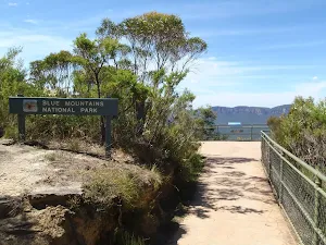
Blue Mountains National Park
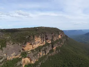
Attracting over 3 million visitors annually, Blue Mountains National Park holds some of Australia's most spectacular and diverse wilderness areas. Explore the Grose Valley, with its sheer sandstone cliffs, waterfalls and scenic walking, or enjoy the famous views of the Three Sisters. Easy access makes a day trips very worthwhile, but with such diversity it would be great to stay in one of the many B&B's and spend a few days soaking up the region.
Comments
Short URL: http://wild.tl/tphcw