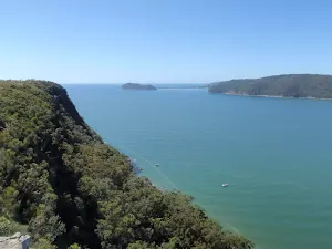
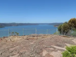
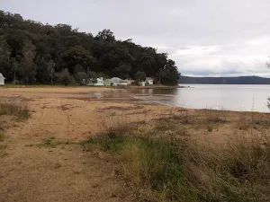
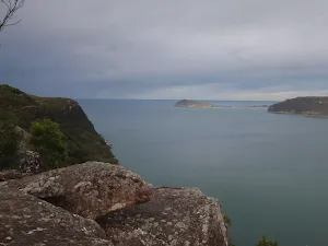
Mt Ettalong Lookout


(0km) Mt Ettalong Water Tank → End of management trail
(1km) End of management trail → Lookout intersection
(1km) Lookout intersection → Pearl Beach Lookout
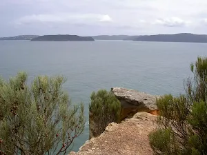
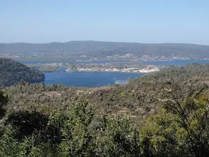
Pearl Beach Lookout
(1km) Lookout intersection → Mt Ettalong Lookout
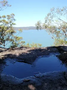
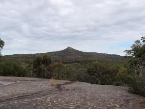
Mt Ettalong Lookout
Maps for the Mt Ettalong Lookout walk
You can download the PDF for this walk to print a map.
These maps below cover the walk and the wider area around the walk, they are worth carrying for safety reasons.
| Broken Bay | 1:25 000 Map Series | 91301N BROKEN BAY | NSW-91301N |
| Sydney | 1:100 000 Map Series | 9130 SYDNEY | 9130 |
Cross sectional view of the Mt Ettalong Lookout bushwalking track
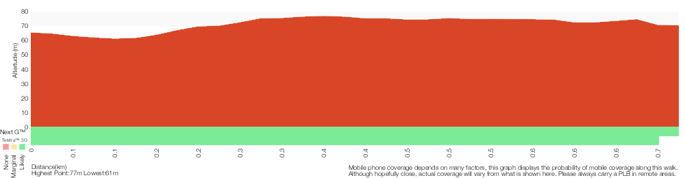
Analysis and summary of the altitude variation on the Mt Ettalong Lookout
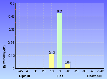
Overview of this walks grade – based on the AS 2156.1 – 2001
Under this standard, a walk is graded based on the most difficult section of the walk.
| Length | 1.4 km | ||
| Time | 30 mins | ||
| . | |||
Grade 2/6 Easy track | AS 2156.1 | Gradient | Gentle hills with occasional steps (2/6) |
| Quality of track | Clear and well formed track or trail (2/6) | ||
| Signs | Clearly signposted (1/6) | ||
| Experience Required | No experience required (1/6) | ||
| Weather | Weather generally has little impact on safety (1/6) | ||
| Infrastructure | Generally useful facilities (such as fenced cliffs and seats) (1/6) |
Some more details of this walks Grading
Here is a bit more details explaining grading looking at sections of the walk
Gradient
This whole walk, 680m has gentle hills with occasional steps.
Quality of track
This whole walk, 680m follows a clear and well formed track or trail.
Signs
This whole walk, 680m is clearly signposted.
Experience Required
This whole walk, 680m requires no previous bushwalking experience.
weather
This whole walk, 680m is not usually affected by severe weather events (that would unexpectedly impact safety and navigation).
Infrastructure
This whole walk, 680m is close to useful facilities (such as fenced cliffs and seats).
Other Nearby walks
A list of walks that start near the Mt Ettalong Lookout walk.
Pearl Beach to Warrah Lookout
5.1 km Return, 2 hrs
Moderate track
Box Head Track
3.1 km Return, 2 hrs
Moderate track
Hawke Head Drive to Box Head
3.1 km Return, 1 hr 15 mins
Moderate track
Warrah Trig to Patonga
2.2 km One way, 1 Hr
Moderate track
Warrah Trig to Pearl Beach
2.8 km One way, 1 hr 15 mins
Moderate track
Warrah Trig to Lookout
756 m Return, 20 mins
Easy track
Patonga to Pearl Beach
4.3 km One way, 1 hr 45 mins
Moderate track
Patonga to Somersby
41.5 km One way, 3 Days
Hard track
Patonga to Staples Lookout
17 km One way, 6 hrs 30 mins
Hard track
Patonga to Wondabyne station via Mt Wondabyne
19.5 km One way, 7 hrs 30 mins
Hard track
Patonga to Wondabyne station via Pindar Caves overnight
28.1 km One way, 2 Days
Experienced only
Patonga to Warrah Trig Station
4.3 km Return, 2 hrs
Moderate track
Plan your trip to and from the walk here
The Mt Ettalong Lookout walk starts and ends at the Mt Ettalong Water Tank (gps: -33.536336, 151.30605)
Comments
Short URL: http://wild.tl/mel