Tap again to allow map panning

Time 4 hrs
Return 6 km Return
Climb 375 m
Grade 6 Very experienced only
Car
no_pets
A great day or overnight walk along Erskine Creek to the Dadder Camping Cave. This cave has a long history of use for overnight camps. The lovely Erskine Creek provides plenty of opportunities to cool the feet down. The climb down to Erskine Creek is steep, and the walk along the banks of Erskine Creek can be very slow at times.

* This walk passes through very remote areas and sections have no visible track. At least one person in your group should have training and experience in off track walking and navigation. Even with these notes and a GPS these extra skills and equipment are required.

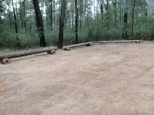
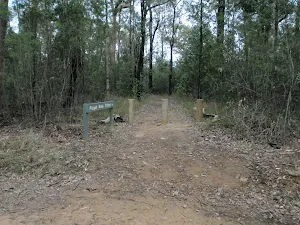
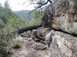
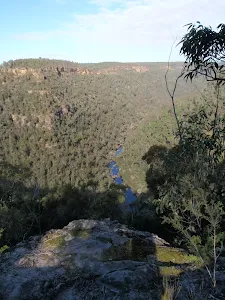
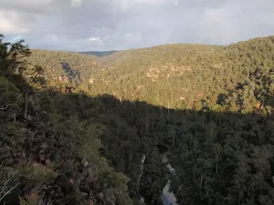
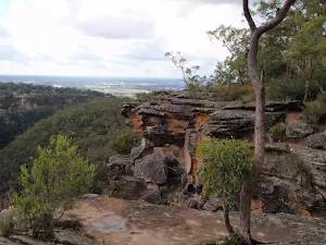
(0km) Pisgah Rock track head → Pisgah Rock

distance 780 m time 15 mins climb 21m descent -22m Moderate track
From the Pisgah Rock car park (2.2km further along Nepean Lookout Fire Trail from the Oaks Picnic Area), this walk follows the 'Pisgah Rock 700mt' sign along the old management trail. The track meanders through the Eucalypt and Casuarina forest as it climbs a gentle hill and then heads down the other side. The track soon comes to an intersection with a small bush track off to the left, from the intersection there are glimpses of the valley views.
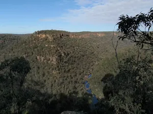
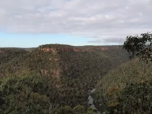
Veer left: From the intersection this walk takes the short bush track toward the view of the valley. The track comes to the unfenced cliff and great view from the top of Pisgah Rock and a sign posted 'take care when walking near cliffs'.
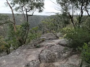
Pisgah Rock

Pisgah Rock
Pisgah Rock, is a short walk from Nepean Lookout Fire Trail in the lower Blue Mountains, and provides excellent views up Erskine Creek Gorge. The informal lookout is not fenced, and the surface is uneven with large crevasse like cracks. The view is simply amazing, with great views right up the middle of Erskine Creek Gorge. There are also great views to the left, down Erskine Creek Gorge and across the flats of the southern parts for greater Sydney. The rock presumably derives its name from the height point on Mount Nebo, where the Bible reports Moses seeing the promised land for the first time. In Hebrew pisgah refers to a high place. This Pisgah Rock is very much a high place, with great views.

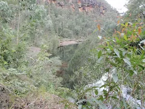
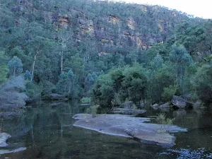
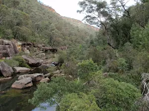
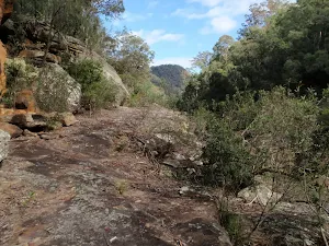
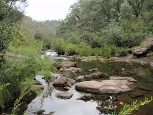
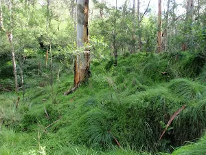
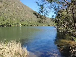
(1km) Pisgah Rock → Junction of Erskine and Lincoln Crks

distance 610 m time 21 mins climb 18m descent -200m Very experienced only
Turn right: From the 'take care when walking near cliffs' signpost on Pisgah Rock this walk now follows the rock at the top of the cliff keeping the valley below to the left. After passing a couple of very steep looking cracks in the rock, the faint track comes to a much more gentle looking pass with a large Banksia growing out of it. The walk heads down through this pass. The track turns right and heads down a much steeper climb through the V in the rock. At the bottom of this climb the bush track leads to a small unfenced rock platform. The walk then turns right heading down the couple more climbs then turns left back under the rock platform. The track continues to wind down several more steep rocky climbs following a faint track and cairns. after most climbs the track generally tends left and down hill. After the last climb, the track heads away from the cliff making, tending left heading fairly steeply to an intersection near the junction of Erskine Creek and Lincoln Creek.

Junction of Erskine and Lincoln Creeks

Junction of Erskine and Lincoln Creeks
The junction of Erskine and Lincoln Creeks, in the Blue Mountains National park, occurs at a large rock platform. The rock platform contains many water holes, a few large square boulders and a few short cascades. There are breath taking views up looking Erskine Creek Gorge. Looking up to the escarpment, to the north east, there is a view of Pisgah Rock. This area floods after rain, but when water levels are normal, this can be a lovely place to rest and enjoy the creeks and gorge.

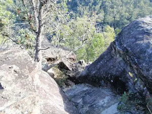
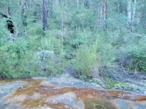
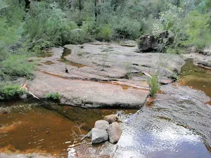
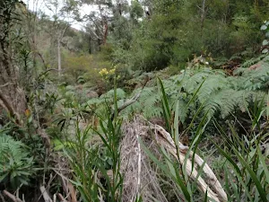
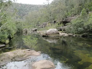
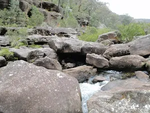
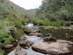
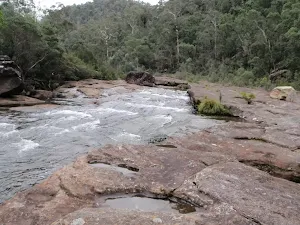
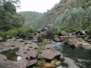
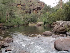
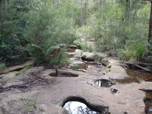
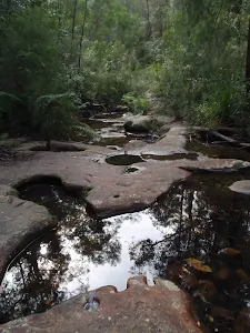
(1km) Junction of Erskine and Lincoln Creeks → Rock platform

distance 260 m time 7 mins climb 22m descent -13m Experienced only
Continue straight: From the intersection, this walk head downstream along Erskine Creek, keeping the creek to the right. After following the indistinct bush track for a short while it leads to an large open rock platform. The walk continues along the rock until coming to the edge of a large pool at the bottom of the cascades. At the end of this side trip, retrace your steps back to the main walk then Veer left.

Rock Platform

Rock Platform
This is a rock platform on Erskine creek about 200m downstream from the junction with Lincoln Creek. The area does flood so depending on water levels this is usually a large rock platform with some interesting water holes, and a lovely cascade flowing into a shallow pool. Although this lacks the majestic view up Erskine Creek (found a short distance upstream), this spot does provide an open spot, great for a snack, lunch and to rest.

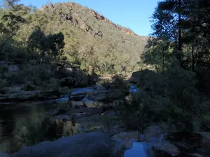
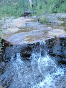
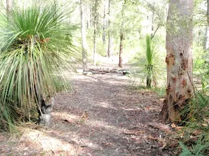
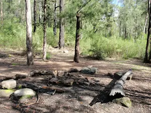
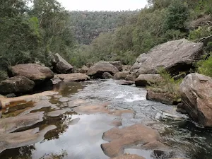
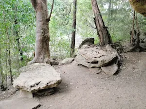
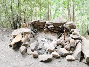
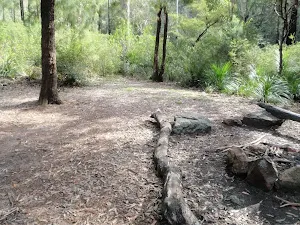
(1km) Junction of Erskine and Lincoln Creeks → Lower Lincoln Campsite

distance 70 m time 2 mins climb 3m descent -4m Experienced only
Turn right: From the intersection, this walk cross Lincoln Creek at the rock pools staying upstream of the small cascade (this may be impassable after rain). On the other side of the creek the walk picks up a faint track heading gently up the ridge. Soon the track opens up into a large campsite with some wonderful grass trees.

Lower Lincoln Campsite

Lower Lincoln Campsite
This well established campsite is found about 60m up the spur, south west of the junction of Lincoln and Erskine Creek. The large campsite has enough room for 6-10 tents and has an established campfire with log seats. The campsite is set among some lovely eucalypt and grass trees. Water from both creeks should be treated before drinking. If this campsite is full, there are a few alternative smaller sites in the area, one further up the hill, and another down by Erskine Creek.

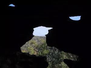
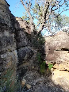
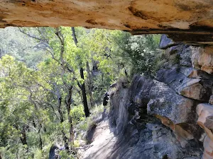
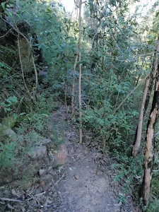
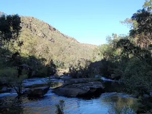
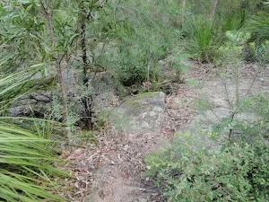
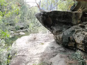
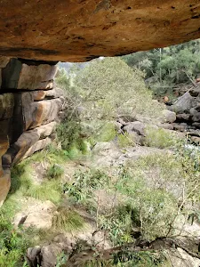
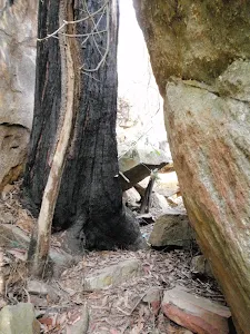
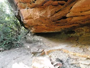
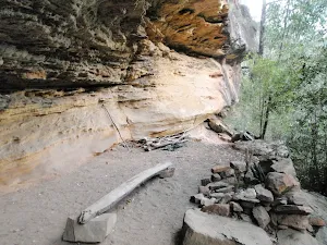
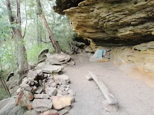
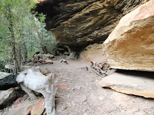
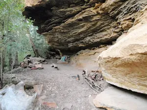
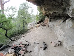
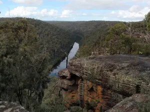
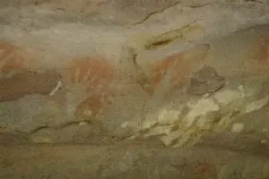
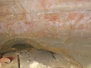
(1km) Lower Lincoln Campsite → Dadder Cave

distance 1.5 km time 32 mins climb 67m descent -40m Very experienced only
Turn left: From the eastern side of the campsite this walk follows the narrow track towards Erskine Creek. Just before the creek the track turns right and heads up stream. The track soon fades and becomes undefined, this walk continues along the flood bank to find a good spot to cross to the other side of Erskine Creek. There are a few cossing options before coming to the land slide, feet will most likely get wet (the creek may be impassable after rain). When crossing notice the rounded hill upstream, Dadder cave is about 1km before it. One on the eastern bank the walk continues upstream heading towards the rounded hill with Erskine creek now to the right. The walk passes several smaller caves and as the walk gets closer to Dadder Cave a fairly well defined track forms leading up behind a large boulder and into the cave. The cave is just upstream from, and on the opposite side of the gorge, from a gully entering Erskine Creek from the west. The cave has clearly been used for camping for some time, with a campfire, and left over camping material.

Dadder Cave

Dadder Cave
Dadder cave, is a large sandstone cave, that has been used as a camping cave by bushwalkers for several decades. The cave is on the easter side of Erskine Creek, about 1.5km upstream from the junction with Lincoln Creek. The large cave is about 30m up the bank and fairly well protected from the weather. There is enough room to sleep about 6 people, more if people are comfortable with each other, and happy to spread along the full length of the cave. A large stone fire place, a bench seat, and a few other items have been left by previous walkers. A log book that makes interesting reading is found under a tarp at the high end of the cave. The cave make a great base camp, for walkers planning to spend some time enjoying Erskine Creek. The name 'Dadder' is believed to come from Death Adder, abbreviated to D'adder, and then finally to Dadder. Erskine Creek provides plenty of water, treat the water before drinking.

Maps for the Dadder Cave walk

You can download the PDF for this walk to print a map.
These maps below cover the walk and the wider area around the walk, they are worth carrying for safety reasons.

Penrith1:25 000 Map Series90303N PENRITHNSW-90303N
Penrith1:100 000 Map Series9030 PENRITH9030

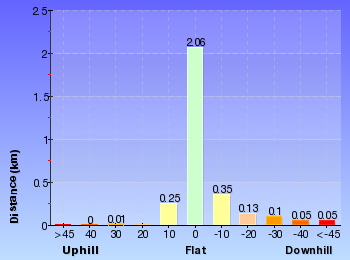
Cross sectional view of the Dadder Cave bushwalking track

Terrain profile for Dadder Cave

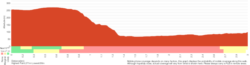
Analysis and summary of the altitude variation on the Dadder Cave

Altitude analysis for Dadder Cave

Overview of this walks grade – based on the AS 2156.1 – 2001

Under this standard, a walk is graded based on the most difficult section of the walk.

Length6 km
Time4 hrs
.


Grade 6/6


Very experienced only
AS 2156.1GradientVery steep and difficult scrambles (5/6)
Quality of trackOff track (no visible track at times) (6/6)
SignsNo directional signs (5/6)
Experience RequiredVery high level of bushwalking experience recommended (6/6)
WeatherForecast, unforecast storms and severe weather may impact on navigation and safety (4/6)
InfrastructureNo facilities provided (5/6)

Some more details of this walks Grading

Here is a bit more details explaining grading looking at sections of the walk

Gradient

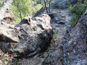
Around 2.1km of this walk is very steep with difficult rock scrambles, whilst the remaining 850m has gentle hills with occasional steps.

Quality of track

1.5km of this walk follows a known route where there is no visible track and another 760m follows a clear and well formed track or trail. Whilst another 610m follows a smooth and hardened path and a 75m section follows a rough track, where fallen trees and other obstacles are likely. The remaining 20m follows a formed track, with some branches and other obstacles.

Signs

Around 2.2km of this walk Has no directional signs, whilst the remaining 780m has directional signs at most intersection.

Experience Required

1.5km of this walk requires a leader with a high level of bushwalking experience and another 760m requires no previous bushwalking experience. Whilst another 610m requires at least one leader with a very high level of bushwalking experience and a 75m section requires a leader a with moderate level of bushwalking experience. The remaining 20m requires some bushwalking experience.

weather

1.6km of this walk is affected by forecast, unforecast storms and severe weather events that may impact on navigation and safety and another 780m is not usually affected by severe weather events (that would unexpectedly impact safety and navigation). The remaining (610m) is affected by storms that may impact your navigation and safety.

Infrastructure

Around 2.2km of this walk has no facilities provided, whilst the remaining 780m has limited facilities (such as not all cliffs fenced).

Similar walks

A list of walks that share part of the track with the Dadder Cave walk.

Other Nearby walks

A list of walks that start near the Dadder Cave walk.

Plan your trip to and from the walk here

The Dadder Cave walk starts and ends at the Pisgah Rock track head (gps: -33.828459, 150.57170)

Weather Forecast

This walk starts in the Central Tablelands weather district.

Current Alerts

Park Information

Blue Mountains National Park

Attracting over 3 million visitors annually, Blue Mountains National Park holds some of Australia's most spectacular and diverse wilderness areas. Explore the Grose Valley, with its sheer sandstone cliffs, waterfalls and scenic walking, or enjoy the famous views of the Three Sisters. Easy access makes a day trips very worthwhile, but with such diversity it would be great to stay in one of the many B&B's and spend a few days soaking up the region.

Comments