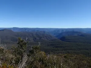
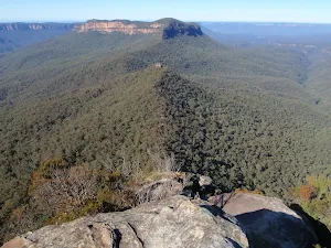
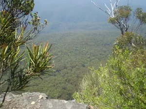
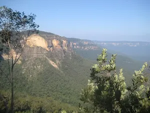
McKeowns Valley Lookdown Walk
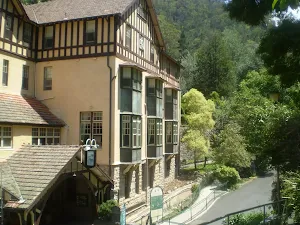
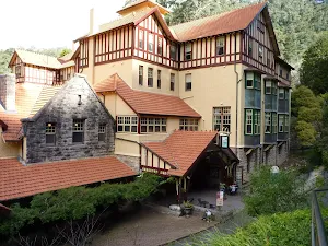
Jenolan Caves House
(0km) Caves House → Carlotta Arch Lookout
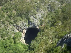
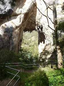
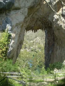
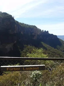
Carlotta Arch
(0km) Top of Carlotta Arch Steps → Bottom of Carlotta Arch Steps
(0km) Carlotta Arch Lookout → Int of 6FT and Carlotta Arch Track
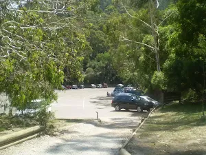
(0km) Int of 6 ft track and Carlotta Arch Track → Carlotta Carpark Intersection
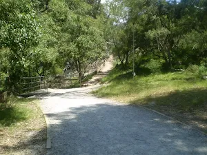
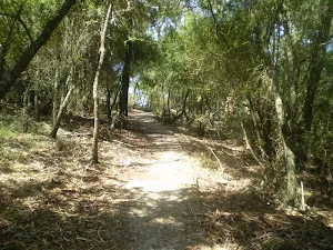
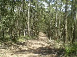
Veer left: From the intersection, this walk heads along the gravel footpath, following the 'carpark no 2' sign. The walk soon passes by the entrance to a cave, before going slightly uphill to an intersection. (There is a large car park to the left).
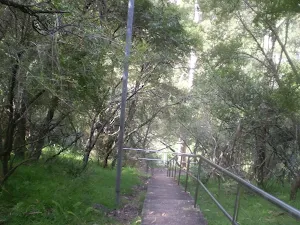
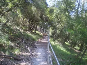
(1km) Carlotta Carpark Intersection → McKeowns Valley Lookdown
Maps for the McKeowns Valley Lookdown Walk walk
You can download the PDF for this walk to print a map.
These maps below cover the walk and the wider area around the walk, they are worth carrying for safety reasons.
| Six Foot Track | 1:50 000 Map Series | Six Foot Track | NSW-six-foot-track |
| Jenolan | 1:25 000 Map Series | 89303N JENOLAN | NSW-89303N |
| Katoomba | 1:100 000 Map Series | 8930 KATOOMBA | 8930 |
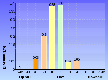
Cross sectional view of the McKeowns Valley Lookdown Walk bushwalking track
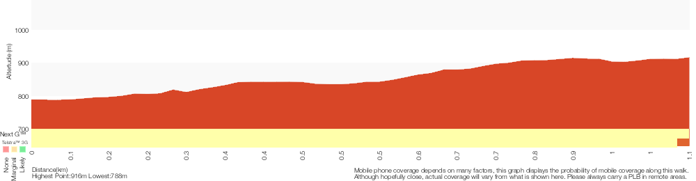
Analysis and summary of the altitude variation on the McKeowns Valley Lookdown Walk
Overview of this walks grade – based on the AS 2156.1 – 2001
Under this standard, a walk is graded based on the most difficult section of the walk.
| Length | 2.2 km | ||
| Time | 1 hr 9 mins | ||
| . | |||
Grade 3/6 Moderate track | AS 2156.1 | Gradient | Short steep hills (3/6) |
| Quality of track | Smooth and hardened path (1/6) | ||
| Signs | Clearly signposted (1/6) | ||
| Experience Required | No experience required (1/6) | ||
| Weather | Weather generally has little impact on safety (1/6) | ||
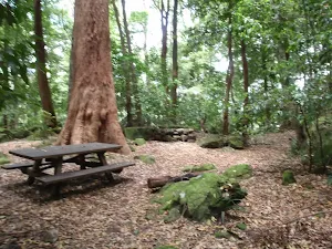
| Infrastructure | Generally useful facilities (such as fenced cliffs and seats) (1/6) |
Some more details of this walks Grading
Here is a bit more details explaining grading looking at sections of the walk
Gradient
1km of this walk has short steep hills and another 75m is flat with no steps. The remaining (35m) has gentle hills with occasional steps.
Quality of track
This whole walk, 1.1km follows a smooth and hardened path.
Signs
This whole walk, 1.1km is clearly signposted.
Experience Required
This whole walk, 1.1km requires no previous bushwalking experience.
weather
This whole walk, 1.1km is not usually affected by severe weather events (that would unexpectedly impact safety and navigation).
Infrastructure
This whole walk, 1.1km is close to useful facilities (such as fenced cliffs and seats).
Similar walks
A list of walks that share part of the track with the McKeowns Valley Lookdown Walk walk.
Carlotta's Arch Track
828 m Return, 30 mins
Moderate track
McKeowns Valley Walk
3.1 km Return, 1 hr 30 mins
Hard track
McKeowns Valley Circuit
3.5 km Circuit, 2 hrs
Hard track
Jenolan Cottages to Caves
4.6 km One way, 2 hrs
Hard track
Six Foot Track
44.8 km One way, 3 Days
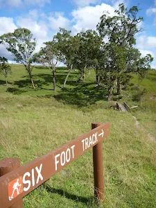
Hard track
Six Foot Track (Alum Creek Reserve)
44.8 km One way, 2 Days
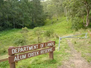
Hard track
Other Nearby walks
A list of walks that start near the McKeowns Valley Lookdown Walk walk.
River Walk (Blue Lake)
2.6 km Circuit, 1 hr 30 mins
Moderate track
Megalong Rd to Bowtells Swing Bridge (Coxs River)
12.6 km Return, 5 hrs 30 mins
Hard track
Along Narrow Neck to Taro's Ladder
20 km Return, 7 hrs
Moderate track
Narrow Neck to Castle Head
4.2 km Return, 1 hr 45 mins
Hard track
Golden Staircase to Mt Solitary via Ruined Castle
11.7 km Return, 8 hrs 45 mins

Experienced only
Ruined Castle Walk
7.9 km Return, 5 hrs

Hard track
Katoomba to Wentworth Falls via the Jamison Valley
29.2 km One way, 2 Days
Experienced only
Scenic Railway - Ruined Castle - Mt Solitary - Kedumba River - Wentworth Falls
29.3 km One way, 3 Days
Experienced only
Scenic Railway to Golden Staircase Circuit
5.9 km Circuit, 3 hrs 30 mins
Hard track
Scenic Railway to Leura Forest
6.7 km Return, 4 hrs 30 mins
Moderate track
Scenic Railway to Mt Solitary via the Ruined Castle
16.2 km Return, 11 hrs
Experienced only
Scenic Railway to Ruined Castle
12.4 km Return, 7 hrs 30 mins
Hard track
Plan your trip to and from the walk here
The McKeowns Valley Lookdown Walk walk starts and ends at the Caves House (gps: -33.820325, 150.02117)
Weather Forecast
This walk starts in the Central Tablelands weather district.
Current Alerts
Park Information
Jenolan Karst Conservation Reserve
This Reserve is home to the world famous Jenolan Caves. The are a number of guided tours avaible paying visitors to explore the underground on well maintianed tracks through the caves. There are also a number of self guided caves that you can walk through at your own leisure, including the masive Grand Arch which you can drive through. There is accomodation and food avaialble in the area and a number of nice walks.
Comments
Short URL: http://wild.tl/mvlw