Jerusalem Bay Track (Cowan to Brooklyn)
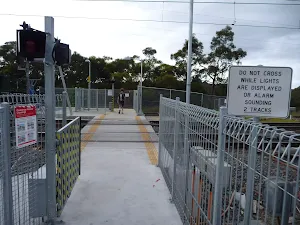
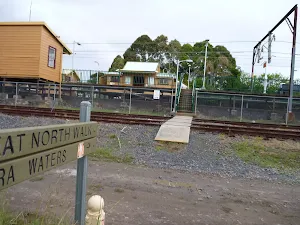

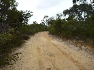
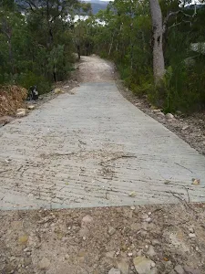
(0km) Cowan Station → Freeway Bridge
(0km) Freeway Bridge → Jerusalem Bay
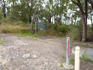
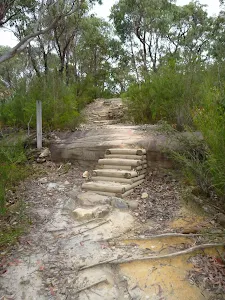
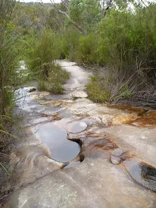
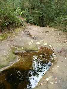
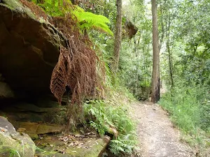
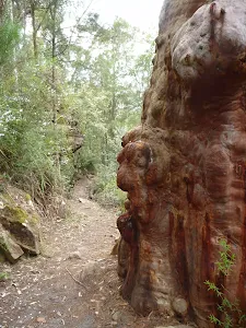
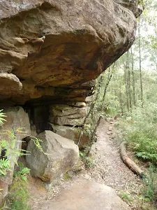
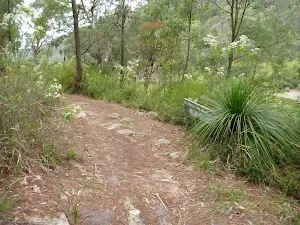
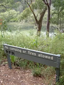
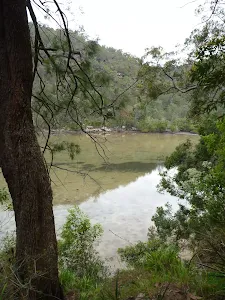
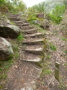
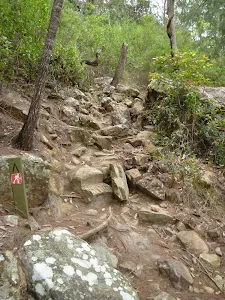
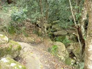
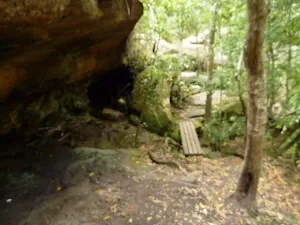
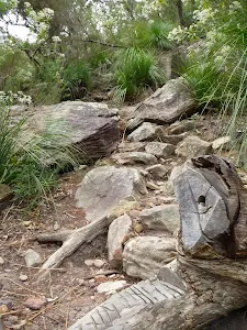
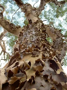
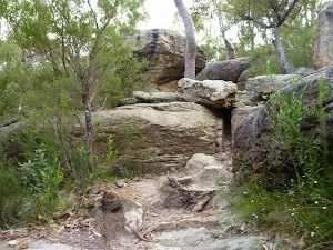
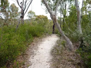
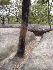
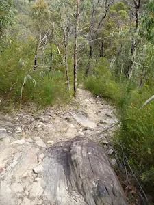
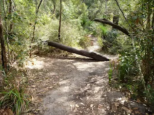
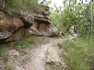
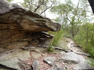
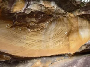
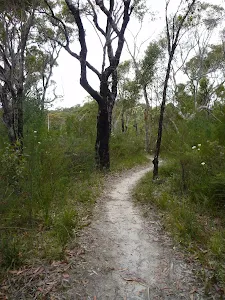
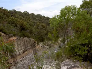
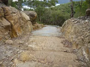
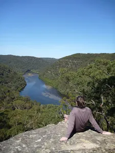
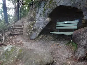
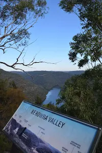
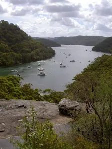
Continue straight: From the intersection, this walk heads downhill along the rocky track[23][24]. The track leads past a few rock walls[25] over about 350m, then turns right onto, then steps down off, a long thin rock platform[26]. The track continues down along the side of the valley for another 200m, passing into a much more lush and dense forest[27], where the track then crosses the creek at a large rock platform[28]. On the other side of the creek, the track leads right down along the other side of the valley[29], passing a few small sandstone overhangs[30][31] then a particularly broad angophora tree[32] after about 500m. Soon after this angophora, the track leads down some rock steps[34] then begins to widen for about 300m, and passes a small track (on your right) marked with a 'No Camping or fires allowed' sign[35]. By this point, the broad waters (or mud flats, depending on the tide) of Cowan Creek are obvious[36], on your right. The walk now continues along the generally broad and flat track[37] for another 500m, then climbs up a set of concrete steps[38], marked with a GNW arrow post. At the top of these steps is a large, fairly flat clearing[39] with a 'No Camping' and a 'Great North Walk' sign[40] and a great view up the middle of Jerusalem Bay[41].
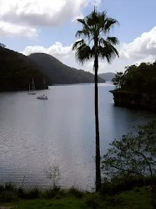
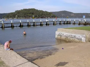
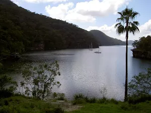
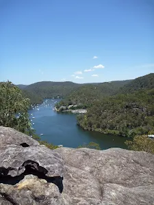
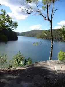
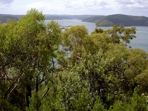
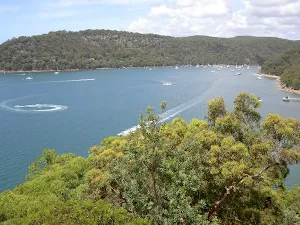
Jerusalem Bay
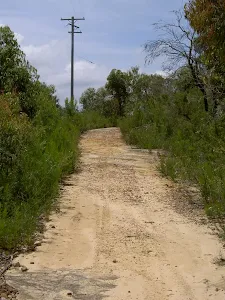
(2km) Jerusalem Bay → Ridge Top
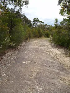
(4km) Ridge Top → Campbells Ck
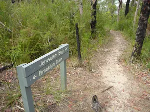
(4km) Campbells Ck → Int. Jerusalem Bay Trk and Brooklyn Dam Service Trail
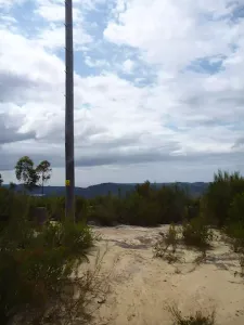
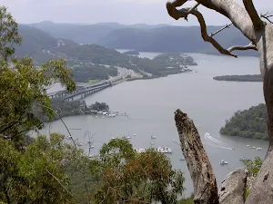
(5km) Int. Jerusalem Bay Trk and Brooklyn Dam Service Trail → freeway view point
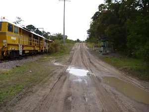
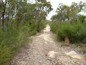
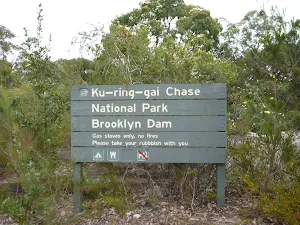
(5km) Int. Jerusalem Bay Trk and Brooklyn Dam Service Trail → Upper Int. of Brooklyn Dam Service Track and Brooklyn Dam Bushtrack
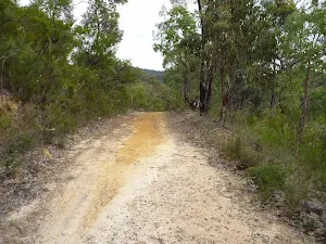
(8km) Upper Int. of Brooklyn Dam Service Track and Brooklyn Dam Bushtrack → NW Brooklyn Dam Campsite
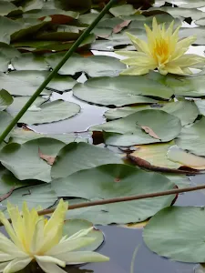
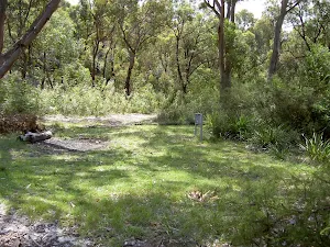
Small Campsite Brooklyn Dam
(10km) NW Brooklyn Dam Campsite → NE Brooklyn Dam Campsite
(10km) NW Brooklyn Dam Campsite intersection → NE Brooklyn Dam Campsite
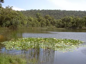
Continue straight: From the intersection, this walk follows the GNW arrow post along the wide trail, keeping the dam to your left. (This section of trail leads around to the far side of the dam.) After just over 250m, the trail crosses a small creek (at the apex of the dam) then continues bending left. The track passes some old concrete pipes[138] (on your left) then after about 400m, the trail comes to an intersection with a clearing and dam wall (to your left).
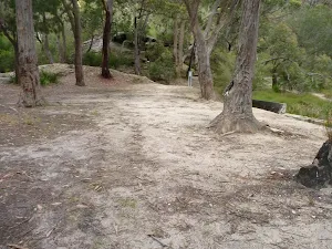
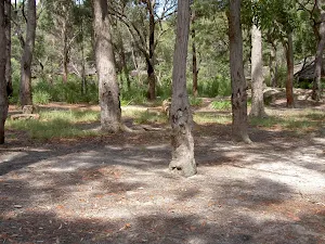
Large Campsite Brooklyn Dam
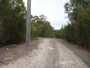
(10km) NE Brooklyn Dam Campsite → Int of Hawkesbury Track and Brooklyn Trail
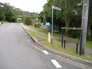
(12km) Int of Hawkesbury Track and Brooklyn Trail → Int of George & William Sts
(13km) Int of George AND William Sts → Hawkesbury River Railway Station
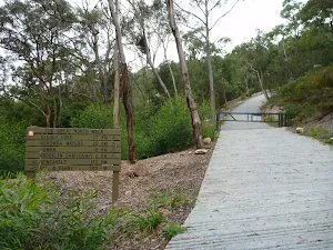
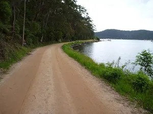
Turn left: From the boat ramp, this walk follows the GNW arrow post through the gate[170] and along the dirt 'Parsley Bay' management trail[171], keeping the water to your right. The trail leads along the foreshore for about 250m then passes the 'Public Loading Dock'[172] (just past a bench seat[173]), and soon bends left[174] around Flat Rock Point. The trail then leads past a square log seat[175], coming to an intersection[176] (where there is a set of stairs on your left).
Continue straight: From the intersection[177] (at the base of the stairs), this walk follows the GNW arrow post[178] along the wide flat trail, keeping the shoreline to your right. Enjoying the view over the water to Dangar Island[179], this dirt trail continues for just over 150m, passing a few seats to come to a concrete footpath[180] beside a Brooklyn Baths[181]. The footpath leads past the toilet block[182], then past several picnic shelters[183] and comes to an intersection just before the fenced children's playground[184].
Continue straight: From the intersection, this walk heads along the flat concrete footpath[185], keeping the water to your right. The path leads around the edge of the metal and glass 'Federation' interpretive signs[186][187] and playground[188]. Here the walk veers right to follow the gravel path[189] between the car park (on your left) and the water[190] (on your right) for about 130m before coming to the end of the car park[191].
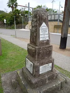
Turn left: From near the end of the car park[192], this walk follows the GNW arrow post across Dangar Rd[193] to then turn right and follow the footpath[194]. The footpath leads past the 'Hawkesbury River Marina'[195][196], to cross a side street[197] then pass some public toilets[198] and a few cafes[199]. The walk then leads past a small park to come to the sandstone 'Obelisk' commemorating the naming of the Hawkesbury River[200]. This is just on the other side of the road, opposite some large 'Great North Walk' signs and the Hawkesbury River Railway Station[201]. Now Turn sharp right to rejoin the main walk .
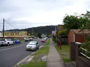
(13km) Int of George & William Sts → Int of Brooklyn & Dangar Rds
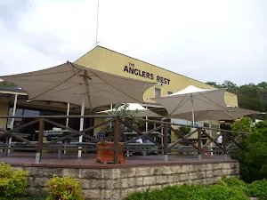
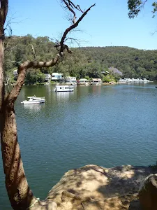
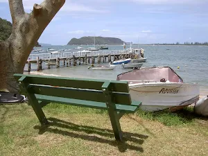
Brooklyn Accomodation
(13km) Int of Brooklyn AND Dangar Rds → Hawkesbury River Railway Station
Maps for the Jerusalem Bay Track (Cowan to Brooklyn) walk
You can download the PDF for this walk to print a map.
These maps below cover the walk and the wider area around the walk, they are worth carrying for safety reasons.
| Cowan | 1:25 000 Map Series | 91304N COWAN | NSW-91304N |
| Ku-ring-gai Chase National Park Tourist Map | 1:40 000 Map Series | CMA Ku-ring-gai Chase National Park Tourist Map | CMA Ku-ring-gai Chase National Park Tourist Map |
| Sydney | 1:100 000 Map Series | 9130 SYDNEY | 9130 |
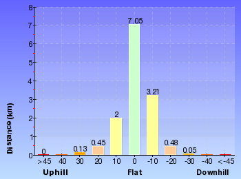
Cross sectional view of the Jerusalem Bay Track (Cowan to Brooklyn) bushwalking track
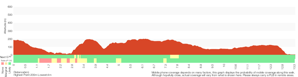
Analysis and summary of the altitude variation on the Jerusalem Bay Track (Cowan to Brooklyn)
Overview of this walks grade – based on the AS 2156.1 – 2001
Under this standard, a walk is graded based on the most difficult section of the walk.
| Length | 13.4 km | ||
| Time | 5 hrs 30 mins | ||
| . | |||
Grade 4/6 Hard track | AS 2156.1 | Gradient | Very steep (4/6) |
| Quality of track | Rough track, where fallen trees and other obstacles are likely (4/6) | ||
| Signs | Minimal directional signs (4/6) | ||
| Experience Required | Some bushwalking experience recommended (3/6) | ||
| Weather | Storms may impact on navigation and safety (3/6) | ||
| Infrastructure | Limited facilities (such as cliffs not fenced, significant creeks not bridged) (4/6) |
Some more details of this walks Grading
Here is a bit more details explaining grading looking at sections of the walk
Gradient
6km of this walk has short steep hills and another 4km has gentle hills with occasional steps. Whilst another 3km is very steep and the remaining 290m is flat with no steps.
Quality of track
5km of this walk follows a clear and well formed track or trail and another 4.9km follows a formed track, with some branches and other obstacles. Whilst another 3km follows a rough track, where fallen trees and other obstacles are likely and the remaining 290m follows a smooth and hardened path.
Signs
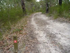
11km of this walk has directional signs at most intersection and another 1.4km is clearly signposted. The remaining (1.1km) has minimal directional signs.
Experience Required
Around 7km of this walk requires some bushwalking experience, whilst the remaining 7km requires no previous bushwalking experience.
weather
Around 12km of this walk is not usually affected by severe weather events (that would unexpectedly impact safety and navigation), whilst the remaining 1.9km is affected by storms that may impact your navigation and safety.
Infrastructure
8km of this walk has limited facilities (such as not all cliffs fenced) and another 4.1km is close to useful facilities (such as fenced cliffs and seats). The remaining (760m) has limited facilities (such as cliffs not fenced, significant creeks not bridged).
Similar walks
A list of walks that share part of the track with the Jerusalem Bay Track (Cowan to Brooklyn) walk.
McKell Park Loop
931 m Circuit, 30 mins
Moderate track
McKell Park to Flat Rock Point
1.4 km Return, 30 mins
Very easy
Jerusalem Bay Track (to Jerusalem Bay and back)
4.9 km Return, 2 hrs
Moderate track
Crosslands to Brooklyn
27.4 km One way, 2 Days
Hard track
Cowan to Wondabyne station via Patonga rest area
33.4 km One way, 2 Days
Hard track
Hornsby to Brooklyn three day walk
43.1 km One way, 3 Days
Hard track
Other Nearby walks
A list of walks that start near the Jerusalem Bay Track (Cowan to Brooklyn) walk.
Berowra Waters to Cowan Station
7.2 km One way, 3 hrs 30 mins
Hard track
Berowra to Mt Kuring-gai
9.4 km One way, 4 hrs 30 mins
Hard track
Berowra to Bobbin Head
8.7 km One way, 4 hrs
Hard track
Berowra to Berowra Waters
5.7 km One way, 2 hrs 45 mins
Hard track
Berowra to Cowan via Berowra Waters
12.9 km One way, 6 hrs
Hard track
Berowra to Hornsby
22.6 km One way, 9 hrs 18 mins
Hard track
Barnetts Lookout
420 m Return, 15 mins
Very easy
Challenger Track
3 km Return, 1 hr 15 mins
Moderate track
America Bay Track (to beach)
2.2 km Return, 1 hr 15 mins
Hard track
America Bay Waterfall
1.9 km Return, 45 mins
Moderate track
Mackerel Beach
8.2 km Return, 3 hrs
Hard track
The Basin Track and Mackerel Track
5.9 km Circuit, 3 hrs
Hard track
Plan your trip to and from the walk here
The Jerusalem Bay Track (Cowan to Brooklyn) walk starts at the Cowan Station (gps: -33.593766, 151.17169)
The Jerusalem Bay Track (Cowan to Brooklyn) ends at the Hawkesbury River Railway Station (gps: -33.547222, 151.22659)
Weather Forecast
This walk starts in the Metropolitan weather district.
Current Alerts
Park Information
Ku-ring-gai Chase National Park
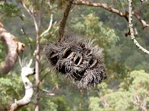
A largely untouched wilderness on the northern boundary of Sydney, Ku-ring-gai Chase NP is one of Australia's oldest national parks. Here at the head of the Hawkesbury River, you'll find Aboriginal engravings and sites, as well as sandstone escarpments,
Comments
Short URL: http://wild.tl/ctbs