Gordon to Chatswood Station
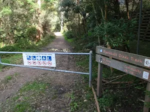
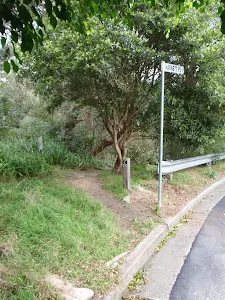
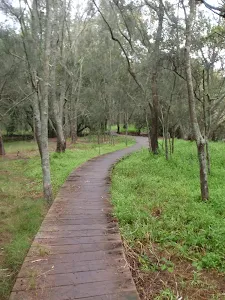
(0km) Gordon Station → Int. Blackbutt Creek Trk and Vale St
Continue straight: From Gordon Station bus depot, this walk heads up the hill of St Johns Ave to the Pacific Highway. The walk crosses to the other side at the pedestrian crossing. From here, this walk follows the shop fronts up the Pacific Highway, then turns left onto Moree St. This street is followed until the walk turns right onto Vale St. This walk continues along Vale St for a short time to the intersection with the bush track on the left of the street.
(1km) Int. Blackbutt Creek Trk and Vale St → Int. Lady Game Drive and Falls Creek Trk
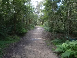
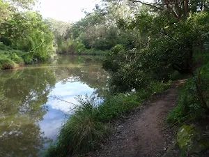
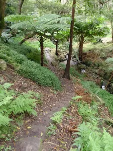
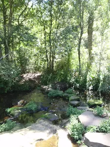
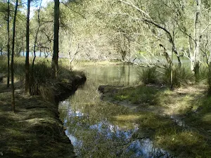
Veer left: From the intersection, this walk heads down the hill, passing a concrete sewerage inspection hole on the right. The trail continues along the creek line for another 20m, to the intersection which leads down to the creek on the right.
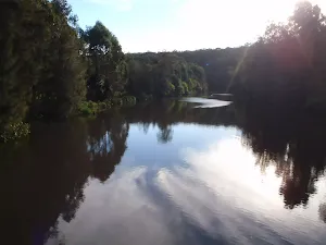
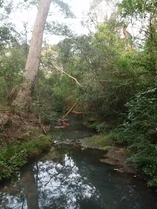
Continue straight: From the intersection, this walk follows the creek downstream for approximately 200m to the signposted intersection.
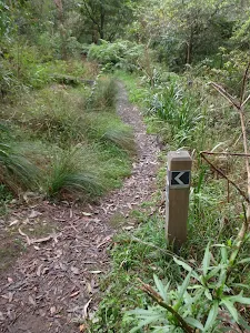
Continue straight: From the intersection, this walk follows the left-hand arrow on the 'Blackbutt Creek Track' sign, down the hill. The track contours with the creek on the right, and the houses high on the left, for approximately 1km to then steeply descend to the intersection above the concreted water-crossing.
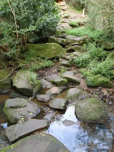
Continue straight: From the intersection, this walk heads down the hill, across the concrete ford (creek), to then turn right and follow along side the creek. The trail tends left away from the creek, up to a white gate.
(3km) Int. Lady Game Drive and Falls Creek Trk → Allen Park
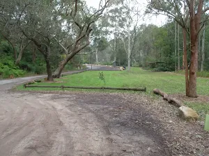
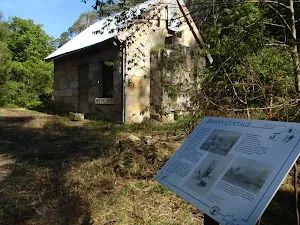
Allen Park
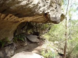
(4km) Allen Park → Sandstone caves
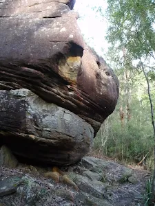
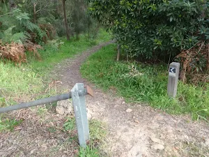
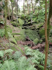
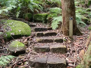
Turn left : From the intersection, this walk follows the GNW arrow post down the steps and along the narrower track[4], directly away from the face of the 'Great North Walk' sign. This track soon passes under some power lines[5] then continues through the open forest[6] for about 50m to head down some rocky steps[7]. From here, the walk follows the base of the rock wall[8] to head through a long tunnel-like sandstone overhang[9][10]. Here the track leads down to cross a mossy and rocky gully[11], then heads up around the left side of a large cube boulder[12] (know as 'The Block'). The walk then follows along the base of long sandstone wall[14] (on your left) for about 130m and then enters a sandstone overhang[15].
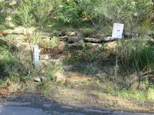
Sandstone caves
(4km) Sandstone caves → Fiddens Wharf Oval Trk
(6km) Bottom of Fiddens Wharf Oval Trk → Int. Opposite Bakers Flat
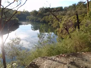
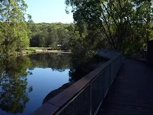
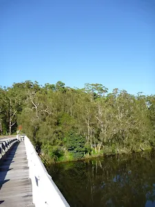
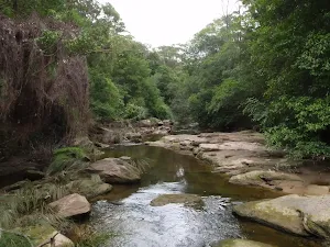
Continue straight: From the intersection, this walk heads around the hillside, with the river below on the right. The walk tends left as it contours around the hill. It then descends over speed bumps for approximately 50m to the car park of Thistlethwaytes picnic area.
Continue straight: From the picnic area, this walk heads down the road, with the water to the right. The walk continues down the road for a short time, to the intersection with the entrance of the National Parks and Wildlife Service's Depot on the left, and the Schwartz Homestead a short distance up the hill.
Continue straight: From the intersection, this walk heads along the road, with the water on the right. The walk tends left, continuing up the road to pass a brick building on the right, before coming to the signposted intersection, opposite Baker's Flat.
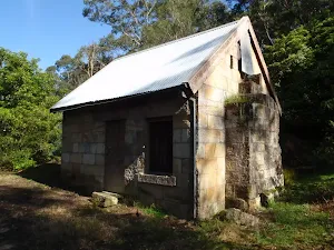
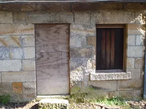
(8km) Int. Opposite Bakers Flat → Baker's Cottage
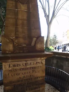
Baker's Cottage
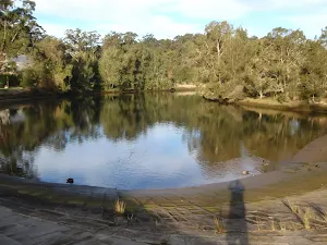
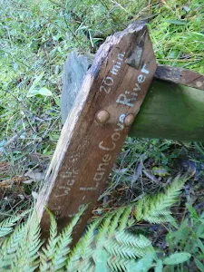
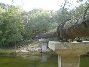
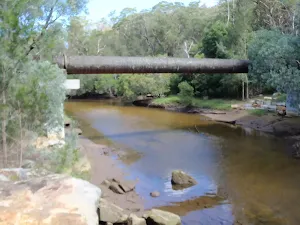
(8km) Int. Opposite Bakers Flat → Lane Cove Weir South
Turn right: From the intersection, this walk heads down the path for approximately 50m to pass a toilet block on the left of the track. The track continues to an intersection with a railed footpath.
Veer right: From the intersection, this walk heads down the slight gradient, away from the toilet block to the large concreted area above the weir.
Turn right: From the intersection, this walk heads directly down the hill to the weir at the water.
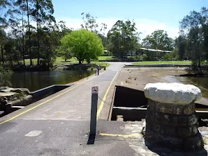
Continue straight: From the intersection, this walk follows the GNW arrow post[50] (past a seaton the right) to cross over the concrete ford(top of the weir wall[51]) to the other side of Lane Cove River to find an intersection marked with another GNW arrow post[52]. After heavy or prolonged rain, this crossing may be closed. It is unsafe to cross if water is flowing over the top.


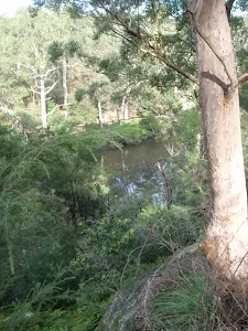
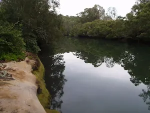
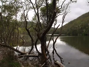
Lane Cove Weir
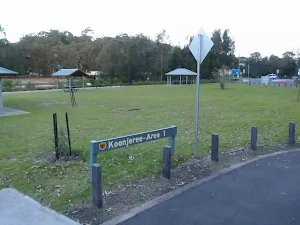
(8km) Lane Cove Weir South → Koonjeree Middle Trk
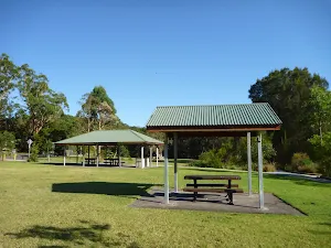
Koonjeree Picnic Area
(8km) Koonjeree Middle Trk → Fullers Bridge Bus Stop
Turn left: From the toilets, this walk heads through the low bushes, following the car park (which is on the left). The walk winds through the bushes to pass a stone seat on the left before crossing the entrance road to the Lane Cove National Park. This walk then continues along the footpath for a few metres to the road, which it crosses to come to the bus stop.
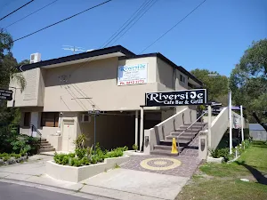
Riverside Cafe Bar & Grill
(9km) Fullers Bridge Bus Stop → Int. Fairway and Delhi Rd
Continue straight: From the corner, this walk crosses Lady Game Drive[74] at the traffic lights, heading away from Fullers Bridge [75].
Turn right: From the intersection, this walk crosses Delhi Rd at the pedestrian crossing, then heads right to cross The Fairway. The walk immediately comes to an intersection with a bush track.
(9km) Int. Fairway and Delhi Rd → Int. Rail to River Trk and Reid Drive
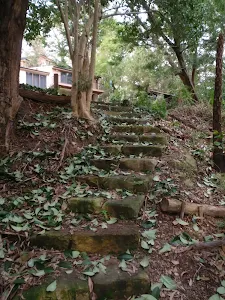
Veer left: From the intersection, the walk heads up the hill tending right, to a set of stairs which it climbs up to Reid Drive, opposite No. 17.
(9km) Int. Rail to River Trk and Reid Drive → Eastern side of O.H. Reid Memorial Oval
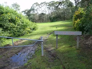
Continue straight: From the car park, this walk heads past the metal gate and across the oval to the far side of the oval, where a track marker stands just off the oval.
(10km) Eastern side of O.H. Reid Memorial Oval → Int. Rail to River Trk and Hawthorne Ave
(10km) Int. Rail to River Trk and Hawthorne Ave → Int. Fullers Rd and Bellevue Ave
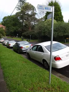
Turn right: From the intersection, this walk follows the 'Rail to River Walk' sign up Bellevue Ave for approximately 500m to the signposted intersection with Fullers Rd.
(10km) Int. Fullers Rd and Bellevue Ave → Harnett Pl sign post
Turn right: From the Fullers Rd gate entry of Lowanna Park, this walk passes through the park diagonally, past the BBQs and play equipment, to the gate opening to Greville St. There is a 'Rail to River Walk' signpost outside the gate.
Turn right: From the gate, this walk heads down the hill, away from Fullers Rd. The track heads down the hill for approximately 200m to cross the road to the Harnett Pl sign, opposite No. 86.
(11km) Harnett Pl sign post → Int. Park Ave and Rail to River Trk
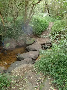
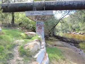
Turn left: From the intersection, the walk heads down the steps and along the creek (which remains on your right) for approximately 60m to a signposted intersection.
Veer left: From the intersection, the walk heads up the gully, with the creek on the right. The track continues climbing up the gully for approximately 100m to an intersection in a clearer area.
Continue straight: From the intersection, the walk follows the 'Rail to River Walk' arrow on the signpost, to head up the gully. The track leads up along the creek (on your right) for approximately 50m to some steppingstones across the creek. Approximately 50m later, the track comes out onto a grassed clearing, from which the walk continues along the management trail to Park Ave.
(11km) Int. Park Ave and Rail to River Trk → Int. Park Ave and Edgar St Reserve Trk
(11km) Int. Park Ave and Edgar St Reserve Trk → Int. Edgar St and Edgar St Reserve Trk
Continue straight: From the memorial bench, this walk heads up the hill, with the stormwater on the right and the house fences on both sides. The track heads up the hill for approximately 150m to a clearing with a playground. This walk passes the playground (with the playground on the left), continuing to the gate and road.
(12km) Int. Edgar St and Edgar St Reserve Trk → Chatswood Station
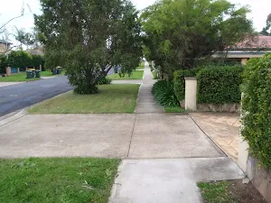
Turn left: From the intersection, this walk crosses at pedestrian crossing on Pacific Highway, or takes the foot bridge just near the intersection. This walk then continues down Victoria Ave to the entrance of the train station on the right. If the road turns left, you have gone too far.
Maps for the Gordon to Chatswood Station walk
You can download the PDF for this walk to print a map.
These maps below cover the walk and the wider area around the walk, they are worth carrying for safety reasons.
| Parramatta River | 1:25 000 Map Series | 91303N PARRAMATTA RIVER | NSW-91303N |
| Sydney | 1:100 000 Map Series | 9130 SYDNEY | 9130 |
Cross sectional view of the Gordon to Chatswood Station bushwalking track
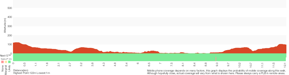
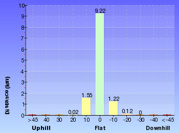
Analysis and summary of the altitude variation on the Gordon to Chatswood Station
Overview of this walks grade – based on the AS 2156.1 – 2001
Under this standard, a walk is graded based on the most difficult section of the walk.
| Length | 12.2 km | ||
| Time | 4 hrs 30 mins | ||
| . | |||
Grade 4/6 Hard track | AS 2156.1 | Gradient | Very steep (4/6) |
| Quality of track | Rough track, where fallen trees and other obstacles are likely (4/6) | ||
| Signs | Directional signs along the way (3/6) | ||
| Experience Required | Some bushwalking experience recommended (3/6) | ||
| Weather | Storms may impact on navigation and safety (3/6) | ||
| Infrastructure | Limited facilities, not all cliffs are fenced (3/6) |
Some more details of this walks Grading
Here is a bit more details explaining grading looking at sections of the walk
Gradient
5km of this walk has short steep hills and another 4.7km is flat with no steps. Whilst another 2.4km has gentle hills with occasional steps and the remaining 55m is very steep.
Quality of track
6km of this walk follows a formed track, with some branches and other obstacles and another 5km follows a smooth and hardened path. Whilst another 1.2km follows a clear and well formed track or trail and the remaining 340m follows a rough track, where fallen trees and other obstacles are likely.
Signs
Around 7km of this walk is clearly signposted, whilst the remaining 4.7km has directional signs at most intersection.
Experience Required
Around 10km of this walk requires no previous bushwalking experience, whilst the remaining 1.9km requires some bushwalking experience.
weather
Around 12km of this walk is not usually affected by severe weather events (that would unexpectedly impact safety and navigation), whilst the remaining 55m is affected by storms that may impact your navigation and safety.
Infrastructure
Around 7km of this walk is close to useful facilities (such as fenced cliffs and seats), whilst the remaining 4.8km has limited facilities (such as not all cliffs fenced).
Similar walks
A list of walks that share part of the track with the Gordon to Chatswood Station walk.
Lane Cove Weir to Boat Shed
1.3 km Return, 1 Hr
Moderate track
Baker's Cottage
1.5 km Return, 45 mins
Moderate track
Lane Cove National Park Heritage Walk
2.6 km One way, 1 Hr
Moderate track
Ferndale Park Loop
3.3 km Circuit, 1 hr 30 mins
Moderate track
Fiddens Wharf walking track
4.3 km Circuit, 1 hr 27 mins
Moderate track
Riverside Walk
5.3 km One way, 2 hrs
Hard track
Fairylands Loop Track
5.3 km Circuit, 2 hrs 30 mins
Hard track
Chatswood Station to Mowbray Park
5.4 km One way, 2 hrs
Hard track
Riverside Walking Track
5.5 km One way, 2 hrs
Hard track
Blackbutt Creek Return
5.5 km Return, 2 hrs

Moderate track
Lane Cove Tourist Park to Baker's Cottage
5.9 km Return, 2 hrs 30 mins
Moderate track
De Burghs Bridge to Fullers Bridge
6 km One way, 2 hrs 30 mins
Hard track
Roseville to Chatswood Station via Lane Cove River
6 km One way, 2 hrs 30 mins
Hard track
North Ryde Fairyland circuit
6.9 km Circuit, 2 hrs 30 mins
Hard track
Rail to River Walk
7.5 km Circuit, 3 hrs
Hard track
Roseville to Macquarie Park
8.9 km One way, 3 hrs 30 mins
Hard track
Gordon to Roseville Railway Station
10.7 km One way, 4 hrs 30 mins

Hard track
Rail to River and Stringybark Creek Reserve Walk
11.2 km Circuit, 4 hrs
Hard track
Epping to Gordon Station
11.7 km One way, 4 hrs 15 mins
Hard track
Lane Cove Tourist Park River Circuit
11.9 km Circuit, 5 hrs
Hard track
Gordon to Roseville Station (Riverside Walk)
13.3 km One way, 4 hrs 30 mins
Hard track
Chatswood to Epping Station
16.3 km One way, 6 hrs
Hard track
Chatswood Station to Eastwood Station
18.1 km One way, 6 hrs 45 mins
Hard track
Gordon to Hornsby (overnight at Scout camp)
25.8 km One way, 2 Days

Hard track
Sydney to Thornleigh via Lane Cove Tourist Park
33 km One way, 2 Days
Hard track
Circular Quay to Hornsby
44.4 km One way, 3 Days

Hard track
Other Nearby walks
A list of walks that start near the Gordon to Chatswood Station walk.
East Killara Track
6 km One way, 2 hrs 45 mins
Hard track
Killara to St Ives via Rocky Creek
6.8 km One way, 3 hrs
Experienced only
St Ives to Davidson Park via Casuarina Track
9 km One way, 4 hrs
Hard track
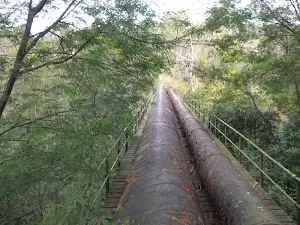
The Pipeline Track
4.7 km Return, 2 hrs
Moderate track
The Pipeline Way
4.7 km One way, 2 hrs 15 mins
Hard track
Sheldon Cascades walk
360 m Return, 15 mins
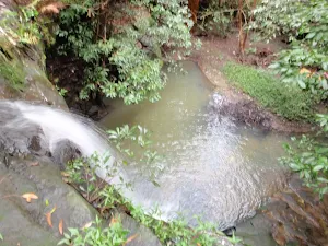
Easy track
East Killara Bushtrack
2.6 km One way, 1 hr 15 mins
Hard track
Bungaroo Track
3.6 km Return, 1 hr 30 mins
Hard track
Founders Way
3 km Return, 1 hr 30 mins
Moderate track
Bungaroo and Founders Way Loop
3.5 km Circuit, 1 hr 30 mins

Hard track
Browns Waterhole Track
1.3 km One way, 30 mins
Moderate track
Kissing Pt Rd to De Burghs Bridge
4.4 km One way, 1 hr 45 mins
Hard track
Plan your trip to and from the walk here
The Gordon to Chatswood Station walk starts at the Gordon Station (gps: -33.756038, 151.15425)
The Gordon to Chatswood Station ends at the Chatswood Station (gps: -33.797073, 151.18037)
Weather Forecast
This walk starts in the Metropolitan weather district.
Current Alerts
Park Information
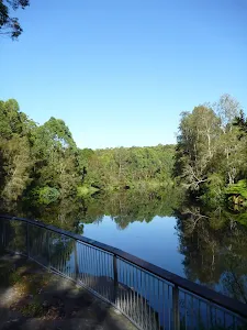
Lane Cove National Park
This small but picturesque city park is a haven of peaceful bushland along the winding Lane Cove River. Home to the Kukundi Wildlife Shelter and 27 km of the Great North Walk, you can also hire a boat, take a stroll or enjoy a picnic by the weir.
Blackbutt Reserve
Blackbutt Reserve is a large area of natural bushland owned and managed by Ku-ring-gai council. The park extends from Lady Game drive up to Vale St, west of Gordon Golf course. The park is supports a number of service trail and bush track allowing visitors to explore large areas of the park. The park is also home to vulnerable Large Forest Owls.
Comments
Short URL: http://wild.tl/gtcs