Roseville to Chatswood Station via Lane Cove River

(0km) Roseville Train Station → Int. Shirley Rd and The Rifleway
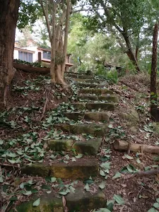
Continue straight: From near the end of Larkin Lane, this walk heads past the green power box and down the pedestrian laneway steps[7]. After approximately 60m, the lane leads down some more steps[8] to find an intersection with another concrete footpath on the other side of Larkin St.
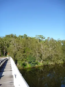
Continue straight: From the intersection, this walk heads down the steps, beside number 4 Larkin St[9]. From the bottom of the steps, the walk heads along the pedestrian alley[10] for about 40m, and then crosses a 60m long bridge[11]. On the other side of the bridge, this walk continues up the alley[12] for about 80m, coming to an intersection with Shirley Rd[13][14].
(0km) Int. Shirley Rd and The Rifleway → Longford St Steps
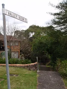
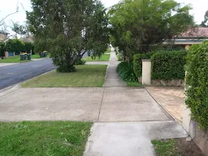
Turn right: From the intersection, this walk heads down along 'Longford St'[19] for about 100m to come to the top of the 'Valley View Cl' steps[20] (on the left), just past No.31.
(1km) Longford St steps → Valley View Close
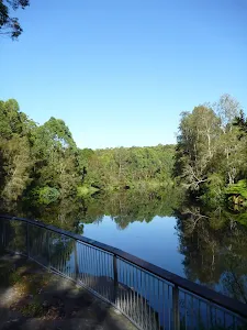
(1km) Valley View Close → End of Fullers Park
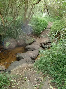
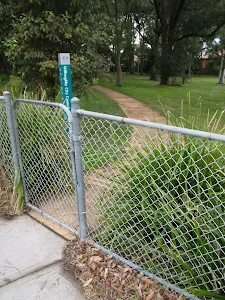
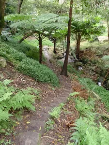
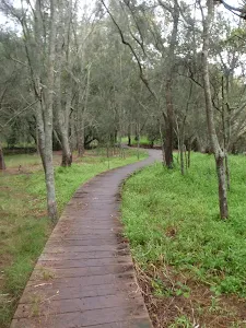
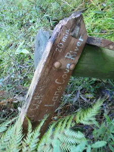
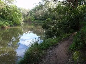
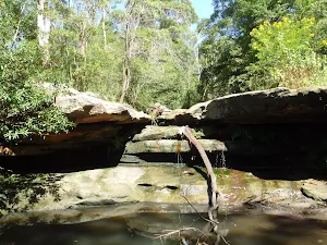
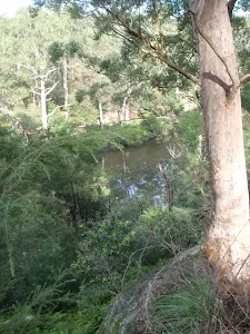
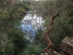
Continue straight: From the intersection, this walk follows the National Park arrow post[32] south along the clear track, keeping the valley to your right. After about 50m, the track leads down some stone steps[33] then continues down for about 80m through the denser vegetation[34] to cross the bouldery and sandy[35] Blue Gum Creek. A short distance after crossing the creek, this walk heads up to a T-intersection marked with a 'Blue Gum Creek Track' sign[36] (pointing back down to 'Valley View Close'[37]).
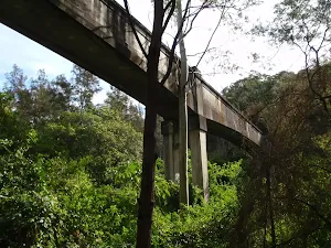
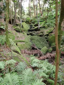
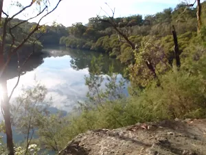
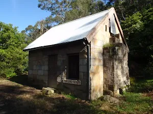
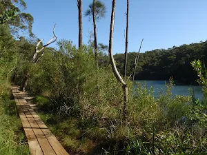
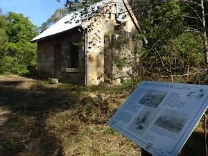
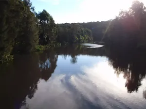
Turn right: From the intersection, this walk heads away from the face of the 'Blue Gum Creek Track' sign[38] (following neither of the arrows). The track meanders through the trees, winding past some rocky ruins[39] for approximately 120m to come to a grassy clearing, just before a concrete (sewerage) bridge[40].
(2km) End of Fullers Park → Int. Lady Game Dr and Delhi Rd
(3km) Int. Lady Game Dr and Delhi Rd → Riverside Cafe
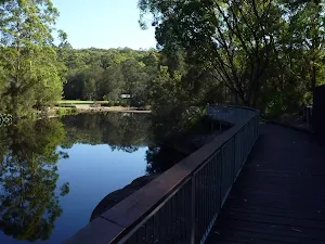
Continue straight: From the corner of Lady Game Drive and Delhi Rd, this walk follows the footpath beside Delhi Rd, across Fullers Bridge[50]. Just on the far side of the bridge, this walk comes to an intersection with a footpath[51] (and steps, on your right) about 15m before the bus stop shelter[52].
Turn right: From the intersection between the bus stop and bridge, this walk heads down the steps[53] (away from the road) to almost immediately come to an intersection with another footpath[54].
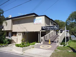
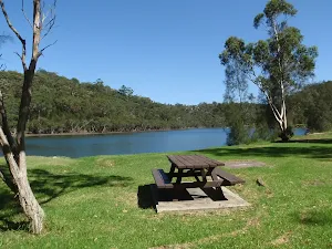
Turn right: From the intersection, this walk follows the footpath under Fullers Bridge[55] and comes to the end of a minor road[56], in front of the 'Riverside Cafe Bar AND Grill'[57]. At the end of this side trip, retrace your steps back to the main walk then Turn right.
Riverside Cafe Bar & Grill
(3km) Int. Lady Game Dr and Delhi Rd → Int. Fairway and Delhi Rd
(3km) Int. Fairway and Delhi Rd → Int. Behind the 8th Tee
(3km) Int. Behind the 8th Tee → Int. Rail to River Trk and Reid Drive
(3km) Int. Rail to River Trk and Reid Drive → Eastern side of O.H. Reid Memorial Oval
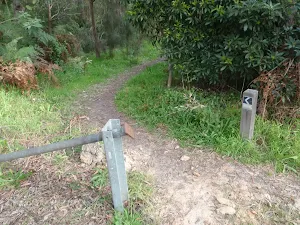
Continue straight: From the car park, this walk heads past the metal gate and across the oval to the far side of the oval, where a track marker stands just off the oval.
(3km) Eastern side of O.H. Reid Memorial Oval → Int. Rail to River Trk and Hawthorne Ave
(3km) Int. Rail to River Trk and Hawthorne Ave → Harnett Pl sign post
Turn right: From the intersection, this walk follows the 'Rail to River Walk' sign up Bellevue Ave for approximately 500m to the signposted intersection with Fullers Rd.
Turn right: From the intersection, this walk heads up Fullers Rd, tending right where Fullers Rd meets Millwood Ave. The walk follows Fullers Rd for a short time to Lowanna Park on the right. Entry to the park is via a gate at the near-end of the park.
Turn right: From the Fullers Rd gate entry of Lowanna Park, this walk passes through the park diagonally, past the BBQs and play equipment, to the gate opening to Greville St. There is a 'Rail to River Walk' signpost outside the gate.
Turn right: From the gate, this walk heads down the hill, away from Fullers Rd. The track heads down the hill for approximately 200m to cross the road to the Harnett Pl sign, opposite No. 86.
(4km) Harnett Pl sign post → Int. Park Ave and Rail to River Trk
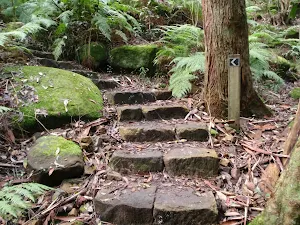
Turn left: From the intersection, the walk heads down the steps and along the creek (which remains on your right) for approximately 60m to a signposted intersection.
Veer left: From the intersection, the walk heads up the gully, with the creek on the right. The track continues climbing up the gully for approximately 100m to an intersection in a clearer area.
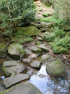
Continue straight: From the intersection, the walk follows the 'Rail to River Walk' arrow on the signpost, to head up the gully. The track leads up along the creek (on your right) for approximately 50m to some steppingstones across the creek. Approximately 50m later, the track comes out onto a grassed clearing, from which the walk continues along the management trail to Park Ave.
(5km) Int. Park Ave and Rail to River Trk → Int. Park Ave and Edgar St Reserve Trk
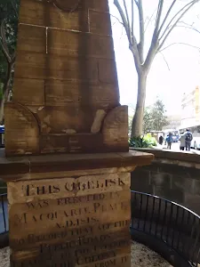
(5km) Int. Park Ave and Edgar St Reserve Trk → Bob Peirson Memorial Seat
(5km) Bob Peirson Memorial Seat → Int. Edgar St and Edgar St Reserve Trk
(5km) Int. Edgar St and Edgar St Reserve Trk → Chatswood Station
Turn left: From the intersection, this walk crosses at pedestrian crossing on Pacific Highway, or takes the foot bridge just near the intersection. This walk then continues down Victoria Ave to the entrance of the train station on the right. If the road turns left, you have gone too far.
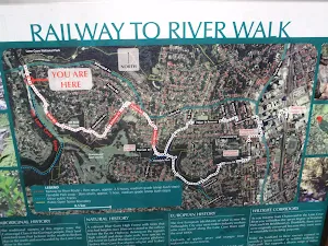
Maps for the Roseville to Chatswood Station via Lane Cove River walk
You can download the PDF for this walk to print a map.
These maps below cover the walk and the wider area around the walk, they are worth carrying for safety reasons.
| Parramatta River | 1:25 000 Map Series | 91303N PARRAMATTA RIVER | NSW-91303N |
| Sydney | 1:100 000 Map Series | 9130 SYDNEY | 9130 |
Cross sectional view of the Roseville to Chatswood Station via Lane Cove River bushwalking track
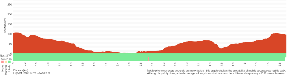
Analysis and summary of the altitude variation on the Roseville to Chatswood Station via Lane Cove River
Overview of this walks grade – based on the AS 2156.1 – 2001
Under this standard, a walk is graded based on the most difficult section of the walk.
| Length | 6 km | ||
| Time | 2 hrs 30 mins | ||
| . | |||
Grade 4/6 Hard track | AS 2156.1 | Gradient | Very steep (4/6) |
| Quality of track | Formed track, with some branches and other obstacles (3/6) | ||
| Signs | Directional signs along the way (3/6) | ||
| Experience Required | No experience required (1/6) | ||
| Weather | Weather generally has little impact on safety (1/6) | ||
| Infrastructure | Limited facilities, not all cliffs are fenced (3/6) |
Some more details of this walks Grading
Here is a bit more details explaining grading looking at sections of the walk
Gradient
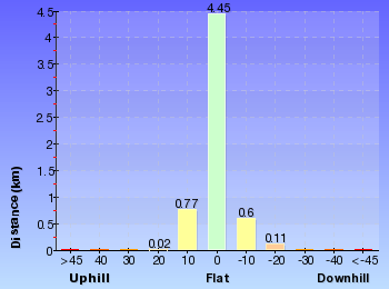
3.5km of this walk is flat with no steps and another 2.1km has gentle hills with occasional steps. Whilst another 310m has short steep hills and the remaining 55m is very steep.
Quality of track
3.9km of this walk follows a smooth and hardened path and another 1.6km follows a formed track, with some branches and other obstacles. The remaining (470m) follows a clear and well formed track or trail.
Signs
Around 4.1km of this walk is clearly signposted, whilst the remaining 1.9km has directional signs at most intersection.
Experience Required
This whole walk, 6km requires no previous bushwalking experience.
weather
This whole walk, 6km is not usually affected by severe weather events (that would unexpectedly impact safety and navigation).
Infrastructure
Around 5km of this walk is close to useful facilities (such as fenced cliffs and seats), whilst the remaining 700m has limited facilities (such as not all cliffs fenced).
Similar walks
A list of walks that share part of the track with the Roseville to Chatswood Station via Lane Cove River walk.
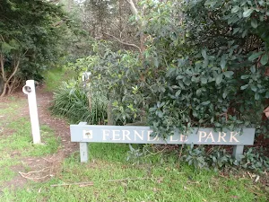
Ferndale Park Loop
3.3 km Circuit, 1 hr 30 mins
Moderate track
Fairylands Loop Track
5.3 km Circuit, 2 hrs 30 mins
Hard track
Chatswood Station to Mowbray Park
5.4 km One way, 2 hrs
Hard track
De Burghs Bridge to Fullers Bridge
6 km One way, 2 hrs 30 mins
Hard track
North Ryde Fairyland circuit
6.9 km Circuit, 2 hrs 30 mins
Hard track
Rail to River Walk
7.5 km Circuit, 3 hrs
Hard track
Roseville to Macquarie Park
8.9 km One way, 3 hrs 30 mins
Hard track
Gordon to Roseville Railway Station
10.7 km One way, 4 hrs 30 mins

Hard track
Rail to River and Stringybark Creek Reserve Walk
11.2 km Circuit, 4 hrs
Hard track
Gordon to Chatswood Station
12.2 km One way, 4 hrs 30 mins
Hard track
Gordon to Roseville Station (Riverside Walk)
13.3 km One way, 4 hrs 30 mins
Hard track
Chatswood to Epping Station
16.3 km One way, 6 hrs
Hard track
Chatswood Station to Eastwood Station
18.1 km One way, 6 hrs 45 mins
Hard track
Sydney to Thornleigh via Lane Cove Tourist Park
33 km One way, 2 Days
Hard track
Circular Quay to Hornsby
44.4 km One way, 3 Days

Hard track
Other Nearby walks
A list of walks that start near the Roseville to Chatswood Station via Lane Cove River walk.
Little Digger Track
2.2 km One way, 1 Hr
Moderate track
Two Creeks Track
6.1 km One way, 2 hrs 30 mins
Moderate track
Lane Cove National Park Heritage Walk
2.6 km One way, 1 Hr
Moderate track
Lindfield Park and Little Digger Track Loop
6.7 km Circuit, 2 hrs 45 mins
Moderate track
Little Digger Track to Davidson Reserve and Lyrebird Circuit
11.5 km One way, 4 hrs 30 mins
Hard track
Lane Cove Weir to Boat Shed
1.3 km Return, 1 Hr
Moderate track
Riverside Walk
5.3 km One way, 2 hrs
Hard track
Fiddens Wharf walking track
4.3 km Circuit, 1 hr 27 mins
Moderate track
Baker's Cottage
1.5 km Return, 45 mins
Moderate track
Fullers Bridge to Epping Rd
2.6 km One way, 1 Hr
Hard track
Lane Cove Tourist Park River Circuit
11.9 km Circuit, 5 hrs
Hard track
Lane Cove Tourist Park to Boat Shed
3.4 km Return, 1 hr 30 mins
Moderate track
Plan your trip to and from the walk here
The Roseville to Chatswood Station via Lane Cove River walk starts at the Roseville Train Station (gps: -33.784534, 151.17783)
The Roseville to Chatswood Station via Lane Cove River ends at the Chatswood Station (gps: -33.797073, 151.18037)
Weather Forecast
This walk starts in the Metropolitan weather district.
Current Alerts
Park Information
Lane Cove National Park
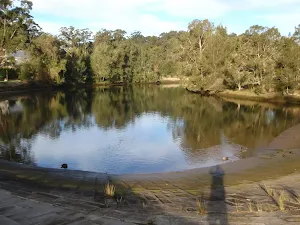
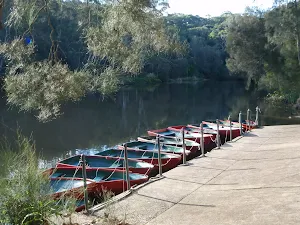
This small but picturesque city park is a haven of peaceful bushland along the winding Lane Cove River. Home to the Kukundi Wildlife Shelter and 27 km of the Great North Walk, you can also hire a boat, take a stroll or enjoy a picnic by the weir.
Comments
Short URL: http://wild.tl/rtcsvlcr