Rockpool to Norah Head Lighthouse
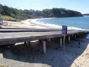

(0km) Boat ramp → Rock Pool
Norah Head Rock Pool
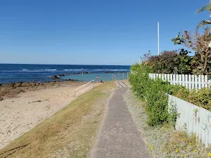
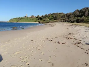
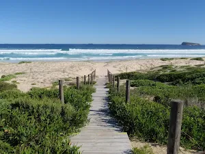
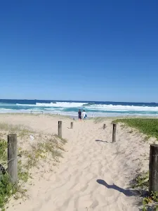
(0km) Rock Pool → Southern end of Lighthouse Beach
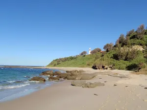
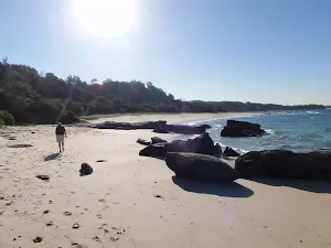
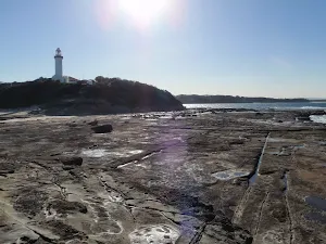
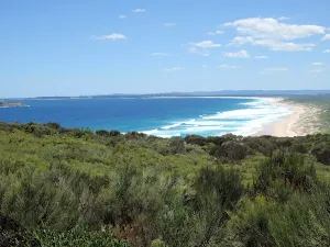
Continue straight: From the northern end of Lighthouse Beach[2], this walk follows the beach south, keeping the ocean to the left, until reaching the southern end of the beach.
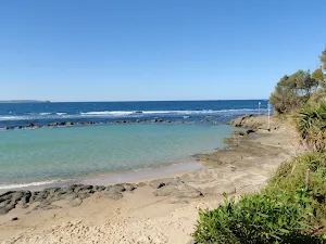
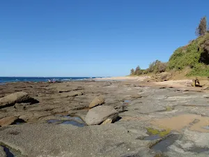
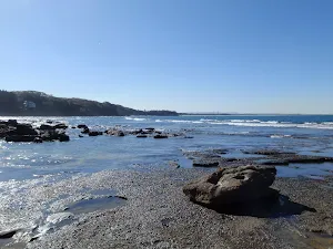
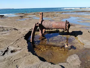
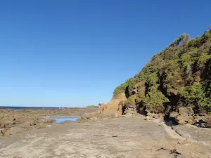
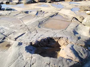
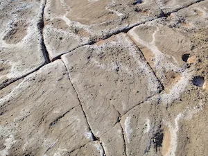
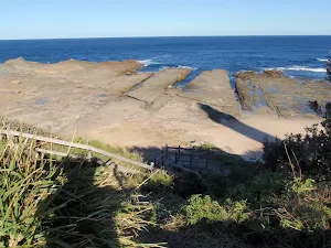
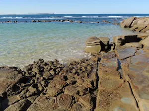
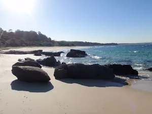
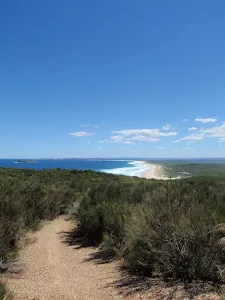
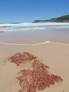
Norah Head rockshelf
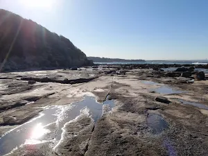
(1km) Southern end of Lighthouse Beach → Bottom of Norah Head steps
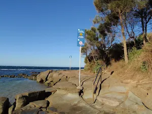
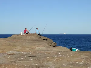
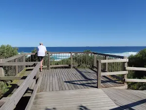
(1km) Bottom of Norah Head steps → Lighthouse Point lookout
Norah Head Lighthouse Point lookout
(1km) Lighthouse Point lookout → Lighthouse
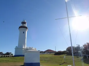
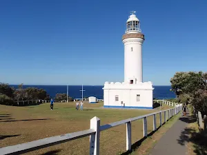
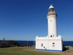
Norah Head Lighthouse
(1km) Lighthouse → Merchant Mariners memorial lookout
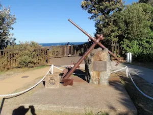
Continue straight: From the corner of the cottage yard, this walk follows the footpath away from the lighthouse, keeping the car park and driveway to the right. The walk passes an information board, to the left, then arrives at the merchant navy memorial lookout. There are numerous plaques in the footpath and set in rocks at the memorial, providing information about merchant ships and lives lost during times of war. At the end of this side trip, retrace your steps back to the main walk then Turn left .
Merchant Mariners memorial and lookout
Maps for the Rockpool to Norah Head Lighthouse walk
You can download the PDF for this walk to print a map.
These maps below cover the walk and the wider area around the walk, they are worth carrying for safety reasons.
| Toukley | 1:25 000 Map Series | 92313N TOUKLEY | NSW-92313N |
| Lake Macquarie | 1:100 000 Map Series | 9231 LAKE MACQUARIE | 9231 |
Cross sectional view of the Rockpool to Norah Head Lighthouse bushwalking track
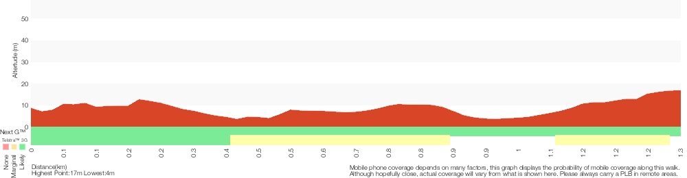
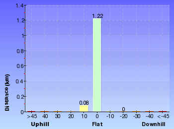
Analysis and summary of the altitude variation on the Rockpool to Norah Head Lighthouse
Overview of this walks grade – based on the AS 2156.1 – 2001
Under this standard, a walk is graded based on the most difficult section of the walk.
| Length | 2.6 km | ||
| Time | 1 Hr | ||
| . | |||
Grade 4/6 Hard track | AS 2156.1 | Gradient | Short steep hills (3/6) |
| Quality of track | Rough track, where fallen trees and other obstacles are likely (4/6) | ||
| Signs | Minimal directional signs (4/6) | ||
| Experience Required | Some bushwalking experience recommended (3/6) | ||
| Weather | Storms may impact on navigation and safety (3/6) | ||
| Infrastructure | Limited facilities (such as cliffs not fenced, significant creeks not bridged) (4/6) |
Some more details of this walks Grading
Here is a bit more details explaining grading looking at sections of the walk
Gradient
1.2km of this walk has gentle hills with occasional steps and another 75m is flat with no steps. The remaining (45m) has short steep hills.
Quality of track
1.1km of this walk follows a rough track, where fallen trees and other obstacles are likely and another 75m follows a smooth and hardened path. Whilst another 75m follows a clear and well formed track or trail and the remaining 45m follows a formed track, with some branches and other obstacles.
Signs
1.1km of this walk has minimal directional signs and another 150m is clearly signposted. The remaining (45m) has directional signs at most intersection.
Experience Required
Around 1.1km of this walk requires some bushwalking experience, whilst the remaining 150m requires no previous bushwalking experience.
weather
Around 850m of this walk is not usually affected by severe weather events (that would unexpectedly impact safety and navigation), whilst the remaining 450m is affected by storms that may impact your navigation and safety.
Infrastructure
750m of this walk has limited facilities (such as not all cliffs fenced) and another 360m has limited facilities (such as cliffs not fenced, significant creeks not bridged). The remaining (200m) is close to useful facilities (such as fenced cliffs and seats).
Similar walks
A list of walks that share part of the track with the Rockpool to Norah Head Lighthouse walk.
Norah Head Rockpool
150 m Return, 15 mins
Easy track
Norah Head Lighthouse walk
762 m Return, 30 mins
Very easy
Norah Head Lighthouse and Rockshelf walk
1.6 km Return, 45 mins
Hard track
Norah Head Nature Trail
2.2 km Return, 1 Hr

Moderate track
Norah Head Lighthouse Loop
2.5 km Circuit, 1 Hr
Hard track
Other Nearby walks
A list of walks that start near the Rockpool to Norah Head Lighthouse walk.
Wetland trail to Rainforest
4.8 km One way, 1 hr 45 mins
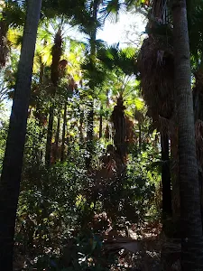
Moderate track
Wetland Trail to Redgum Lookout
3.1 km Return, 1 hr 15 mins
Moderate track
Redgum trail
3.4 km Circuit, 1 hr 15 mins
Moderate track
Wyrrabalong Figure 8
6.9 km Circuit, 2 hrs 15 mins
Moderate track
Lillypilly Loop Trail
3.6 km Circuit, 1 hr 15 mins
Moderate track
Tuggerah Lake vista and Rainforest
1.8 km Return, 45 mins
Moderate track
Tea Tree Picnic Area to Birdie Beach
444 m Return, 10 mins
Easy track
Tea Tree Picnic Area to Bird Island Lookout
136 m Return, 3 mins
Very easy
Freemans camping area to Birdie Beach
1.2 km Return, 25 mins
Easy track
Campbell Dr to Birdie Beach View (Geebung Track)
3.3 km Return, 1 hr 15 mins
Moderate track
Campbell Drive to Snapper Point
4.2 km One way, 1 hr 45 mins
Experienced only
Geebung Track
2.4 km One way, 1 Hr
Moderate track
Plan your trip to and from the walk here
The Rockpool to Norah Head Lighthouse walk starts and ends at the Boat ramp (gps: -33.279197, 151.56865)
Weather Forecast
This walk starts in the Hunter weather district.
Current Alerts
Park Information
Norah Head Lighthouse Reserve
Norah Head Lighthouse Reserve is home to a small parcel of bushland and a lighthouse, north of The Entrance on the NSW Central Coast. The land and lighthouse is managed by the Norah Head Lighthouse Reserve Trust who was appointed by the NSW Minister for Lands in 2007. The trust maintains some walking track and the lighthouse. The lighthouse can be booked for overnight accommodation. The Lighthouse was opened on 15th November 1903 and is still in active use today.
Comments
Short URL: http://wild.tl/rtnhl