The Coast Track (Otford to Bundeena)
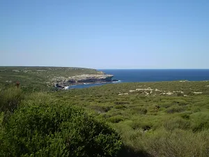
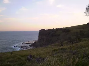
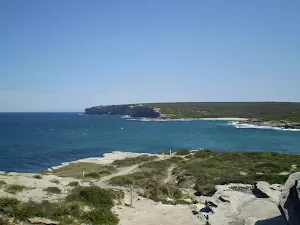
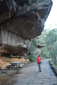
(0km) Otford Train Station → Otford Lookout
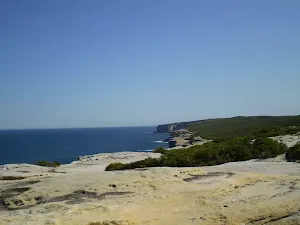
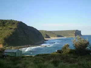
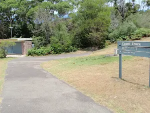
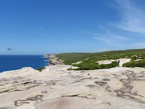
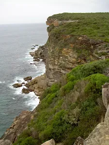
(1km) Otford Lookout → The Squeeze Way and Burning Palms Tracks
Continue straight: From the intersection, this walk follows the Coast Track along the bush track, winding up the long hill the the top, where it flattens out and continues along a well-managed bush track through a rather beautiful section of ferns. After quite a while, the track joins onto a flat service trail which it follows, undulating gently until it comes to the signposted intersection of the North Era bush track.
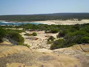
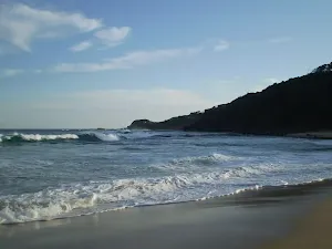
(3km) The Squeeze Way and Burning Palms Tracks → Burning Palms Beach (southern end)
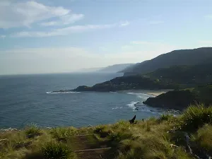
Continue straight: From the end of the palm jungle and the start of the grasslands, the walk heads through the grasslands and along the coast for a while before winding down to the signposted intersection with the Burning Palms track, near the rangers' hut.
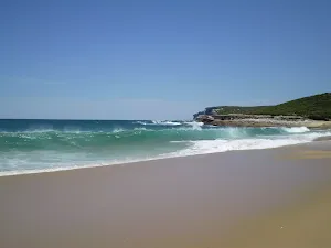
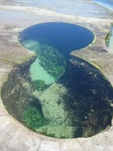
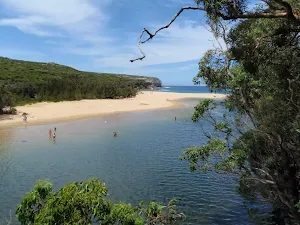
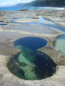
(6km) Burning Palms Beach (southern end) → Figure 8 Pools
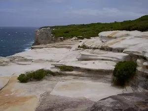
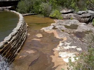
Figure Eight Pools
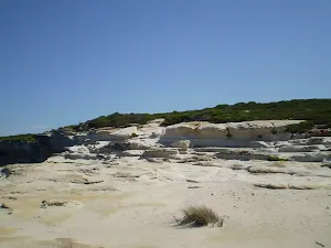
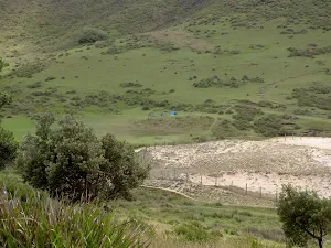
(6km) Burning Palms Beach (southern end) → North Era Bush Campground
Turn right: From the intersection, this walk follows the 'North Era' arrow along the bush track heading down the hill, keeping the ocean to the right as it winds down to the intersection with the faint bush track in the large grassy clearing on the side of the hill, above some of the cabins at Era.
Continue straight: From the intersection, the walk heads down the hill past the cabins to the bottom where it comes to South Era beach. From here, the walk continues around the back of the beach, keeping the ocean to the right as it continues up the other side to the top of the ridgeline where it comes to the intersection with a faint bush track (heading off to the left).
Continue straight: From the top of the ridge, the walk crosses the headland and open grassy area, down towards the beach (keeping the ocean to the right), coming to a 'North Era Bush Campground' sign just before the beach.
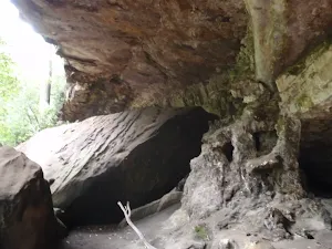
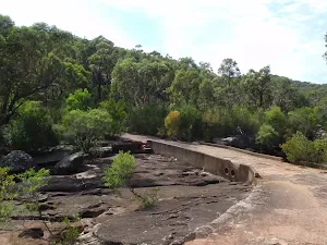
North Era camping ground
End of day 1
(8km) North Era Bush Campground → Little Garie
(9km) Little Garie → Garie Beach Car Park
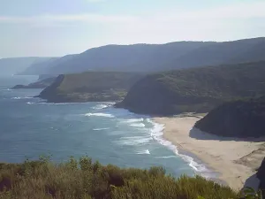
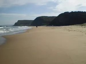
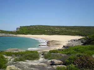
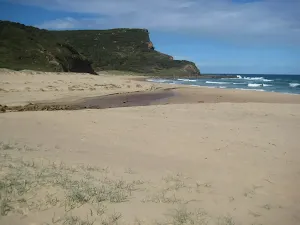
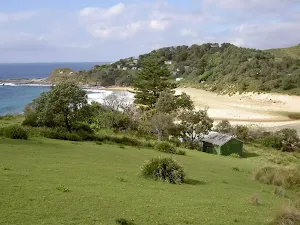
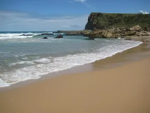
Garie Beach
(9km) Garie Beach Car Park → Int. Garie Beach YHA Trk
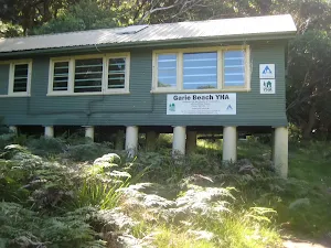
(10km) Int. Garie Beach YHA Trk → Garie Beach YHA
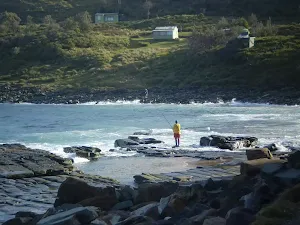
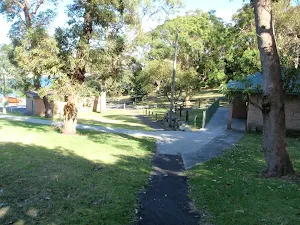
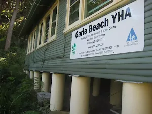
YHA Garie Beach - Destroyed
(10km) Int. Garie Beach YHA Trk → Garie Beach Lookout
Continue straight: From the end of Garie Beach, this walk heads up the short hill and through the grassy clearing to the base of the large hill. The walk continues up the steep bush track, winding up the steep rock and wooden steps as it climbs to the top of the hill.
(11km) Garie Beach Lookout → Int of North Rill and Coastal Track
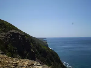
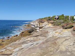
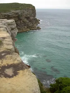
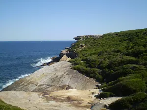
(11km) Int of North Rill and Coastal Track → Eagles Rock Lookout
Continue straight: Keeping the ocean to the right the track follows the bushtrack through the scrub and along the coast for a short while before coming to the information signpost with views of Eagle Rock.
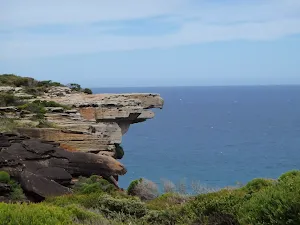
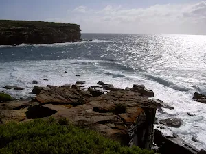
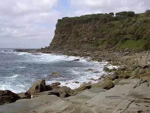
Eagle Rock Lookout
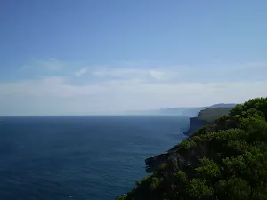
(13km) Eagles Rock Lookout → Curracurrang Cove
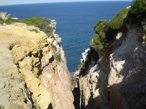
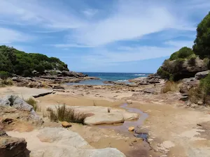
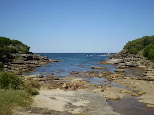
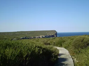
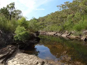
Curracurrang Cove
(15km) Curracurrang Cove → Overflow Carpark
(17km) Overflow Carpark → Northern End Wattamolla Picnic Ground
Turn left: From the toilet block, this walk follows the path down the hill and through the car park to the northern end of the picnic area, near the creek crossing.
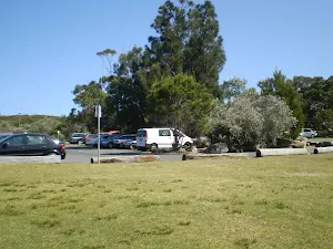
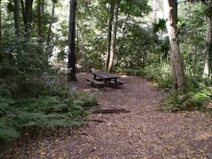
Wattamolla Picnic Area
Wattamolla Kiosk
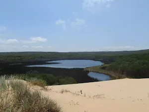
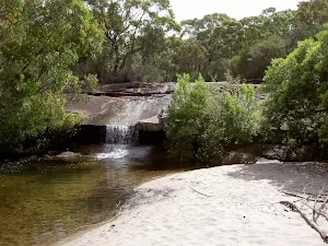
(17km) Northern End Wattamolla Picnic Ground → Wattamolla Dam
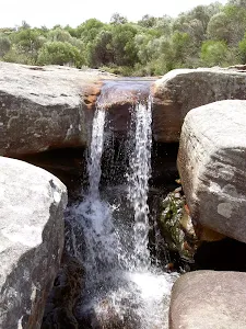
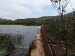
Wattamolla Dam
(18km) Wattamolla Dam → Int. Coastal Trk NE of Wattamolla Ck
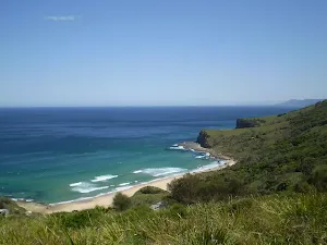
(18km) Int. Coastal Trk NE of Wattamolla Ck → Little Marley Beach
Little Marley Beach
(20km) Little Marley Beach → Int. Coastal Trk and Chimney Trk
(21km) Int. Coastal Trk and Chimney Trk → West Marley Beach
(21km) West Marley Beach → East Marely Beach
(21km) East Marely Beach → Bundeena Lookout
Veer right: From the intersection, this walk follows the bush track heading north-east along the coast, winding through the high heath for about 1.5km until the track descends into a large gully along hardened path. At the bottom, it crosses a small bridged stream. From here, the track continues up the other side of the gully, using the rock steps to the top. From here, the track follows the post markers along the track to the clifftop coastline, however on a few occasions the track will split into two and meet up again a short while later - just stick to the track closest to the coast. After several hundred metres, the track comes to an unsignposted vantage point at the end of the rock platform, where the bush track turns inland.
Bundeena Lookout
(25km) Bundeena Lookout → Int of Beachcomber Rd Servicetrail and Coast Walk
(26km) Int of Beachcomber Rd Service Trail and Coast Walk → Bundeena Ferry Wharf
Continue straight: From the intersection, this walk heads north around a sweeping left-hand bend along the sealed management trail. Soon, the trail leads past a track (on the right) then passes around a locked gate at the end of of Beachcomber Ave and a 'Coast Walk' information sign[4].
Continue straight: From the end of Beachcomber Ave, this walk heads along Beachcomber Ave north-west and gradually around to the north, until turning left into Scarbourough St. The first right is taken into Bournemouth St, then left into Loftus St. The walk continues along this road until turning right into Brighton Rd. Bundeena Ferry is located at the end of Brighton St.
Bundeena
Maps for the The Coast Track (Otford to Bundeena) walk
You can download the PDF for this walk to print a map.
These maps below cover the walk and the wider area around the walk, they are worth carrying for safety reasons.
| Otford | 1:25 000 Map Series | 91294S OTFORD | NSW-91294S |
| Port Hacking | 1:25 000 Map Series | 91294N PORT HACKING | NSW-91294N |
| Port Hacking | 1:100 000 Map Series | 9129 PORT HACKING | 9129 |
Cross sectional view of the The Coast Track (Otford to Bundeena) bushwalking track
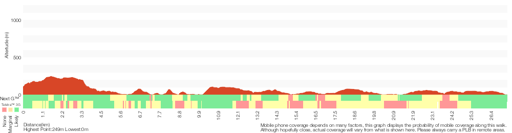
Analysis and summary of the altitude variation on the The Coast Track (Otford to Bundeena)
Overview of this walks grade – based on the AS 2156.1 – 2001
Under this standard, a walk is graded based on the most difficult section of the walk.
| Length | 27.4 km | ||
| Time | 2 Days | ||
| . | |||
Grade 4/6 Hard track | AS 2156.1 | Gradient | Very steep (4/6) |
| Quality of track | Formed track, with some branches and other obstacles (3/6) | ||
| Signs | Directional signs along the way (3/6) | ||
| Experience Required | Some bushwalking experience recommended (3/6) | ||
| Weather | Weather generally has little impact on safety (1/6) | ||
| Infrastructure | Limited facilities, not all cliffs are fenced (3/6) |
Some more details of this walks Grading
Here is a bit more details explaining grading looking at sections of the walk
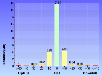
Gradient
19km of this walk has short steep hills and another 3.5km is very steep. Whilst another 3.5km has gentle hills with occasional steps and the remaining 1.5km is flat with no steps.
Quality of track
16km of this walk follows a formed track, with some branches and other obstacles and another 9km follows a clear and well formed track or trail. The remaining (2km) follows a smooth and hardened path.
Signs
Around 15km of this walk is clearly signposted, whilst the remaining 12km has directional signs at most intersection.
Experience Required
Around 17km of this walk requires no previous bushwalking experience, whilst the remaining 10km requires some bushwalking experience.
weather
This whole walk, 27km is not usually affected by severe weather events (that would unexpectedly impact safety and navigation).
Infrastructure
Around 17km of this walk has limited facilities (such as not all cliffs fenced), whilst the remaining 10km is close to useful facilities (such as fenced cliffs and seats).
Similar walks
A list of walks that share part of the track with the The Coast Track (Otford to Bundeena) walk.
Garie Beach YHA
1.3 km Return, 45 mins
Moderate track
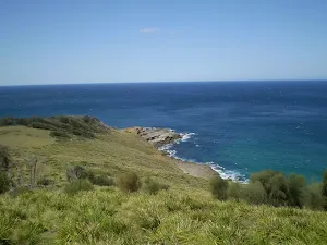
Providential Point
1.6 km Return, 45 mins
Easy track
Wattamolla picnic area to Wattamolla Dam
1.7 km Return, 45 mins
Moderate track
Wattamola picnic area to Curracurrang Cove
3.1 km Return, 1 hr 15 mins
Moderate track
Garie Beach to North Era Beach
3.2 km Return, 2 hrs
Moderate track
Stockyard spur to Garie Beach
3.3 km One way, 1 hr 45 mins
Hard track
Garawarra Farm to Garie Beach
3.9 km One way, 2 hrs
Moderate track
Curra Moors car park to Garie Beach
4.4 km One way, 1 hr 45 mins
Hard track
Garie Road to Era Loop
5 km Circuit, 2 hrs 15 mins
Hard track
Garawarra Farm carpark to figure eight pools
6 km Return, 2 hrs 30 mins
Hard track
Bundeena to Jibbon Head Circuit
6.8 km Circuit, 2 hrs 30 mins
Moderate track
Wattamolla to Eagle Rock Lookout
7.4 km Return, 3 hrs
Moderate track
Wattamolla to Garie Beach
7.6 km One way, 3 hrs 30 mins
Hard track
Garie Beach to Eagle Rock
7.7 km Return, 3 hrs
Hard track
Burning Palms loop from Garawarra
8.2 km Circuit, 3 hrs 30 mins
Hard track
Curra Moors Loop
9.2 km Circuit, 3 hrs 30 mins
Hard track
Bundeena Road to Marley
9.7 km Return, 3 hrs 30 mins
Hard track
Wattamolla to Big Marley Beach
10.4 km Circuit, 4 hrs
Moderate track
Bundeena to Marley Head
10.8 km Circuit, 3 hrs 20 mins
Moderate track
Marley Track
11 km Circuit, 4 hrs 30 mins
Hard track
Garie Beach to Helensburgh (The Burgh Track)
11 km One way, 4 hrs 30 mins
Hard track
Bundeena to Marley Beach
12.7 km Return, 4 hrs 30 mins
Moderate track
Otford to Helensburgh
12.9 km One way, 5 hrs 15 mins
Hard track
Otford to Figure of Eight Pools via Burning Palms
13.2 km Return, 6 hrs 30 mins
Hard track
Mowlee Ridge to Garie Beach
13.3 km One way, 5 hrs
Hard track
Otford to Figure of Eight Pools Circuit
13.4 km Circuit, 6 hrs
Hard track
Garie Beach to Garawarra to Burning Palms Circuit
13.5 km Circuit, 7 hrs
Hard track
Bundeena to Little Marley Beach
14 km Return, 5 hrs
Moderate track
The Coast Track
27.4 km One way, 2 Days
Hard track
Other Nearby walks
A list of walks that start near the The Coast Track (Otford to Bundeena) walk.
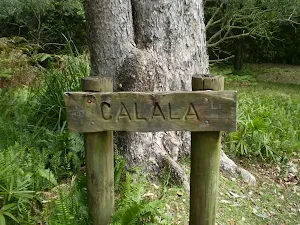
Forest Island to Calala
8.9 km Return, 3 hrs 30 mins
Moderate track
Lady Carrington Drive
9.7 km One way, 3 hrs 45 mins
Moderate track
Lady Carrington Drive to Palona Cave
5.1 km Return, 2 hrs
Hard track
The Forest Way Track
4.4 km Circuit, 1 hr 45 mins
Moderate track
Lake Toolooma Trail
6.4 km Circuit, 2 hrs 30 mins
Moderate track
Waterfall to Heathcote
10.8 km One way, 5 hrs
Hard track
Couranga
9.8 km Return, 4 hrs 30 mins
Hard track
The Wallumarra Track to Bola Creek
4.7 km One way, 1 hr 45 mins
Moderate track
Wallumarra to Palona Cave
11.8 km Return, 4 hrs 30 mins
Hard track
Wallumarra Track to Forest Way
12.5 km Circuit, 4 hrs 30 mins
Moderate track
Wises Track
4.1 km One way, 1 hr 30 mins

Moderate track
Heathcote to Waterfall
10.1 km One way, 5 hrs
Hard track
Plan your trip to and from the walk here
The The Coast Track (Otford to Bundeena) walk starts at the Otford Train Station (gps: -34.210782, 151.00562)
The The Coast Track (Otford to Bundeena) ends at the Bundeena Ferry Wharf (gps: -34.082703, 151.15107)
Weather Forecast
This walk starts in the Illawarra weather district.
Current Alerts
Park Information
Royal National Park
Comments
Short URL: http://wild.tl/tcttb