The Coast Track
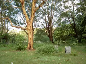
Bundeena
(0km) Bundeena Ferry Wharf → Int of Beachcomber Rd Service Trail and Coast Walk
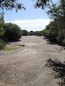
Continue straight: From the end of Beachcomber Av, this walk heads around the locked gate, following the 'Coast Walk'[1] sign along the wide management trail. After about 50m, the trail passes a track (on the left) and continues until coming to an intersection with a wider sandy trail (on the left, which leads to Jibbon Head).
Continue straight: From the intersection, this walk follows the asphalt management trail heading towards the green signposts nearby, where it comes to the signposted intersection of the 'Coast Track'[2].
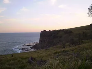
(2km) Int of Beachcomber Rd Servicetrail and Coast Walk → Bundeena Lookout
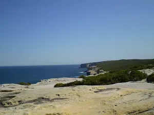
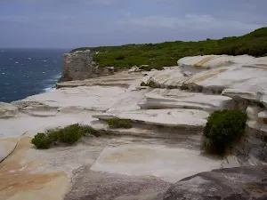
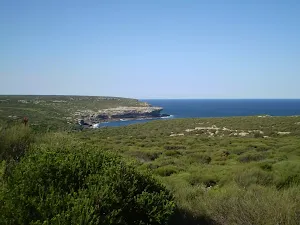
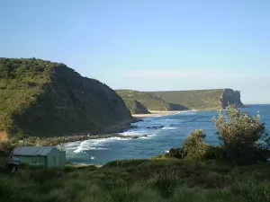
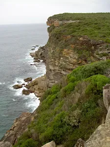
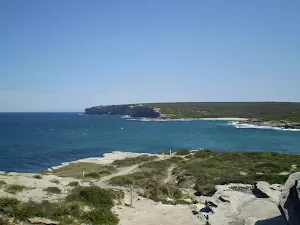
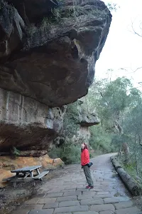
Bundeena Lookout
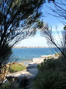
(2km) Bundeena Lookout → West Marley Beach
Veer left: From the signposted intersection, the walk follows the coast, keeping the ocean to the left. The track winds down the long hill to the end of Marley Beach, and comes to a large green information sign.
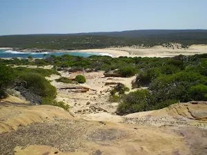
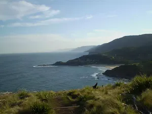
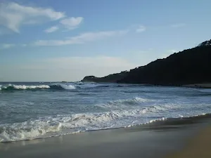
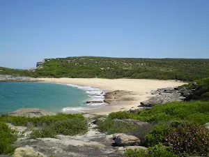
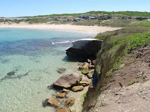
Continue straight: From the end of Marley Beach, this walk follows the coast along the beach until coming to the rock-shelf at the end. Marley Beach is very beautiful and, on a warm day, it would be a great spot to swim. On the rockshelf at the end of the beach, there are some shady spots to break from the walk. (At this, point there is also an intersection with a small bush track that heads up the hill and away from the beach.)
(6km) West Marley Beach → Little Marley Beach
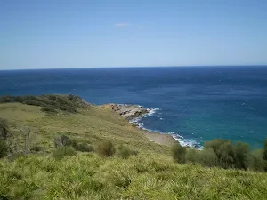
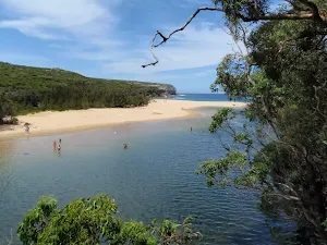
Veer left: From the intersection, this walk follows the bush track winding along the coast, keeping the ocean and the cliffs to the left. The track winds down the hill for a while before coming to the end of Little Marley Beach.
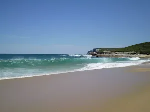
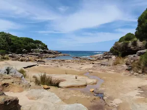
Little Marley Beach
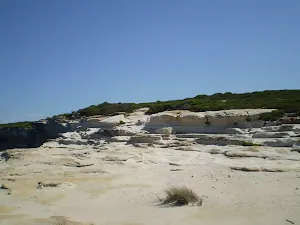
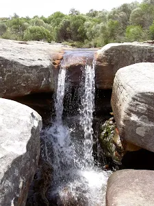
(7km) Little Marley Beach → Wattamolla Dam
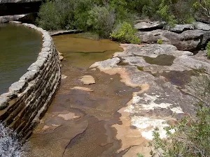
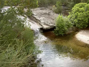
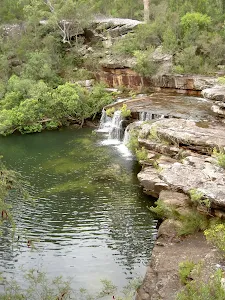
Veer left: From the intersection, this walk heads south-west along the bush track, heading down the long hill through the high scrub and down through some rocks, as it approaches the small swimming hole made by the dam in Wattamolla Creek.
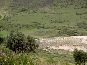
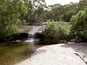
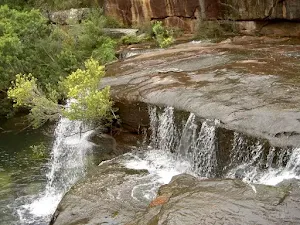
Wattamolla Dam
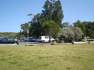
(10km) Wattamolla Dam → Northern End Wattamolla Picnic Ground
Wattamolla Kiosk
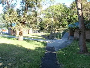
Wattamolla Picnic Area
(10km) Northern End Wattamolla Picnic Ground → Overflow Carpark
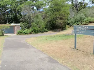
Turn right: From the toilet block, this walk follows the signs to the Overflow Car Park. (This is the upper car park.) At the back of the car park, this walk comes to an intersection with a large management trail, with a gate and signpost saying 'Garrie 5.8km'.
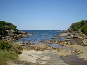
(11km) Overflow Carpark → Curracurrang Cove
Curracurrang Cove
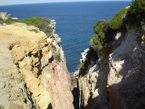
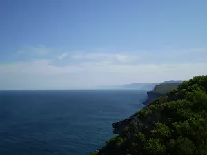
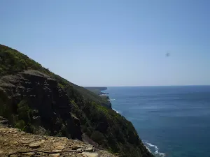
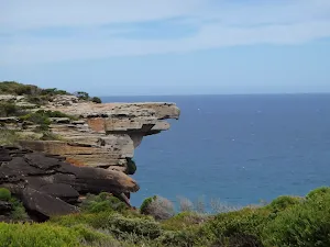
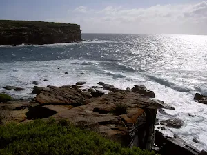
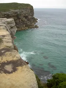
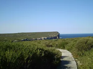
(12km) Curracurrang Cove → Eagles Rock Lookout
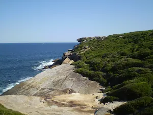
Eagle Rock Lookout
(14km) Eagles Rock Lookout → Int. Coastal Walk and Curra Moors Brook Trail
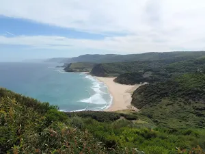
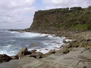
(14km) Int. Coastal Walk and Curra Moors Brook Trail → Garie Beach Lookout
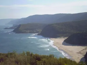
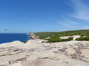
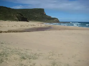
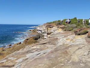
Continue straight: From the intersection, this walk follows the bush track around the left-hand side of the 'Curra Moors car park' sign, following the cliffs and keeping the ocean on the left of the track. After several hundred metres of high scrub, the track emerges out into the opening which has fantastic views of Garie Beach and the hills to the south.
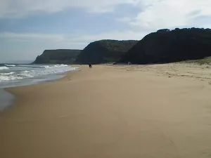
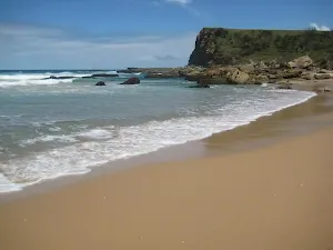
Garie Beach Lookout
(17km) Garie Beach Lookout → North-East End of Garie Beach
(17km) North-East End of Garie Beach → Int. Garie Beach YHA Trk
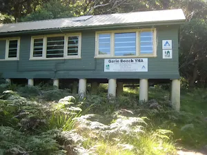
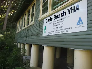
(18km) Int. Garie Beach YHA Trk → Garie Beach YHA
YHA Garie Beach - Destroyed
(18km) Int. Garie Beach YHA Trk → Garie Beach Car Park
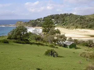
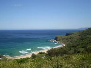
Garie Beach
(18km) Garie Beach Car Park → North Era Bush Campground
Continue straight: From the community hall in Little Garie, the walk heads steeply up the hill, following the track to the south-west. To prevent erosion of the hill, wooden steps have been installed. From the top of the ridge, the track continues down the other side, keeping the ocean on the left while winding down into North Era Bush Campground.
North Era camping ground
End of day 1
(20km) North Era Bush Campground → Int of Coast Track and Burgh Ridge Track (Sth)
Continue straight: From the top of the ridge, the walk heads down the hill, keeping the ocean to the left as it winds down between the cabins to the beach at the bottom. From here, the walk continues around the back of the beach following the coast, and up between the houses to the large clearing before the top of the hill. Here, the walk comes to an intersection with two rough bush tracks towards the top of the hill.
Continue straight: From the intersection, this walk heads up the hill and through the ferns, heading up and away from the cabins but still keeping the sea to the left of the track. This continues until the track comes to a large sign saying 'Coast Track'.
(21km) Int of Coast Track and Burgh Ridge Track (Sth) → Burning Palms Beach (southern end)
(22km) Burning Palms Beach (southern end) → The Squeeze Way and Burning Palms Tracks
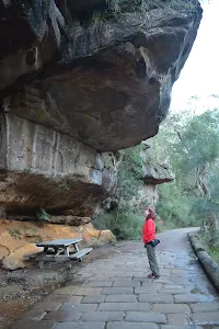
Continue straight: From the intersection, this walk follows the bush track heading up into the palm jungle. After entering the jungle, the track is quite clear but in some places there are obstacles, such as fallen trees and branches. The track continues in this manner for some time before turning inland and climbing steeply up to the top of the large hill. At the top, the track flattens out and heads towards the ocean, soon arriving at an intersection with a management trail. At this point there are several signposts pointing towards 'Otford' and 'Carawarra Farm'.
(25km) The Squeeze Way and Burning Palms Tracks → Otford Lookout
Continue straight: From the intersection, this walk follows the bush track, winding down the hill for a short while before coming to the fenced-off edge of the cliffs, which it follows keeping the ocean to the left as it winds down the hill. After a while, the track changes back to a bush track and continues down some wooden stairs to a car park signposted as 'Otford Lookout'.
(27km) Otford Lookout → Otford Train Station
Maps for the The Coast Track walk
You can download the PDF for this walk to print a map.
These maps below cover the walk and the wider area around the walk, they are worth carrying for safety reasons.
| Otford | 1:25 000 Map Series | 91294S OTFORD | NSW-91294S |
| Port Hacking | 1:25 000 Map Series | 91294N PORT HACKING | NSW-91294N |
| Port Hacking | 1:100 000 Map Series | 9129 PORT HACKING | 9129 |
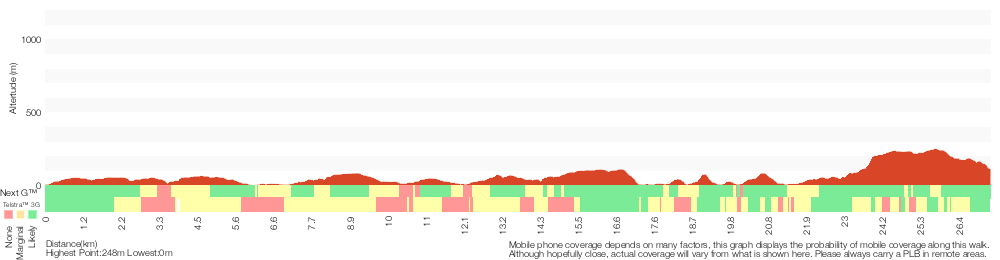
Cross sectional view of the The Coast Track bushwalking track
Analysis and summary of the altitude variation on the The Coast Track
Overview of this walks grade – based on the AS 2156.1 – 2001
Under this standard, a walk is graded based on the most difficult section of the walk.
| Length | 27.4 km | ||
| Time | 2 Days | ||
| . | |||
Grade 4/6 Hard track | AS 2156.1 | Gradient | Very steep (4/6) |
| Quality of track | Formed track, with some branches and other obstacles (3/6) | ||
| Signs | Directional signs along the way (3/6) | ||
| Experience Required | Some bushwalking experience recommended (3/6) | ||
| Weather | Weather generally has little impact on safety (1/6) | ||
| Infrastructure | Limited facilities, not all cliffs are fenced (3/6) |
Some more details of this walks Grading
Here is a bit more details explaining grading looking at sections of the walk
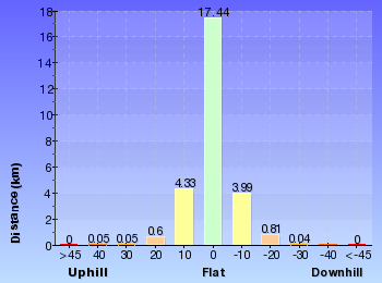
Gradient
19km of this walk has short steep hills and another 3.5km is very steep. Whilst another 3.5km has gentle hills with occasional steps and the remaining 1.5km is flat with no steps.
Quality of track
16km of this walk follows a formed track, with some branches and other obstacles and another 9km follows a clear and well formed track or trail. The remaining (2km) follows a smooth and hardened path.
Signs
Around 15km of this walk is clearly signposted, whilst the remaining 12km has directional signs at most intersection.
Experience Required
Around 17km of this walk requires no previous bushwalking experience, whilst the remaining 10km requires some bushwalking experience.
weather
This whole walk, 27km is not usually affected by severe weather events (that would unexpectedly impact safety and navigation).
Infrastructure
Around 17km of this walk has limited facilities (such as not all cliffs fenced), whilst the remaining 10km is close to useful facilities (such as fenced cliffs and seats).
Similar walks
A list of walks that share part of the track with the The Coast Track walk.
Garie Beach YHA
1.3 km Return, 45 mins
Moderate track
Providential Point
1.6 km Return, 45 mins
Easy track
Wattamolla picnic area to Wattamolla Dam
1.7 km Return, 45 mins
Moderate track
Wattamola picnic area to Curracurrang Cove
3.1 km Return, 1 hr 15 mins
Moderate track
Garie Beach to North Era Beach
3.2 km Return, 2 hrs
Moderate track
Stockyard spur to Garie Beach
3.3 km One way, 1 hr 45 mins
Hard track
Garawarra Farm to Garie Beach
3.9 km One way, 2 hrs
Moderate track
Curra Moors car park to Garie Beach
4.4 km One way, 1 hr 45 mins
Hard track
Garie Road to Era Loop
5 km Circuit, 2 hrs 15 mins
Hard track
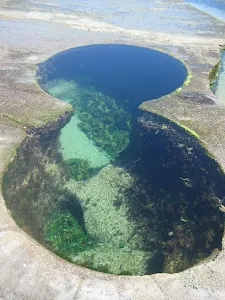
Garawarra Farm carpark to figure eight pools
6 km Return, 2 hrs 30 mins
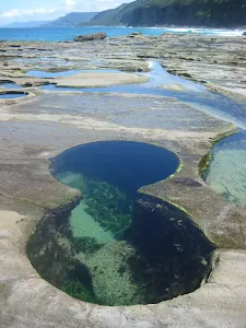
Hard track
Bundeena to Jibbon Head Circuit
6.8 km Circuit, 2 hrs 30 mins
Moderate track
Wattamolla to Eagle Rock Lookout
7.4 km Return, 3 hrs
Moderate track
Wattamolla to Garie Beach
7.6 km One way, 3 hrs 30 mins
Hard track
Garie Beach to Eagle Rock
7.7 km Return, 3 hrs
Hard track
Burning Palms loop from Garawarra
8.2 km Circuit, 3 hrs 30 mins
Hard track
Curra Moors Loop
9.2 km Circuit, 3 hrs 30 mins
Hard track
Bundeena Road to Marley
9.7 km Return, 3 hrs 30 mins
Hard track
Wattamolla to Big Marley Beach
10.4 km Circuit, 4 hrs
Moderate track
Bundeena to Marley Head
10.8 km Circuit, 3 hrs 20 mins
Moderate track
Marley Track
11 km Circuit, 4 hrs 30 mins
Hard track
Garie Beach to Helensburgh (The Burgh Track)
11 km One way, 4 hrs 30 mins
Hard track
Bundeena to Marley Beach
12.7 km Return, 4 hrs 30 mins
Moderate track
Otford to Helensburgh
12.9 km One way, 5 hrs 15 mins
Hard track
Otford to Figure of Eight Pools via Burning Palms
13.2 km Return, 6 hrs 30 mins
Hard track
Mowlee Ridge to Garie Beach
13.3 km One way, 5 hrs
Hard track
Otford to Figure of Eight Pools Circuit
13.4 km Circuit, 6 hrs
Hard track
Garie Beach to Garawarra to Burning Palms Circuit
13.5 km Circuit, 7 hrs
Hard track
Bundeena to Little Marley Beach
14 km Return, 5 hrs
Moderate track
The Coast Track (Otford to Bundeena)
27.4 km One way, 2 Days
Hard track
Other Nearby walks
A list of walks that start near the The Coast Track walk.
Jibbon Loop Track
5.1 km Circuit, 1 hr 45 mins
Moderate track
Jibbon Head Engravings
2.6 km Return, 45 mins
Moderate track
Cronulla to Botany Bay Discovery Centre
13.1 km One way, 4 hrs 30 mins
Hard track
Deer Pools
3.8 km Return, 1 hr 30 mins
Hard track
Winifred Falls
4.4 km One way, 2 hrs
Hard track
Gibraltar Rock
858 m Return, 20 mins
Easy track
Jersey Spring
5 km Return, 1 hr 45 mins
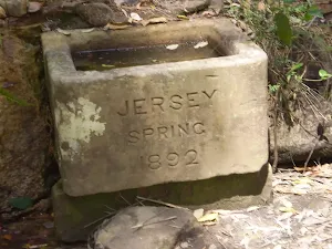
Easy track
Willow Tree to Calala
10.5 km Return, 4 hrs
Moderate track
Robertson's Roundabout
2.3 km Circuit, 1 hr 15 mins

Hard track
Audley to Gibraltar Rock
2.2 km Return, 45 mins
Easy track
Mt Bass- Winifred Falls
6.7 km Return, 2 hrs 30 mins
Hard track
Bungoona Path
918 m Return, 20 mins
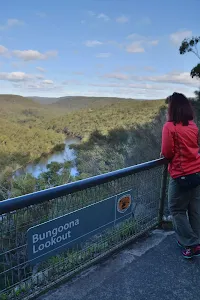
Very easy
Plan your trip to and from the walk here
The The Coast Track walk starts at the Bundeena Ferry Wharf (gps: -34.082703, 151.15107)
The The Coast Track ends at the Otford Train Station (gps: -34.210782, 151.00562)
Weather Forecast
This walk starts in the Metropolitan weather district.
Current Alerts
Park Information
Royal National Park
Comments
Short URL: http://wild.tl/tctto