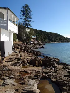
Middle Head
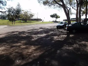
(0km) Int. Middle Head Rd and Chowder Bay Rd → Middle Head Fort
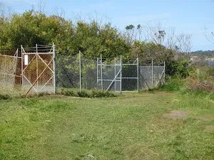
Veer left: From the intersection, this walk heads through the gate, keeping the view of the water to the right of the track. Note that if the gate is closed, visitors can walk around the right-hand side of the fence. The walk then follows the fenceline, (on the left of the track), to then continue up a small hill along the fenceline and to a short stone wall. The walk continues over the stone wall to the fork in the road.
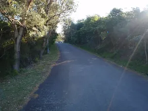
Veer right: From the intersection, this walk heads gently uphill along the signposted and asphalt 'Old Fort Rd'[1], initially keeping the toilet to the rightand 'Barracks No.1'[2] to the left. After about 130m the old road heads over a rise and then leads down between the metal bollards[3] to come to an intersection in a large clearing beside a row large gun timber brackets (bases)[4], marked with a 'Middle Head' sign[5]

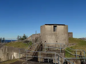
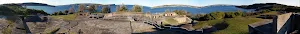
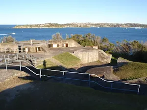
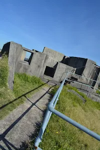
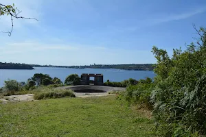
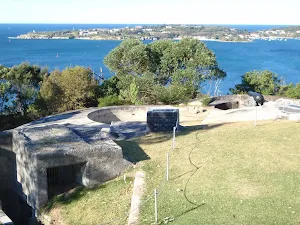
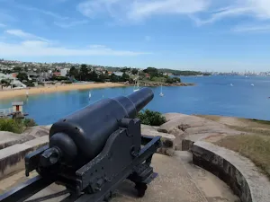
Continue straight: From beside the row of large gun timber brackets (bases)[6], this walk heads downhill for 50m along the wide gravely trail[7] towards the water to come the large network of concrete and sandstone forts and gun emplacements[8][9][10]. The area can be explored, taking care of cliff edges and large potential falls into the fortifications.
Outer Middle Head Battery
(1km) Middle Head Fort → Disappearing Gun Pit South
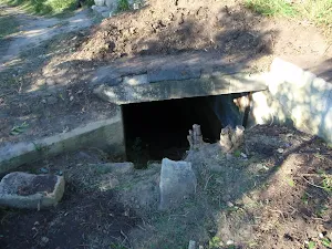
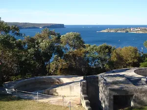
Veer right: From the intersection, this walk heads away from the built-up forts and road, to cross the clearing to the signposted 'Inner Middle Head Forts'. The track follows the arrow on this sign for approximately 200m through the bush to a sunken concrete fort on the right.
(1km) Disappearing Gun Pit South → Disappearing Gun Pit North
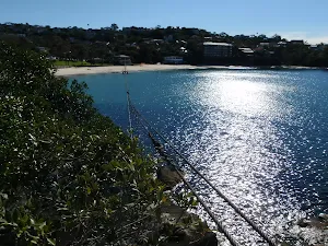
Turn right: From the intersection, this walk heads along the clear dirt track[18] towards the distant water view between two long sandstone trenches[19]. After 60m this walk heads across the grassy section[20] to come to the top edge of the northern Disappearing Gun Pit[21][22] beside the ocean cliffs[23]. Take extra care as the ground slopes towards the gun pit and cliff edges - stay 2 body lengths back from any significant drop.

(1km) Disappearing Gun Pit North → Middle Head Oval NE Gate
Continue straight: From the intersection, this walk heads directly away from the water views and sandstone forts, along a mostly flat but clear dirt track for about 90m to pass the sign pointing back to 'Inner Middle Head Forts'[29]. About 10m after this sign the walk comes to an intersection beside a white metal pole fence[30] and the sealed Governors Rd[31].
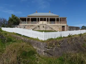
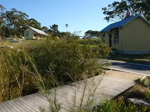
Turn sharp right: From the intersection, this walk heads down the grass hill beside the old house, keeping the house on the left. The track then turns left and down the hill with the fence, to continue along the fenceline. Near the end of the fence, the track turns right, down the hill and comes to a management trail.
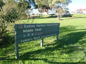
Turn left: From the intersection, this walk heads uphill along the wide gravel trail. After about 20m the trail narrows for about 5m (to 90cm) to pass a pile of spoil[32] then continues up for another 110m coming to a grassy area beside the 'Sydney Harbour National Park' sign[33], with an arrow point back down 'Cobblers Beach Road'.
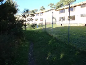
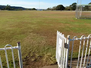
Turn right: From the intersection, this walk heads along the line of the cyclone fence, on the left, for approximately 150m to the gate in the white picket fence of Middle Head Oval, near the 'Middle Head' sign.
(2km) Middle Head Oval NE Gate → Int. Middle Head Rd and Chowder Bay Rd
Veer left: From the gate, this walk heads to the intersection of Middle Head Road and Chowder Bay Road.
Maps for the Middle Head walk
You can download the PDF for this walk to print a map.
These maps below cover the walk and the wider area around the walk, they are worth carrying for safety reasons.
| Sydney Heads | 1:25 000 Map Series | 91302N SYDNEY HEADS | NSW-91302N |
| Sydney | 1:100 000 Map Series | 9130 SYDNEY | 9130 |
Cross sectional view of the Middle Head bushwalking track
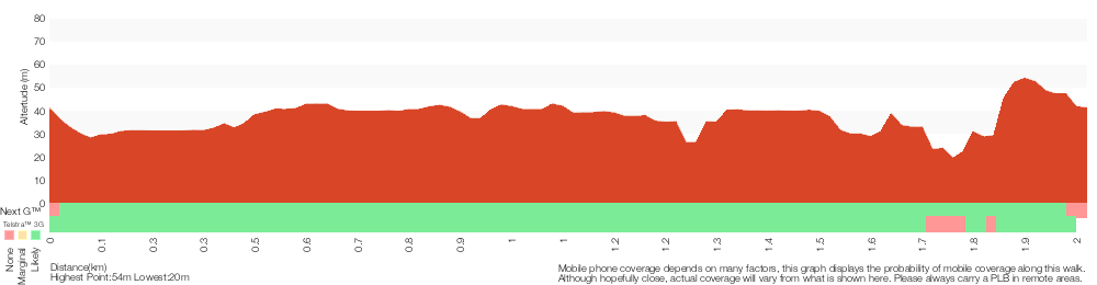
Analysis and summary of the altitude variation on the Middle Head
Overview of this walks grade – based on the AS 2156.1 – 2001
Under this standard, a walk is graded based on the most difficult section of the walk.
| Length | 1.9 km | ||
| Time | 1 Hr | ||
| . | |||
Grade 3/6 Moderate track | AS 2156.1 | Gradient | Short steep hills (3/6) |
| Quality of track | Formed track, with some branches and other obstacles (3/6) | ||
| Signs | Directional signs along the way (3/6) | ||
| Experience Required | No experience required (1/6) | ||
| Weather | Weather generally has little impact on safety (1/6) | ||
| Infrastructure | Limited facilities, not all cliffs are fenced (3/6) |
Some more details of this walks Grading
Here is a bit more details explaining grading looking at sections of the walk
Gradient
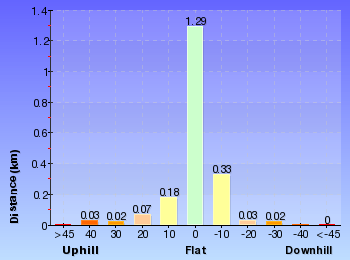
1.5km of this walk has gentle hills with occasional steps and another 240m has short steep hills. The remaining (170m) is flat with no steps.
Quality of track
Around 1.2km of this walk follows a formed track, with some branches and other obstacles, whilst the remaining 630m follows a clear and well formed track or trail.
Signs
Around 1.2km of this walk has directional signs at most intersection, whilst the remaining 630m is clearly signposted.
Experience Required
This whole walk, 1.9km requires no previous bushwalking experience.
weather
This whole walk, 1.9km is not usually affected by severe weather events (that would unexpectedly impact safety and navigation).
Infrastructure
Around 1.2km of this walk is close to useful facilities (such as fenced cliffs and seats), whilst the remaining 660m has limited facilities (such as not all cliffs fenced).
Similar walks
A list of walks that share part of the track with the Middle Head walk.
Middle Head Battery walk
664 m Return, 30 mins
Easy track
Inner Middle Head Battery walk
762 m Return, 30 mins
Moderate track
Cobblers Beach
930 m Return, 30 mins
Hard track
Balmoral to Middle Head Forts
3.9 km Circuit, 2 hrs
Hard track
Chowder Bay to Middle Head return via Chowder Bay Rd
4.9 km Circuit, 2 hrs 30 mins
Moderate track
Spit Bridge to Middle Head Forts
6.1 km One way, 2 hrs 30 mins
Hard track
Other Nearby walks
A list of walks that start near the Middle Head walk.
Balmoral Beach to The Spit
4.3 km One way, 2 hrs 30 mins
Hard track
WW1 Hospital to Georges Heights Lookout
904 m Return, 30 mins
Easy track
Georges Heights Lookout
144 m Return, 7 mins
Very easy
Chowder Bay to Georges Heights Lookout
842 m Return, 30 mins
Moderate track
Clifton Gardens to Georges Heights
1.7 km Return, 1 Hr
Moderate track
Grotto Point Lighthouse Walk
1.7 km Return, 1 Hr
Moderate track
Castle Rock Beach
200 m Return, 30 mins
Moderate track
Castle Rock to Grotto Point Lighthouse
2 km Return, 1 Hr
Moderate track
Chowder Head
548 m Circuit, 20 mins
Moderate track
Crater Cove Lookout
60 m Return, 3 mins
Moderate track
Camp Cove Cannon
358 m Return, 15 mins
Easy track
Lady Bay Beach
992 m Return, 30 mins
Moderate track
Plan your trip to and from the walk here
The Middle Head walk starts and ends at the Int. Middle Head Rd and Chowder Bay Rd (gps: -33.827793, 151.26147)
Weather Forecast
This walk starts in the Metropolitan weather district.
Current Alerts
Park Information
Sydney Harbour National Park
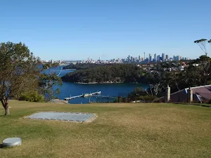
One of Sydney's most diverse parks, Sydney Harbour National Park is formed from 11 pockets of harbour islands and shoreline. Highlights include coastal walks and swimming, breath-taking viewpoints, tours of colonial buildings and Aboriginal cave art.
Comments
Short URL: http://wild.tl/1d