South Head Tour
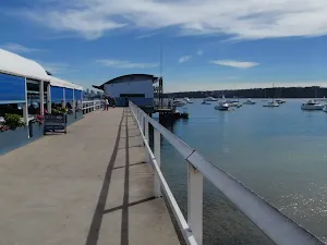
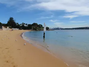
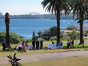
Watsons Bay
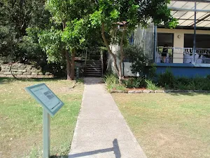
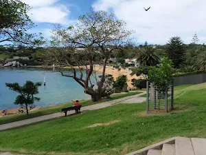
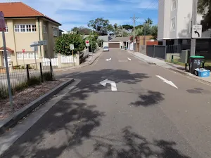
(0km) Watsons Bay Wharf → The Gap
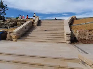
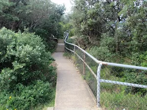
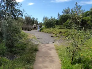
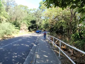
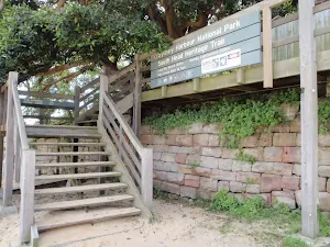
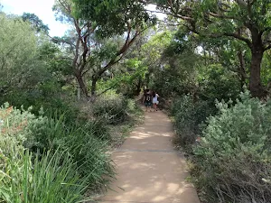
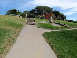
Continue straight: From the bottom of the Gap steps[18], this walk heads up the steps (or ramp[19]). About halfway up the steps, there is an emergency phone for contacting the police or Lifeline[20], then at the top there is a fenced section of footpath (lookout) and ocean views from The Gap[21].
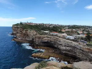
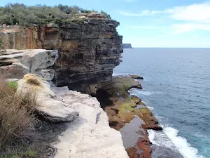
The Gap
(0km) The Gap → The Gap Bluff Lookout
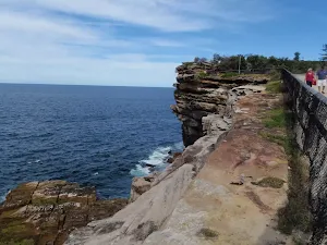
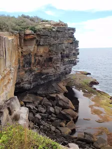
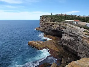
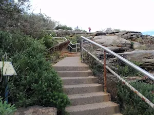
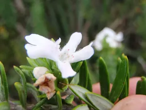
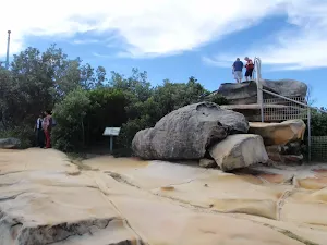
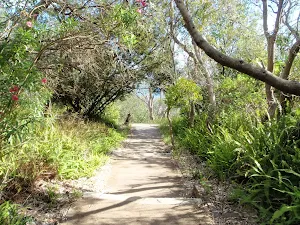
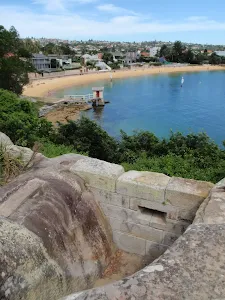
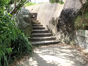
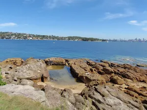
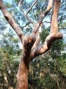
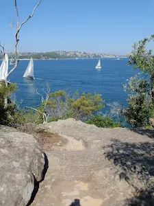
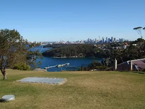
Turn right: From the intersection, this walk heads up the path then steps[31], following the fence and keeping the water views to your right. The path leads past several information signs on local plant life[32][33][34][35] and some lovely wildflowers[36]. The walk continues up the many steps[37] to a rocky clearing[38] near the top. Here the walk tends left and takes the steps through the cleft in the rock to find another rocky clearing and lookout with great panoramic views at the top of Gap Bluff[39].
The Gap Bluff Lookout
(0km) The Gap Bluff Lookout → Old car park Int
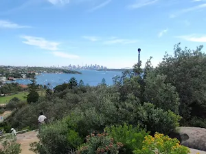
(1km) Old carpark Int → Gun Emplacement Lookout
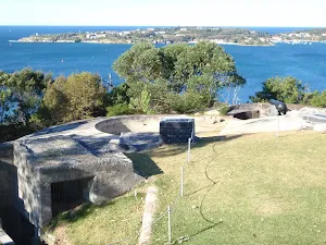
Gun Emplacement Lookout
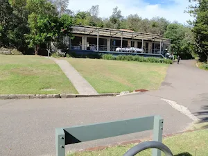
(1km) Old car park Int → The Armoury
The Armoury
(1km) The Armoury → HMAS Watson entrance
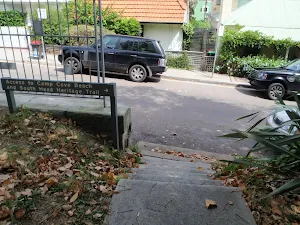
(1km) HMAS Watson entrance → Camp Cove Beach
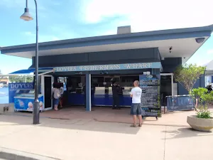
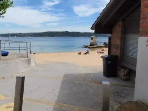
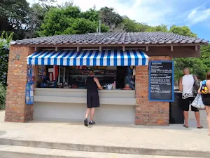
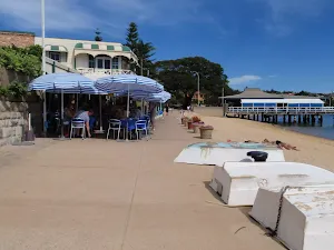
Continue straight: From the signposted 'Camp Cove Car Park[83], this walk follows the 'No Through Road' sign[84] to the end of 'Cliff St'. The footpath leads past a 'Camp Cove timeline' information sign[85] then, at the end of the road, turns left, coming to the front of the kiosk[86] at the northern end of Camp Cove Beach[87].
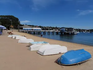
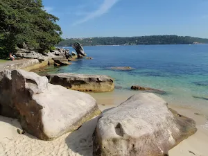
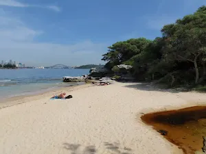
Camp Cove
(1km) Camp Cove Beach → Cannon
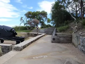
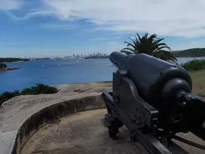
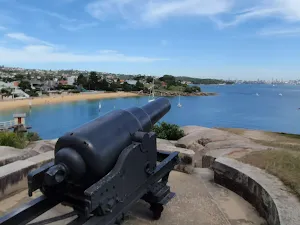
Cannon
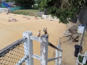
(2km) Cannon → Lady Bay Beach Int
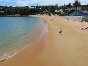
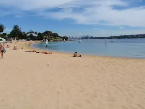
(2km) Lady Bay Beach Int → Lady Bay Beach
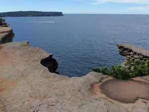
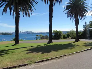
Lady Bay Beach
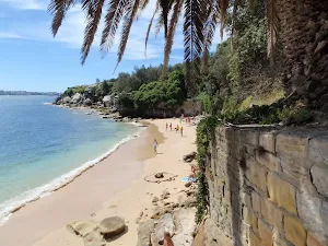
(2km) Lady Bay Beach Int → Lady Bay Lookout
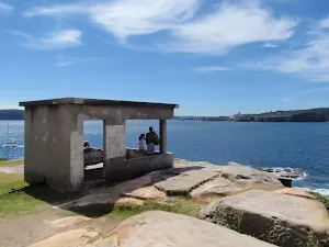
Lady Bay Lookout
(2km) Lady Bay Lookout → Circuit intersection
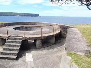
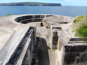
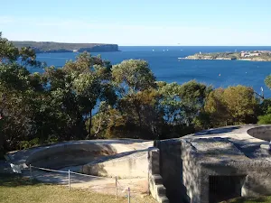
(2km) Circuit Intersection → Gun Emplacements
Gun Emplacements
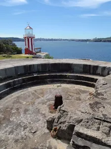
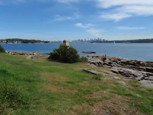
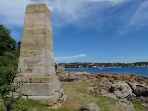
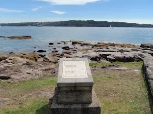
(2km) Gun Emplacements → Hornby Lighthouse
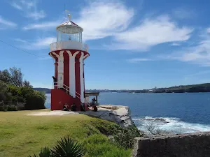
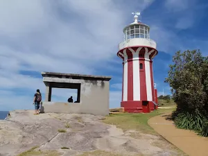
Hornby Lighthouse
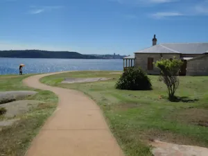
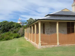
(2km) Hornby Lighthouse → Lightkeepers Cottage
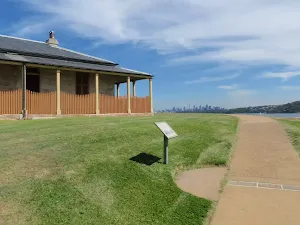
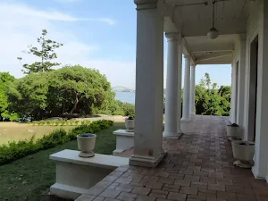
Lightkeepers Cottage
(2km) Lightkeepers Cottage → Camp Cove Beach
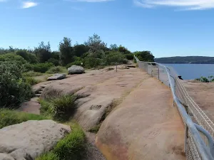
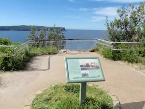
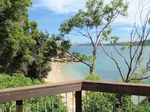
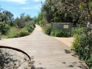
Veer right: From the intersection, this walk heads directly away from the face of the 'South Head Heritage Trail' sign[147] along the timber boardwalk[148] and down a series of steps. The timber boardwalk soon leads to a fenced lookout with a view over Lady Bay[149].
Continue straight: From Lady Bay Lookout, this walk heads down the steps[150] next to the lookout and follows the footpath alongside the large fence[151]. The path heads up a series of steps to the signposted intersection above 'Lady Bay Beach'[152].
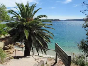
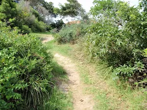
Continue straight: From the intersection, this walk heads gently uphill along the footpath (keeping the water to the right) and after ≈60m, the path comes to the end of an old road. This walk continues along the old road, past the garage bins[153] and the large toilet block (on your left)[154]. The walk now follows the road as it leads around a sweeping left-hand bend, enjoying more harbour views until turning right onto a footpath, near a palm tree (just before the road meets a large fence). The walk heads down this path and some steps to find a disused cannon[155], gun emplacement and more great harbour views[156].
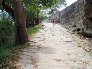
Continue straight: From the cannon, this walk heads down along the wide, cobbled sandstone path[157] (keeping the water views to your right). The walk then follows the footpath gently downhill to an intersection[158][159] (with a toilet block on the left). The walk heads straight, then down the steps and across the beach to the front of the Camp Cove Beach Kiosk[160].
(3km) Camp Cove Beach → Southern End of Camp Cove Beach
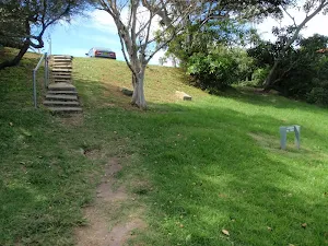
(3km) Southern End of Camp Cove Beach → Green (Laings) Point Park
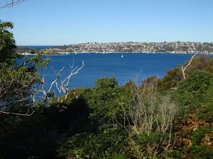
Green Point Park
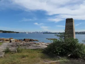
(3km) Green (Laings) Point Park → Green (Laings) Point
Green (Laings) Point
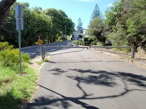
(3km) Green (Laings) Point → End of Pacific St
(4km) End of Pacific St → Int of Cove and Short Sts
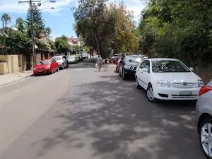
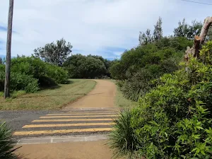
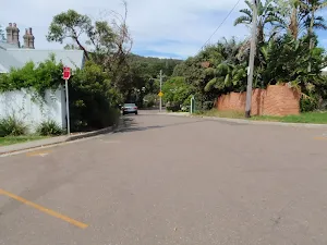
Continue straight: From the intersection, this walk heads downhill, the wrong way along Pacific Street past the 'no entry' signs[202]. The road soon leads past the signposted 'Victoria Wharf Reserve'[203][204] (on your right) and continues along the road, soon turning right into Cove St. The walk follows the footpath that soon leads down a ramp[205], coming to an intersection just below the intersection of Cove and Short Streets.
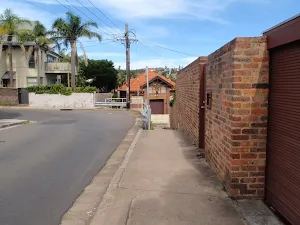
(4km) Int of Cove and Short Sts → Watsons Bay Wharf
Maps for the South Head Tour walk
You can download the PDF for this walk to print a map.
These maps below cover the walk and the wider area around the walk, they are worth carrying for safety reasons.
| Sydney Heads | 1:25 000 Map Series | 91302N SYDNEY HEADS | NSW-91302N |
| Sydney | 1:100 000 Map Series | 9130 SYDNEY | 9130 |
Cross sectional view of the South Head Tour bushwalking track
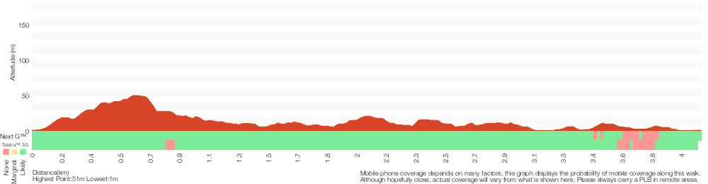
Analysis and summary of the altitude variation on the South Head Tour
Overview of this walks grade – based on the AS 2156.1 – 2001
Under this standard, a walk is graded based on the most difficult section of the walk.
| Length | 4.1 km | ||
| Time | 1 hr 45 mins | ||
| . | |||
Grade 4/6 Hard track | AS 2156.1 | Gradient | Very steep (4/6) |
| Quality of track | Clear and well formed track or trail (2/6) | ||
| Signs | Clearly signposted (1/6) | ||
| Experience Required | No experience required (1/6) | ||
| Weather | Weather generally has little impact on safety (1/6) | ||
| Infrastructure | Generally useful facilities (such as fenced cliffs and seats) (1/6) |
Some more details of this walks Grading
Here is a bit more details explaining grading looking at sections of the walk
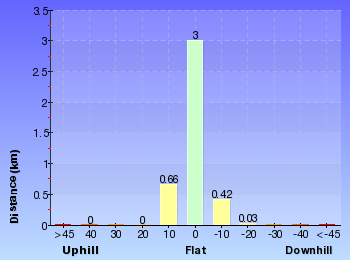
Gradient
2.7km of this walk has gentle hills with occasional steps and another 1.1km is flat with no steps. Whilst another 220m has short steep hills and the remaining 90m is very steep.
Quality of track
Around 3.5km of this walk follows a smooth and hardened path, whilst the remaining 580m follows a clear and well formed track or trail.
Signs
This whole walk, 4.1km is clearly signposted.
Experience Required
This whole walk, 4.1km requires no previous bushwalking experience.
weather
This whole walk, 4.1km is not usually affected by severe weather events (that would unexpectedly impact safety and navigation).
Infrastructure
This whole walk, 4.1km is close to useful facilities (such as fenced cliffs and seats).
Similar walks
A list of walks that share part of the track with the South Head Tour walk.
Green (Laings) Point Loop
243 m Circuit, 15 mins
Easy track
Camp Cove Cannon
358 m Return, 15 mins
Easy track
Gap Bluff Lookout
886 m Return, 30 mins
Hard track
Lady Bay Beach
992 m Return, 30 mins
Moderate track
South Head Heritage Trail
1.7 km Circuit, 45 mins
Easy track
The Gap Bluff and Green Point loop
2.5 km Circuit, 1 Hr
Hard track
Watsons Bay to Hornby Lighthouse
2.8 km Return, 1 hr 15 mins
Easy track
Other Nearby walks
A list of walks that start near the South Head Tour walk.
Hermitage Foreshore Track
2.2 km One way, 1 Hr
Moderate track
History of Nielsen Park
896 m Return, 20 mins
Easy track
Mt Trefle
1.7 km Circuit, 40 mins
Easy track
Nielsen Park and Strickland House loop
2.5 km Circuit, 1 Hr
Moderate track
Nielsen Park Circuit
1.8 km Circuit, 40 mins
Easy track
Shakespheres Point loop
661 m Circuit, 15 mins

Easy track
Chowder Head
548 m Circuit, 20 mins
Moderate track
Chowder Bay to Georges Heights Lookout
842 m Return, 30 mins
Moderate track
Strickland House and Milk Beach
706 m Return, 25 mins
Easy track
Chowder Bay to Middle Head return via Chowder Bay Rd
4.9 km Circuit, 2 hrs 30 mins
Moderate track
Georges Heights Lookout
144 m Return, 7 mins
Very easy
Clifton Gardens to Georges Heights
1.7 km Return, 1 Hr
Moderate track
Plan your trip to and from the walk here
The South Head Tour walk starts and ends at the Watsons Bay Wharf (gps: -33.843316, 151.28184)
Weather Forecast
This walk starts in the Metropolitan weather district.
Current Alerts
Park Information
Sydney Harbour National Park
One of Sydney's most diverse parks, Sydney Harbour National Park is formed from 11 pockets of harbour islands and shoreline. Highlights include coastal walks and swimming, breath-taking viewpoints, tours of colonial buildings and Aboriginal cave art.
Comments
Short URL: http://wild.tl/sht