Wyrrabalong Coast Walk circuit
* This walk passes through very remote areas and sections have no visible track. At least one person in your group should have training and experience in off track walking and navigation. Even with these notes and a GPS these extra skills and equipment are required.
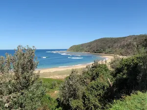
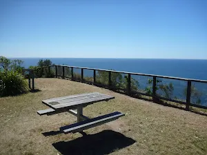

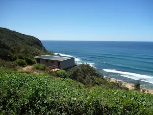
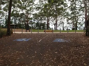
Bateau Bay Beach picnic area and lookout
(0km) Top of northern Bateau Bay Beach access steps → South end of Bateau Bay Beach picnic area
Continue straight: From the viewpoint, this walk goes south across the picnic area, keeping Reserve Dr to the right. The walk passes a fenced viewing area just before reaching an intersection at the end of the picnic area, with a concrete beach-access track to the left.
(0km) South end of Bateau Bay Beach picnic area → Rushby St car park
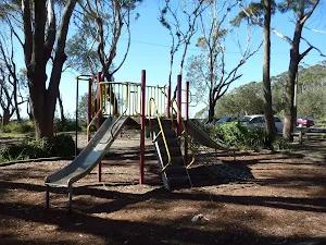
Southern Bateau Bay beach picnic area
(0km) Rushby St car park → Crackneck Lookout
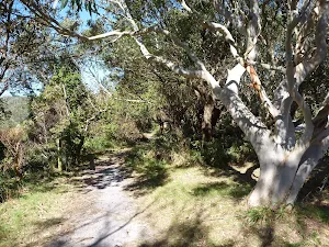
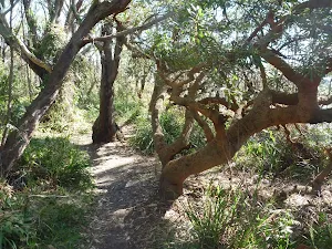
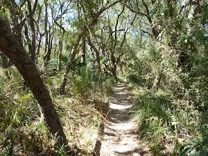
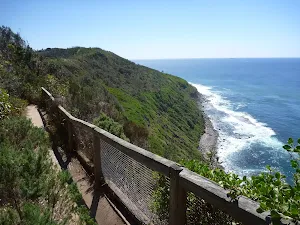
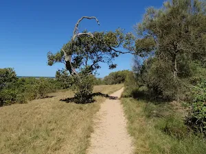
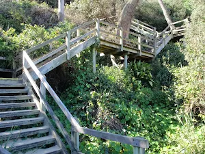
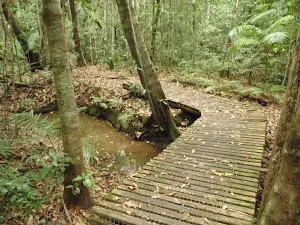
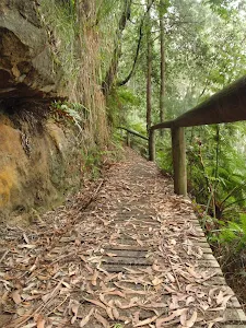
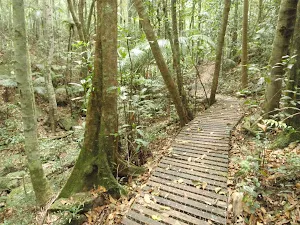
Continue straight: From the intersection, the walk follows the bush track south, keeping Reserve Dr to the right. The walk soon passes a bench seat with a commemorative plaque, and continues through the bush on the sandy track. Ignoring a track to the right (which goes to the nearby street), the walk continues along sections of track with retaining boards, for some time before arriving beside Hilltop St. The walk continues along the bush track close to Hilltop St, going along sections of boardwalk before climbing some wooden steps and emerging at the northern edge of Crackneck Lookout (at the end of Hilltop St).
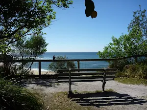
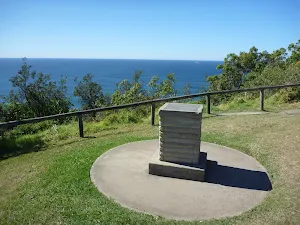
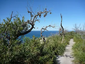
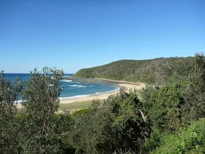
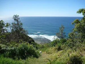
Crackneck Lookout
(2km) Crackneck Lookout → Int of Coast Track and southern Stephenson Rd access track
Veer right: From the junction at the end of the management trail, this walk follows the sandy bush track marked with some timber posts. The track goes for a very short distance to an intersection, with another sandy bush track to the right, marked with several wooden posts and a signpost (indicating walkers are permitted but no dogs or motorbikes).
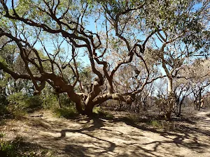
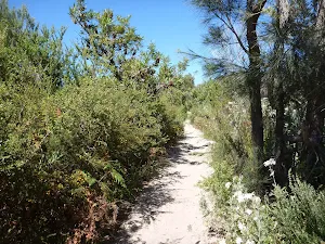
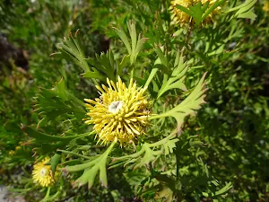
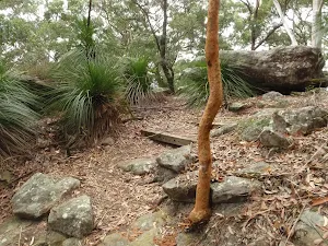
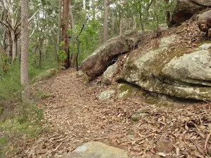
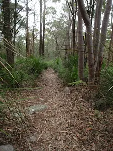
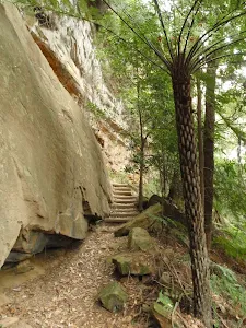
Continue straight: From the intersection, this walk follows the sandy bush track south, leaving the signpost behind on the right. The track passes through lovely bush with plenty of grass trees and, after a short distance, reaches an intersection with another sandy bush track, to the right, at the start of some low sandstone retaining walls.
(2km) Int of Coast Track and southern Stephenson Rd access track → End of Stephenson Rd
(2km) Int of Coast Track and southern Stephenson Rd access track → Wyrrabalong Lookout
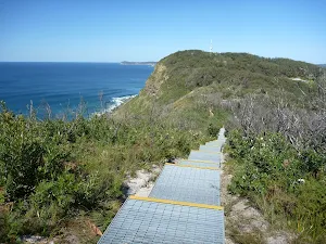
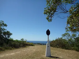
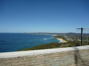
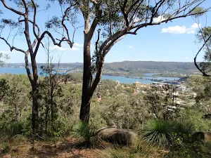
Wyrrabalong Lookout and Cromarty Hill
(3km) Wyrrabalong Lookout → Int of South Scenic Rd and Henrys Rd
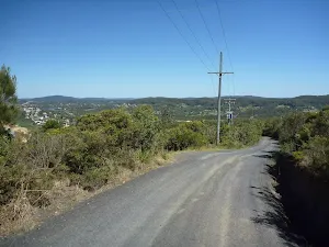
Continue straight: From the end of Cromarty Hill Rd, this walk follows the road down the hill, away from the 'Wyrrabalong National Park' sign. After a while, the road changes from gravel to asphalt, bends to the left and becomes North Scenic Rd. The walk continues along the road until reaching the intersection with Forresters Beach Rd.
Turn left: From the intersection, this walk follows Forresters Beach Rd down the hill. The road soon bends to the right and becomes South Scenic Rd as it runs parallel to the beach. After a short distance, the walk reaches the top of the beach access track near the intersection with Henrys Rd.
(4km) Int of South Scenic Rd and Henrys Rd → Bottom of Henrys Rd beach access
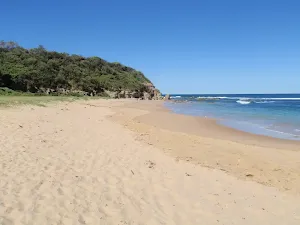
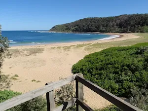
Forresters Beach
(5km) Bottom of Henrys Rd beach access → Crackneck beach
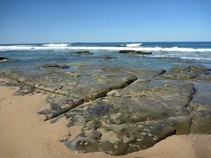
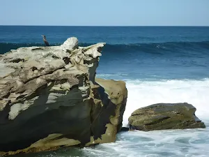
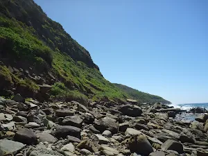
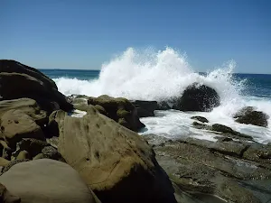
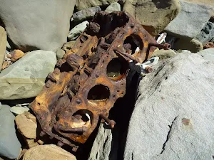
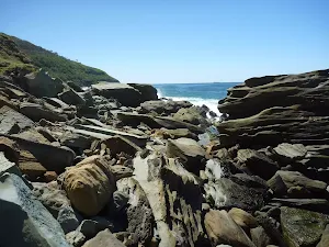
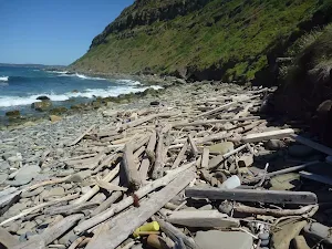
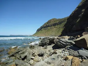
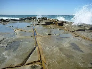
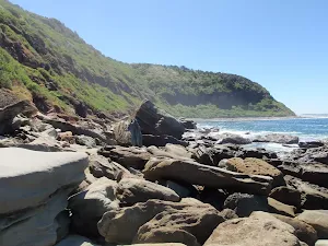
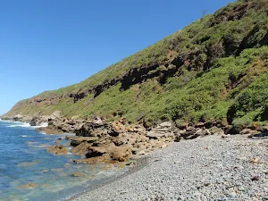
Continue straight: From the northern end of Forresters Beach, this walk follows the coast north, keeping the ocean to the right. The walk travels over the rocky, boulder-covered shoreline for quite a while, with a lot of rock-hopping involved. There is only a narrow strip between the water and the steep hills, to the left, and great care should be exercised. The imposing hills, interesting textures and shapes in the rocks, and the crashing waves all combine to provide fantastic scenery and atmosphere. A fair number of old engine blocks and other car parts are lying in the rocks, rusting away slowly. The walk eventually reaches the unnamed beach beneath Crackneck Lookout, covered in rounded fist-sized rocks. Note: This section of the walk may be impassible at high tide or during high seas.
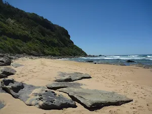
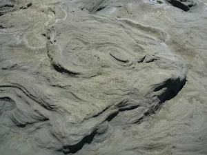
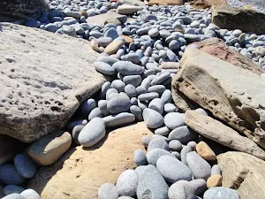
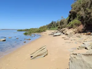
Crackneck Beach

(7km) Crackneck beach → Crackneck rockshelf
(8km) Crackneck rockshelf → Southern end of Bateau Bay Beach
Continue straight: From the end of the narrow beach strip, this walk goes north along the sand, keeping the ocean to the right. The walk passes a concrete stormwater outlet (to the left) and a short distance later reaches the southern end of the much wider Bateau Bay Beach.
(9km) Southern end of Bateau Bay Beach → Bottom of northern Bateau Bay Beach access track
Turn right: From the bottom of the steps, this walk goes north along the beach, keeping the ocean to the right. Towards the northern end of the beach, the walk arrives at the base of a flight of wooden stairs.
(9km) Bottom of northern Bateau Bay Beach access track → Top of northern Bateau Bay Beach access steps
Maps for the Wyrrabalong Coast Walk circuit walk
You can download the PDF for this walk to print a map.
These maps below cover the walk and the wider area around the walk, they are worth carrying for safety reasons.
| Gosford | 1:25 000 Map Series | 91312S GOSFORD | NSW-91312S |
| Gosford | 1:100 000 Map Series | 9131 GOSFORD | 9131 |
Cross sectional view of the Wyrrabalong Coast Walk circuit bushwalking track
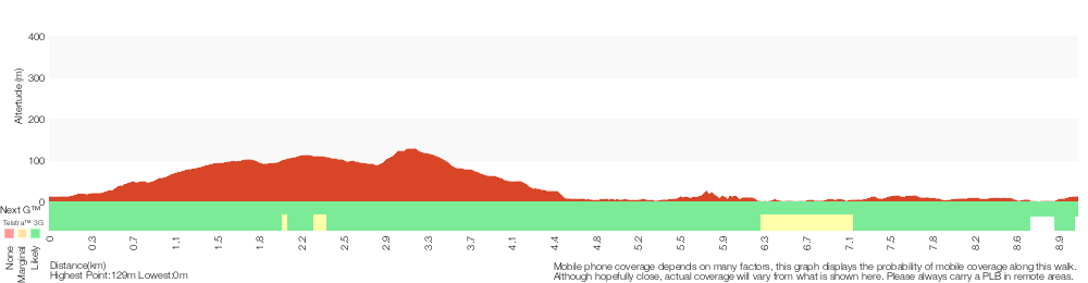
Analysis and summary of the altitude variation on the Wyrrabalong Coast Walk circuit
Overview of this walks grade – based on the AS 2156.1 – 2001
Under this standard, a walk is graded based on the most difficult section of the walk.
| Length | 9.1 km | ||
| Time | 3 hrs 30 mins | ||
| . | |||
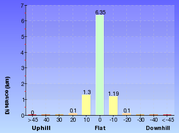
Grade 5/6 Experienced only | AS 2156.1 | Gradient | Short steep hills (3/6) |
| Quality of track | Rough unclear track (5/6) | ||
| Signs | Minimal directional signs (4/6) | ||
| Experience Required | Moderate level of bushwalking experience recommended (4/6) | ||
| Weather | Forecast, unforecast storms and severe weather may impact on navigation and safety (4/6) | ||
| Infrastructure | No facilities provided (5/6) |
Some more details of this walks Grading
Here is a bit more details explaining grading looking at sections of the walk
Gradient
4.8km of this walk has short steep hills and another 3.1km has gentle hills with occasional steps. The remaining (1.2km) is flat with no steps.
Quality of track
2.9km of this walk follows a rough unclear track and another 2.7km follows a formed track, with some branches and other obstacles. Whilst another 1.9km follows a clear and well formed track or trail and the remaining 1.5km follows a rough track, where fallen trees and other obstacles are likely.
Signs
4.4km of this walk has minimal directional signs and another 3.4km has directional signs at most intersection. The remaining (1.2km) is clearly signposted.
Experience Required
4.4km of this walk requires no previous bushwalking experience and another 2.5km requires a leader a with moderate level of bushwalking experience. The remaining (2.1km) requires some bushwalking experience.
weather
6km of this walk is not usually affected by severe weather events (that would unexpectedly impact safety and navigation) and another 2.5km is affected by forecast, unforecast storms and severe weather events that may impact on navigation and safety. The remaining (710m) is affected by storms that may impact your navigation and safety.
Infrastructure
3.1km of this walk is close to useful facilities (such as fenced cliffs and seats) and another 2.3km has limited facilities (such as not all cliffs fenced). Whilst another 2km has no facilities provided and the remaining 1.6km has limited facilities (such as cliffs not fenced, significant creeks not bridged).
Similar walks
A list of walks that share part of the track with the Wyrrabalong Coast Walk circuit walk.
Wyrrabalong lookout
382 m Return, 15 mins
Moderate track
Stephenson Rd to Crackneck Lookout
646 m One way, 15 mins
Moderate track
Bateau Bay Beach loop
892 m Circuit, 30 mins
Hard track
Wyrrabalong Lookout to Crackneck Lookout
1.6 km One way, 45 mins
Moderate track
Bateau Bay Picnic Area to Crackneck lookout
1.7 km One way, 1 hr 30 mins

Moderate track
Bateau Bay Beach to Crackneck Beach
3.4 km Return, 1 hr 15 mins
Experienced only
Wyrrabalong Coast Walking Track
3.8 km One way, 1 hr 30 mins
Moderate track
Wyrrabalong Shoreline walk
4.6 km One way, 2 hrs
Experienced only
Forresters Beach to Crackneck Beach
5.8 km Return, 2 hrs 30 mins

Experienced only
Other Nearby walks
A list of walks that start near the Wyrrabalong Coast Walk circuit walk.
St Johns Lookout
166 m Return, 10 mins
Very easy
Katandra Circuit
4.8 km Circuit, 2 hrs 15 mins
Moderate track
Toomeys Walk
2.9 km One way, 1 hr 30 mins
Moderate track
Guringai Walk
1.2 km Circuit, 45 mins
Moderate track
Graves Walk
1.5 km One way, 45 mins
Moderate track
Mouat Trail (Katandra to Rumbalara)
4.1 km One way, 2 hrs
Hard track
Strangler Fig Walk
2 km Return, 1 Hr
Moderate track
Seymour Pond
890 m Return, 30 mins
Easy track
Watermans Walk
1.6 km Circuit, 45 mins
Easy track
Katandra Reserve Explorer
5.3 km Circuit, 2 hrs 45 mins
Moderate track
Matcham to Gosford
8.5 km One way, 3 hrs 45 mins
Hard track
Arboretum Loop Trail
2.3 km Circuit, 1 Hr
Moderate track
Plan your trip to and from the walk here
The Wyrrabalong Coast Walk circuit walk starts and ends at the Top of northern Bateau Bay Beach access steps (gps: -33.382053, 151.48403)
Weather Forecast
This walk starts in the Hunter weather district.
Current Alerts
Park Information
Wyrrabalong National Park
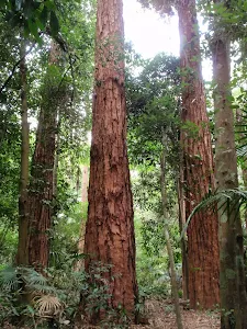
Wyrrabalong National park on the NSW Central Coast is divided into two main sections. The northern section sits between the South Pacific Ocean and Tuggerah Lake (with the Central Coast Hwy cutting up the middle) south of Norah Head. The south section covers a coastal strip from Forresters Beach to Bateau Bay. The park is rich with great views, sandy beaches and the last significant coastal rainforest in the area. A great place for walking, swimming, fishing and relaxing.
Comments
Short URL: http://wild.tl/wcwc