Wyrrabalong Coast Walking Track

(0km) Entrance of Blue Lagoon Beach Resort → Top of northern Bateau Bay Beach access steps
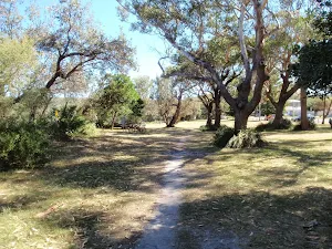
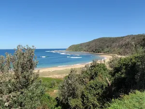
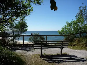
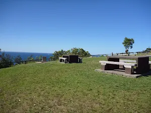
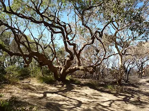
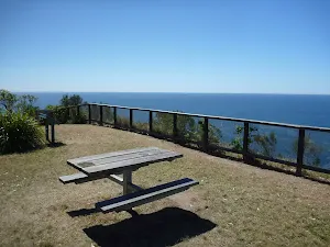
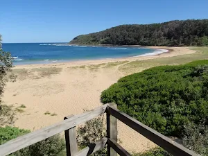
Bateau Bay Beach picnic area and lookout
(1km) Top of northern Bateau Bay Beach access steps → South end of Bateau Bay Beach picnic area
Continue straight: From the viewpoint, this walk goes south across the picnic area, keeping Reserve Dr to the right. The walk passes a fenced viewing area just before reaching an intersection at the end of the picnic area, with a concrete beach-access track to the left.
(1km) South end of Bateau Bay Beach picnic area → Rushby St car park
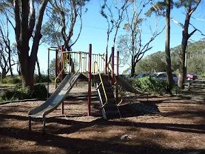
Southern Bateau Bay beach picnic area
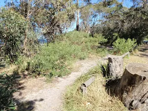
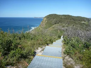
(1km) Rushby St car park → Crackneck Lookout
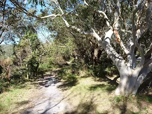
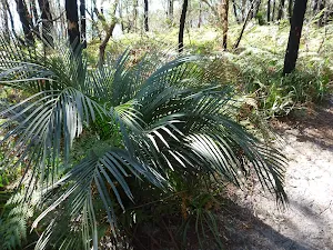
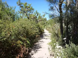
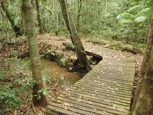
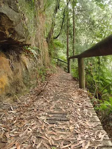
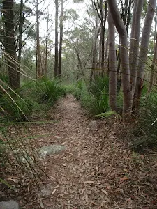
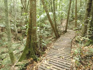
Continue straight: From the intersection, the walk follows the bush track south, keeping Reserve Dr to the right. The walk soon passes a bench seat with a commemorative plaque, and continues through the bush on the sandy track. Ignoring a track to the right (which goes to the nearby street), the walk continues along sections of track with retaining boards, for some time before arriving beside Hilltop St. The walk continues along the bush track close to Hilltop St, going along sections of boardwalk before climbing some wooden steps and emerging at the northern edge of Crackneck Lookout (at the end of Hilltop St).
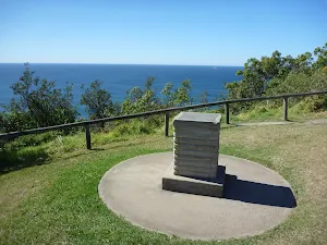
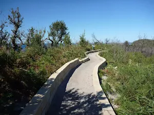
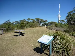
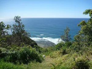
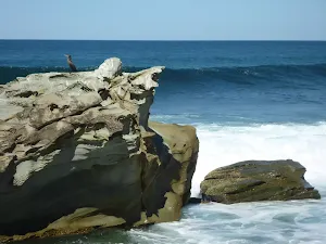
Crackneck Lookout
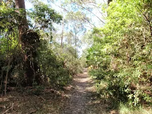
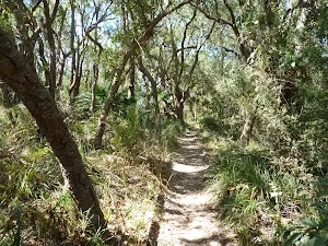
(2km) Crackneck Lookout → End of Crackneck management trail
(2km) End of Crackneck management trail → Int of Coast Track and southern Stephenson Rd access track
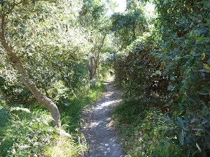
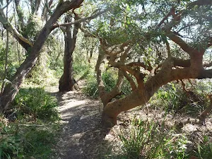
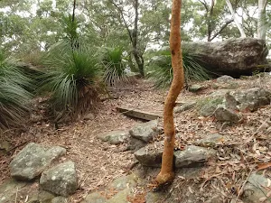
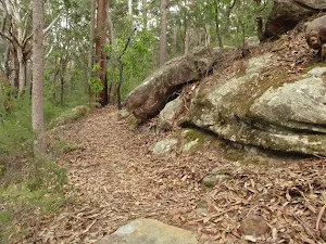
Continue straight: From the intersection, this walk follows the sandy bush track south, leaving the signpost behind on the right. The track passes through lovely bush with plenty of grass trees and, after a short distance, reaches an intersection with another sandy bush track, to the right, at the start of some low sandstone retaining walls.
(3km) Int of Coast Track and southern Stephenson Rd access track → End of Stephenson Rd
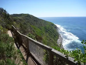
(3km) Int of Coast Track and southern Stephenson Rd access track → Wyrrabalong Lookout
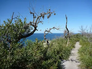
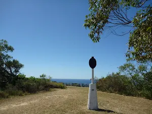
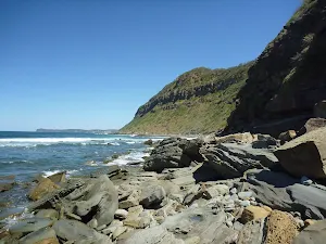
Wyrrabalong Lookout and Cromarty Hill
(4km) Wyrrabalong Lookout → End of Cromarty Hill Rd
Maps for the Wyrrabalong Coast Walking Track walk
You can download the PDF for this walk to print a map.
These maps below cover the walk and the wider area around the walk, they are worth carrying for safety reasons.
| Gosford | 1:25 000 Map Series | 91312S GOSFORD | NSW-91312S |
| Gosford | 1:100 000 Map Series | 9131 GOSFORD | 9131 |
Cross sectional view of the Wyrrabalong Coast Walking Track bushwalking track
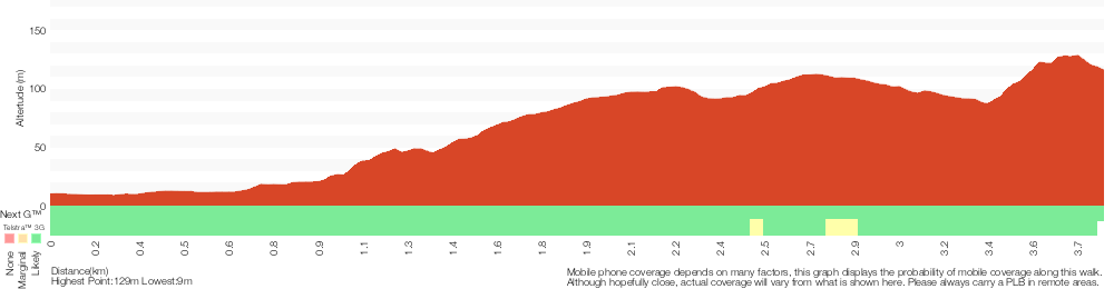
Analysis and summary of the altitude variation on the Wyrrabalong Coast Walking Track
Overview of this walks grade – based on the AS 2156.1 – 2001
Under this standard, a walk is graded based on the most difficult section of the walk.
| Length | 3.8 km | ||
| Time | 1 hr 30 mins | ||
| . | |||
Grade 3/6 Moderate track | AS 2156.1 | Gradient | Short steep hills (3/6) |
| Quality of track | Formed track, with some branches and other obstacles (3/6) | ||
| Signs | Directional signs along the way (3/6) | ||
| Experience Required | No experience required (1/6) | ||
| Weather | Weather generally has little impact on safety (1/6) | ||
| Infrastructure | Limited facilities, not all cliffs are fenced (3/6) |
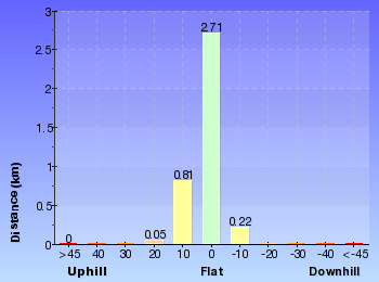
Some more details of this walks Grading
Here is a bit more details explaining grading looking at sections of the walk
Gradient
1.8km of this walk has short steep hills and another 1.6km has gentle hills with occasional steps. The remaining (380m) is flat with no steps.
Quality of track
Around 3.2km of this walk follows a formed track, with some branches and other obstacles, whilst the remaining 560m follows a clear and well formed track or trail.
Signs
Around 2.6km of this walk has directional signs at most intersection, whilst the remaining 1.2km is clearly signposted.
Experience Required
This whole walk, 3.8km requires no previous bushwalking experience.
weather
This whole walk, 3.8km is not usually affected by severe weather events (that would unexpectedly impact safety and navigation).
Infrastructure
Around 3.6km of this walk is close to useful facilities (such as fenced cliffs and seats), whilst the remaining 240m has limited facilities (such as not all cliffs fenced).
Similar walks
A list of walks that share part of the track with the Wyrrabalong Coast Walking Track walk.
Wyrrabalong lookout
382 m Return, 15 mins
Moderate track
Stephenson Rd to Crackneck Lookout
646 m One way, 15 mins
Moderate track
Bateau Bay Beach loop
892 m Circuit, 30 mins
Hard track
Wyrrabalong Lookout to Crackneck Lookout
1.6 km One way, 45 mins
Moderate track
Bateau Bay Picnic Area to Crackneck lookout
1.7 km One way, 1 hr 30 mins

Moderate track
Wyrrabalong Coast Walk circuit
9.1 km Circuit, 3 hrs 30 mins
Experienced only
Other Nearby walks
A list of walks that start near the Wyrrabalong Coast Walking Track walk.
Bateau Bay Beach to Crackneck Beach
3.4 km Return, 1 hr 15 mins
Experienced only
Wyrrabalong Shoreline walk
4.6 km One way, 2 hrs
Experienced only
Forresters Beach to Crackneck Beach
5.8 km Return, 2 hrs 30 mins

Experienced only
St Johns Lookout
166 m Return, 10 mins
Very easy
Katandra Circuit
4.8 km Circuit, 2 hrs 15 mins
Moderate track
Toomeys Walk
2.9 km One way, 1 hr 30 mins
Moderate track
Guringai Walk
1.2 km Circuit, 45 mins
Moderate track
Graves Walk
1.5 km One way, 45 mins
Moderate track
Mouat Trail (Katandra to Rumbalara)
4.1 km One way, 2 hrs
Hard track
Strangler Fig Walk
2 km Return, 1 Hr
Moderate track
Seymour Pond
890 m Return, 30 mins
Easy track
Watermans Walk
1.6 km Circuit, 45 mins
Easy track
Plan your trip to and from the walk here
The Wyrrabalong Coast Walking Track walk starts at the Entrance of Blue Lagoon Beach Resort (gps: -33.378107, 151.48415)
The Wyrrabalong Coast Walking Track ends at the End of Cromarty Hill Rd (gps: -33.405263, 151.47447)
Weather Forecast
This walk starts in the Hunter weather district.
Current Alerts
Park Information
Wyrrabalong National Park
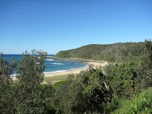
Wyrrabalong National park on the NSW Central Coast is divided into two main sections. The northern section sits between the South Pacific Ocean and Tuggerah Lake (with the Central Coast Hwy cutting up the middle) south of Norah Head. The south section covers a coastal strip from Forresters Beach to Bateau Bay. The park is rich with great views, sandy beaches and the last significant coastal rainforest in the area. A great place for walking, swimming, fishing and relaxing.
Comments
Short URL: http://wild.tl/wcwt