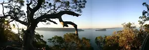
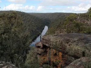
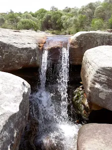
Here is a list of all wildwalks that are less then 1 hour, they are ordered by grade. Happy walking :)
Tea Tree Picnic Area to Bird Island Lookout
136 m Return, 3 mins
Very easy
North Tura Lookout
124 m Return, 5 mins
Very easy
Georges Heights Lookout
144 m Return, 7 mins
Very easy
Mount Portal Lookout
74 m Return, 10 mins
Very easy
Quibray Bay viewing platform
84 m Return, 10 mins
Very easy
St Johns Lookout
166 m Return, 10 mins
Very easy
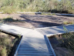
Bobbin Head Boardwalk
552 m Return, 15 mins
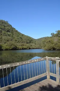
Very easy
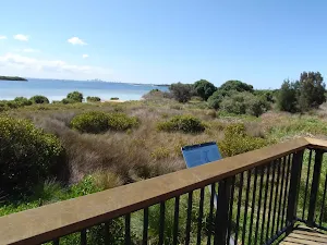
Arabanoo Lookout
142 m Return, 15 mins
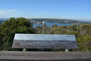
Very easy
Barnetts Lookout
420 m Return, 15 mins
Very easy
Davies Reserve to the Pipe Bridge Picnic Area
566 m Return, 15 mins
Very easy
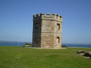
Boyd Tower
582 m Return, 15 mins
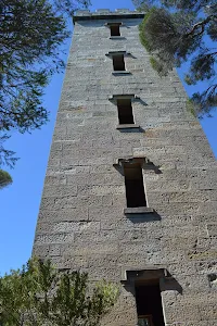
Very easy
Blackbutt Wildlife Exhibit
480 m Circuit, 15 mins
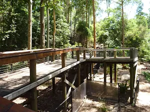
Very easy
Mambara Track
717 m Circuit, 20 mins
Very easy
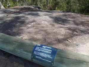
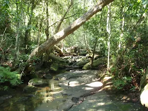
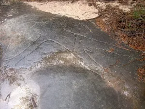
Bulgandry Engravings
800 m Return, 20 mins
Very easy
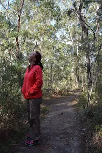
Bungoona Path
918 m Return, 20 mins
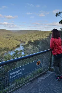
Very easy
Katoomba Falls Park to Cliff View Lookout
556 m Return, 20 mins

Very easy
Davies Reserve to the Salt Pan Creek Footbridge
1 km Return, 20 mins
Very easy
Twofold Bay Lookout via Boyd Tower
764 m Return, 20 mins
Very easy
Kalkari Discovery trail
798 m Circuit, 30 mins
Very easy
McKell Park to Flat Rock Point
1.4 km Return, 30 mins
Very easy
Fairfax Walk
762 m Circuit, 30 mins
Very easy
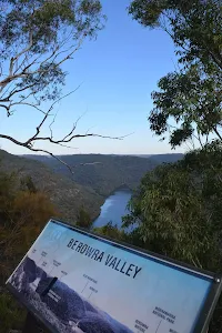
Crosslands to Berowra Creek Lookout
980 m Return, 30 mins
Very easy
Burrawang foreshore walk
1.1 km One way, 30 mins
Very easy
George Phillips Lookout walk
588 m Return, 30 mins
Very easy
Mangrove Boardwalk to Schoolmasters House
1.2 km Return, 30 mins
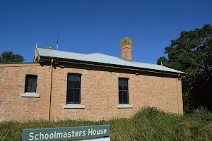
Very easy
Lambeth Reserve to Picnic Point
1.3 km One way, 30 mins
Very easy
Norah Head Lighthouse walk
762 m Return, 30 mins
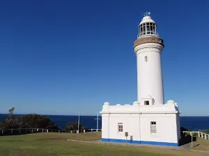
Very easy
Richley Reserve Circuit
731 m Circuit, 30 mins
Very easy
Cain's Timber Bridge Viewpoint Walk
1.3 km Return, 30 mins
Very easy
Fairfax Heritage Track
1.9 km One way, 45 mins
Very easy
Wybung Head whale viewing area
142 m Return, 5 mins
Easy track
West Head Lookout
238 m Return, 10 mins
Easy track
Disaster Bay Lookout
52 m Return, 10 mins
Easy track
Girrakool Aboriginal Engravings track
378 m Return, 10 mins
Easy track
Tea Tree Picnic Area to Birdie Beach
444 m Return, 10 mins
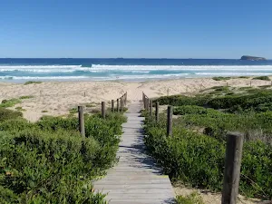
Easy track
Green (Laings) Point Loop
243 m Circuit, 15 mins
Easy track
Robertsons Point Lookout
478 m Return, 15 mins
Easy track
Clarinda St dog walking trail
499 m One way, 15 mins
Easy track
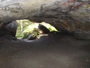
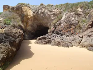
Wind Cave
400 m Return, 15 mins
Easy track
Tarpeian Rock
432 m Return, 15 mins
Easy track
Sheldon Cascades walk
360 m Return, 15 mins
Easy track
Wallagoot Gap
648 m Return, 15 mins
Easy track
Norah Head Rockpool
150 m Return, 15 mins
Easy track
Green (Laings) Point Loop
243 m Circuit, 15 mins
Easy track
Camp Cove Cannon
358 m Return, 15 mins
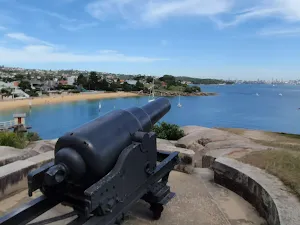
Easy track
Shakespheres Point loop
661 m Circuit, 15 mins

Easy track
Banks-Solander Track
960 m Circuit, 20 mins
Easy track
Warrah Trig to Lookout
756 m Return, 20 mins
Easy track
Gibraltar Rock
858 m Return, 20 mins
Easy track
Kanning Cave Walk
922 m Return, 20 mins
Easy track
History of Nielsen Park
896 m Return, 20 mins
Easy track
Freemans camping area to Birdie Beach
1.2 km Return, 25 mins
Easy track
Strickland House and Milk Beach
706 m Return, 25 mins
Easy track
Middle Head Battery walk
664 m Return, 30 mins
Easy track
WW1 Hospital to Georges Heights Lookout
904 m Return, 30 mins
Easy track
Fairylands track
978 m Return, 30 mins
Easy track
Jennifer Street Boardwalk
750 m Return, 30 mins
Easy track
La Perouse Historical Walk
792 m Circuit, 30 mins
Easy track
Bare Island Walk
866 m Return, 30 mins
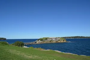
Easy track
Mt Ettalong Lookout
1.4 km Return, 30 mins

Easy track
City Farm walk to Milhams Farmhouse Ruin
1.3 km Return, 30 mins
Easy track
Ly-ee-moon Graveyard
490 m Return, 30 mins
Easy track
Green Cape Lighthouse and Lookout
826 m Return, 30 mins
Easy track
Severs Beach
1.4 km Return, 30 mins

Easy track
Seymour Pond
890 m Return, 30 mins
Easy track
Kanning Walk
1.3 km Circuit, 30 mins
Easy track
Warriwarri Lookout
1.5 km Return, 30 mins
Easy track
Yuelarbah walking track to Flaggy Creek
1.3 km Return, 40 mins
Easy track
Mt Trefle
1.7 km Circuit, 40 mins
Easy track
Nielsen Park Circuit
1.8 km Circuit, 40 mins
Easy track
Cremorne Point to Mosman Wharf
2 km One way, 45 mins
Easy track
Providential Point
1.6 km Return, 45 mins
Easy track
Audley to Gibraltar Rock
2.2 km Return, 45 mins
Easy track
Kings Tableland Walk
1.6 km One way, 45 mins
Easy track
Scots Point Way to Riverside Park Trail
1.9 km One way, 45 mins
Easy track
Riverside Park to Scotts Point
2.5 km Return, 45 mins
Easy track
Watermans Walk
1.6 km Circuit, 45 mins
Easy track
South Head Heritage Trail
1.7 km Circuit, 45 mins
Easy track
Rouse Hill Estate walk
1.8 km Return, 45 mins
Easy track
Crater Cove Lookout
60 m Return, 3 mins
Moderate track
Bittangabee Bay carpark to beach
180 m Return, 5 mins
Moderate track
Bournda Lagoon
286 m Return, 5 mins
Moderate track
North Tura Beach
316 m Return, 10 mins
Moderate track
Bournda Beach car park to Beach
464 m Return, 10 mins

Moderate track
Queens Beach
108 m Return, 10 mins
Moderate track
Snapper Point
280 m Return, 10 mins
Moderate track
Elvina Bay Aboriginal Engraving Walk
508 m Return, 15 mins
Moderate track
Whale Rock
516 m Return, 15 mins
Moderate track
Martin's Lookout
180 m Return, 15 mins
Moderate track
Machins Crater
466 m Return, 15 mins
Moderate track
The Lakes of Cherrybrook loop
439 m Circuit, 15 mins

Moderate track
Daphne Place dog walking trail
515 m One way, 15 mins
Moderate track
Bellamy St to De Saxe Cl dog walking trail
529 m One way, 15 mins
Moderate track
Flat Rock Creek
294 m Return, 15 mins
Moderate track
Katoomba Cascades
254 m Return, 15 mins

Moderate track
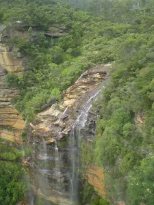
Victoria Falls Lookout
206 m Return, 15 mins
Moderate track
Anvil Rock
460 m Return, 15 mins
Moderate track
Solitary Restaurant to Fossil Rock
150 m Return, 15 mins
Moderate track
Elysian Rock Lookout track
222 m Return, 15 mins
Moderate track
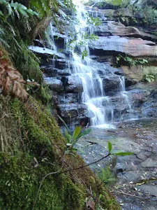
Gordon Falls Lookout Walk
260 m Return, 15 mins
Moderate track
Solitary Restaurant to Jamieson Lookout
308 m Return, 15 mins
Moderate track
Snow Gums Boardwalk
374 m Return, 15 mins
Moderate track
North Tura Beach loop
471 m Circuit, 15 mins
Moderate track
Wyrrabalong lookout
382 m Return, 15 mins

Moderate track
Stephenson Rd to Crackneck Lookout
646 m One way, 15 mins
Moderate track
Raymond Rd to Lawsons Lookout
202 m Return, 15 mins
Moderate track
Moss Wall Walk
516 m Return, 15 mins
Moderate track
Chowder Head
548 m Circuit, 20 mins
Moderate track
Jellybean Pool
218 m Return, 20 mins
Moderate track
Erskine Lookout
648 m Return, 20 mins
Moderate track
Flat Rock Beach track
516 m Return, 20 mins

Moderate track
Somersby Falls
426 m Return, 20 mins
Moderate track
Eastern Girrakool Loop
803 m Circuit, 20 mins
Moderate track
Lady Darley Lookout Track
218 m Return, 20 mins
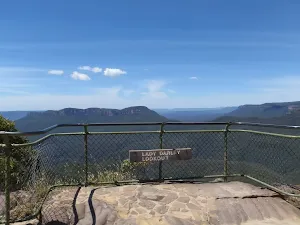
Moderate track
Reids Plateau Loop
352 m Circuit, 20 mins
Moderate track

Solitary Kiosk and Restaurant to Copelands Lookout
570 m Return, 20 mins

Moderate track
Palm Tree Circuit Track
609 m Circuit, 20 mins
Moderate track
Wybung Head
804 m Return, 20 mins
Moderate track
Queens Beach to Hermit Point
552 m Return, 20 mins

Moderate track
Second Ponds Creek walk
865 m Circuit, 20 mins
Moderate track
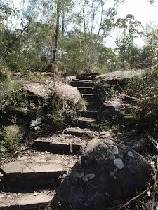
Red Hands Cave
403 m Circuit, 30 mins
Moderate track
Koolewong Track
810 m Circuit, 30 mins
Moderate track
McKell Park Loop
931 m Circuit, 30 mins
Moderate track
Castle Rock Beach
200 m Return, 30 mins
Moderate track
Inner Middle Head Battery walk
762 m Return, 30 mins
Moderate track
Chowder Bay to Georges Heights Lookout
842 m Return, 30 mins
Moderate track
Taronga Zoo to Camp Curlew
930 m Return, 30 mins
Moderate track
Browns Waterhole Track
1.3 km One way, 30 mins
Moderate track
Red Hands Cave
1 km Return, 30 mins
Moderate track
Nepean Lookout
1.3 km Return, 30 mins
Moderate track
Bellamy fire trail
619 m One way, 30 mins
Moderate track
Elouera Lookout
828 m Return, 30 mins
Moderate track
Refuge Rock and Natural Arch
1.4 km Return, 30 mins
Moderate track
The Bluff Track
986 m Return, 30 mins
Moderate track
Little Congwong Beach Walk
1.1 km Return, 30 mins

Moderate track
Western Girrakool Loop
1.1 km Circuit, 30 mins
Moderate track
Carlotta's Arch Track
828 m Return, 30 mins
Moderate track
Carrington Park to BurraBarroo Lookout
582 m Return, 30 mins
Moderate track
Silver Mist Park to Honeymoon Lookout
595 m One way, 30 mins
Moderate track
Round Walk- (Leura Cascades Loop)
844 m Circuit, 30 mins

Moderate track
Carrington Park to Bridal Veil Lookout return
892 m Return, 30 mins
Moderate track
Pulpit Rock car park to Top Lookout
630 m Return, 30 mins
Moderate track
Pulpit Rock car park to Middle Lookout
748 m Return, 30 mins
Moderate track
Queen Victoria Lookout
696 m Return, 30 mins
Moderate track
Conservation Hut to Empress Lookout
762 m Return, 30 mins

Moderate track
Edinburgh Castle Rock
880 m Return, 30 mins
Moderate track
Lyrebird Lookout Loop
950 m Circuit, 30 mins
Moderate track
The Shortcut Track
1.1 km One way, 30 mins
Moderate track
Lyrebird Dell walk
538 m Return, 30 mins
Moderate track
Pool of Siloam
600 m Return, 30 mins
Moderate track
Golf Links Lookout from Gladstone Rd
752 m Return, 30 mins
Moderate track
Leura Cascades Circuit
844 m Circuit, 30 mins

Moderate track
Bridal Veil View Lookout Leura
954 m Return, 30 mins

Moderate track
Flat Top
1 km Return, 30 mins
Moderate track
Ridge Track to Burrawang Flats circuit
769 m Circuit, 30 mins
Moderate track
Davies Reserve to Henry Lawson Drive
1.2 km One way, 30 mins
Moderate track
Charlotte Pass to Village Dam
778 m Return, 30 mins
Moderate track
Bullocks Hut
1.5 km Return, 30 mins
Moderate track
Bittangabee Bay to Southern point lookout
954 m Return, 30 mins
Moderate track
Rock Arch
1.1 km Return, 30 mins

Moderate track
The Pinnacles Loop
1.1 km Circuit, 30 mins
Moderate track
Bittangabee Bay Imlay House loop
1.1 km Circuit, 30 mins

Moderate track
Wallagoot Beach
1 km Return, 30 mins
Moderate track
Ironbark Loop
643 m Circuit, 30 mins
Moderate track
White St firetrail
991 m One way, 30 mins
Moderate track
Ridge Trail loop
962 m Circuit, 30 mins
Moderate track
Lady Bay Beach
992 m Return, 30 mins
Moderate track
Mt Sugarloaf Summit
534 m Return, 30 mins
Moderate track
Boarding House Dam Circuit
718 m Circuit, 30 mins
Moderate track
Rocky-high Circuit Walk
666 m Circuit, 30 mins
Moderate track
Willunga Trig Walk
1.4 km Return, 40 mins
Moderate track
Bobbin Head Rainforest walk
1.6 km Return, 40 mins
Moderate track
Aboriginal Heritage Track
1.1 km Circuit, 45 mins
Moderate track
Mackerel Beach Community
1.4 km Circuit, 45 mins
Moderate track

America Bay Waterfall
1.9 km Return, 45 mins
Moderate track
Baker's Cottage
1.5 km Return, 45 mins
Moderate track
Jellybean Track
1 km Return, 45 mins
Moderate track
Pisgah Rock
1.6 km Return, 45 mins

Moderate track
Natural Bridge Walk
1.4 km Return, 45 mins

Moderate track
Engravings Track
2.2 km One way, 45 mins

Moderate track
Girrakool Loop track
1.4 km Circuit, 45 mins
Moderate track
Garie Beach YHA
1.3 km Return, 45 mins
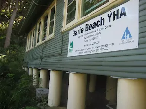
Moderate track
Wattamolla picnic area to Wattamolla Dam
1.7 km Return, 45 mins
Moderate track
Jibbon Head Engravings
2.6 km Return, 45 mins
Moderate track
Katoomba Kiosk to Katoomba Falls
1.1 km Return, 45 mins
Moderate track
Walls Ledge (Short)
1.4 km Circuit, 45 mins
Moderate track
The Princes Rock Track
746 m Return, 45 mins
Moderate track
Den Fenella to Princes Rock Circuit
1.3 km Circuit, 45 mins
Moderate track
The Weeping Rock and Fletchers Lookout Tracks
1.4 km Circuit, 45 mins
Moderate track
The Falls Picnic Area to Upper Wentworth Falls
1.5 km Return, 45 mins
Moderate track
Rainforest walk to Riverside Park
2 km One way, 45 mins
Moderate track
Yeramba Lagoon Loop
1.8 km Circuit, 45 mins
Moderate track
Sawpit Walk
2.2 km Circuit, 45 mins
Moderate track
Bittangabee Bay to Bittangabee Creek
1.8 km Return, 45 mins
Moderate track
Hobart Beach loop
1.2 km Circuit, 45 mins
Moderate track
Bournda Lagoon to North Tura
1.8 km One way, 45 mins
Moderate track
Wyrrabalong Lookout to Crackneck Lookout
1.6 km One way, 45 mins
Moderate track
Tuggerah Lake vista and Rainforest
1.8 km Return, 45 mins
Moderate track
Strickland Falls
1.7 km Return, 45 mins
Moderate track
Flannel Flower Track
1.6 km Circuit, 45 mins

Moderate track
White St Rainforest loop
1.7 km Circuit, 45 mins
Moderate track
Guringai Walk
1.2 km Circuit, 45 mins
Moderate track
Graves Walk
1.5 km One way, 45 mins
Moderate track
Monkey Face Circuit
1.3 km Circuit, 45 mins

Moderate track
Pines Circuit Walk
1.7 km Circuit, 45 mins
Moderate track
Rouse Hill Path circuit
1.5 km Circuit, 45 mins
Moderate track
Sheldon Forest Walk
1.8 km One way, 50 mins
Moderate track
Pulpit Rock
110 m Return, 10 mins

Hard track
White Rock
194 m Circuit, 10 mins
Hard track
Bournda Lagoon lookout
482 m Return, 12 mins
Hard track
Barmouth Beach
360 m Return, 15 mins
Hard track
Kianiny Bay lookout
416 m Return, 15 mins

Hard track
Blue Pool Track
522 m Return, 20 mins
Hard track
Pinnacles car park to Long Beach
702 m Return, 20 mins
Hard track
Bittangabee Bay picnic area to the storehouse
715 m Circuit, 20 mins
Hard track
Timber Beach
768 m Return, 20 mins
Hard track
Cobblers Beach
930 m Return, 30 mins
Hard track
Tunnel View Lookout
512 m Return, 30 mins
Hard track
Lapstone Lookout
756 m Return, 30 mins
Hard track
Bateau Bay Beach loop
892 m Circuit, 30 mins
Hard track
Tottenham Place to Wannagan Lookout
900 m Return, 30 mins
Hard track
Gap Bluff Lookout
886 m Return, 30 mins
Hard track
Monkey Face Cliff Walk
406 m Return, 30 mins

Hard track
Caves Beach Caves Walk
904 m Return, 30 mins
Hard track
Awabakal Viewpoint Walk
948 m Return, 30 mins
Hard track
Northern Redhead Beach Walk
1.2 km Circuit, 30 mins

Hard track
Cape Banks Island walk
1.5 km Return, 45 mins
Hard track
Round Walk
854 m Circuit, 45 mins
Hard track
The Three Sisters Footpath
1.1 km Return, 45 mins
Hard track
Pulpit Rock car park to lower Lookout
816 m Return, 45 mins
Hard track
Den Fenella Track
926 m Return, 45 mins
Hard track
Main Range Track - Charlotte Pass to the Snowy River return
1.6 km Return, 45 mins
Hard track
Bournda Lagoon car park to Bournda Island
2.1 km Return, 45 mins
Hard track
North Tura car park to Bournda Island
2.3 km Return, 45 mins
Hard track
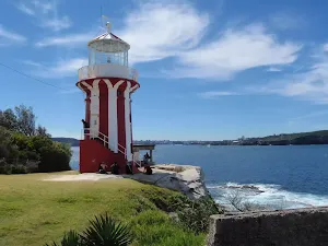
Norah Head Lighthouse and Rockshelf walk
1.6 km Return, 45 mins
Hard track
Red Gum Walk
1.4 km Circuit, 45 mins
Hard track
Warri Warri Track (via Warriwarri Lookout)
1.5 km One way, 45 mins
Hard track
Awabakal Coastal Walk
1.9 km One way, 45 mins

Hard track
Snapper Point Beach
630 m Return, 15 mins
Experienced only
Grass Tree Track
862 m One way, 30 mins
Experienced only
The Nayook Canyon Bushtrack
2.2 km Circuit, 45 mins
Experienced only